


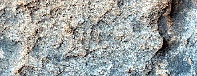
 HiRISE periodically acquires images of the two working rovers on Mars, Opportunity (Mars Exploration Rover) and Curiosity (Mars Science Laboratory). Although earlier pictures are generally sufficient for mapping the terrain and topography, new images allow scientists and engineers to study rover tracks and their covering with dust over time.
The ability to keep track of the rovers’ progress and seeing their current location on Mars in the HiRISE images is of great interest to the public. In the case of Curiosity, new images allow the tracking of active sand dunes currently in the vicinity of the rover. This dune field, informally named the “ Bagnold Dunes” after the pioneering British aeolian scientist Ralph Bagnold (1896-1990), has recently been investigated by Curiosity. [More at link]