THEMIS: Coprates Chasma landslide

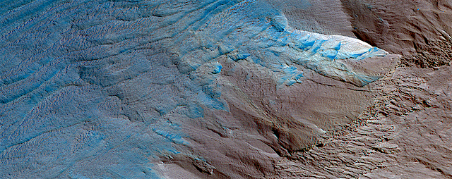
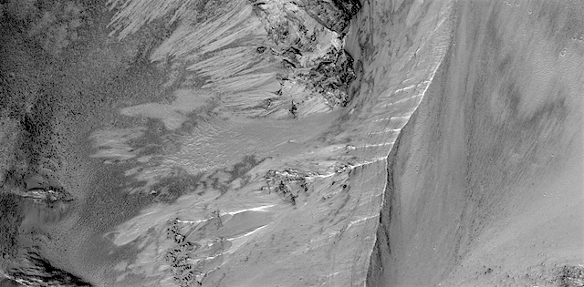
Landslide in Coprates Chasma (THEMIS_IOTD_20170523)THEMIS Image of the Day, May 23, 2017. Today’s false color image shows part of Coprates Chasma. A gigantic landslide has slipped off the ridge crossing the image and dumped uncountable tons of rock at the bottom of the canyon.

The THEMIS VIS camera contains 5 filters. The data from different filters can be combined in multiple ways to create a false color image. These false color images may reveal subtle variations of the surface not easily identified in a single band image.

More THEMIS Images of the Day by geological topic.

Posted in Reports | Tagged , , , , , , , , , , | Comments Off

HiRISE: Erosion of the edge of the south polar layered deposits

ESP_013224_1080This oblique view of the sloping edge of the stack of icy layers over the South Pole has some interesting morphologies.

The slope appears to be eroding from a combination of landslides, block falls, and sublimation. The bright icy exposure in the larger landslide scar (upper right) suggests that this was a relatively recent event.

Small-scale textures over the scene are due to both blowing wind and the thermal expansion and contraction of shallow ice.

Posted in Reports | Tagged , , , , , , | Comments Off

Curiosity update: An island of science

1700ML0088660010701255E01_DXXX-br2Sol 1702-04, May 22, 2017, update by MSL scientist Michelle Minitti: The rover planners parked us in front of the one slab of outcrop – an island among ripples of sand – we could safely drive to from our Sol 1700 position, setting us up to continue our exploration of the Murray formation.

The outcrop slab exhibited color variations (gray, pink and orange) and patchy white veins, so to capture these variations the science team analyzed multiple spots on the outcrop with MAHLI, APXS, ChemCam and Mastcam. We brushed dust off the target “Fern Spring” with the DRT and analyzed two separate spots within this dust-cleared area with APXS. Getting two closely spaced APXS targets makes it easier to pull apart compositional variations within the outcrop than a single APXS analysis alone. We planned a ChemCam raster over Fern Spring to be able to compare the compositional results from APXS and ChemCam, and a second, similar target, “Redfield Hill” to maximize the amount of data from the bedrock. [More at link]

Posted in Reports | Tagged , , , , , , , , , , , , | Comments Off

Opportunity: Imaging the valley

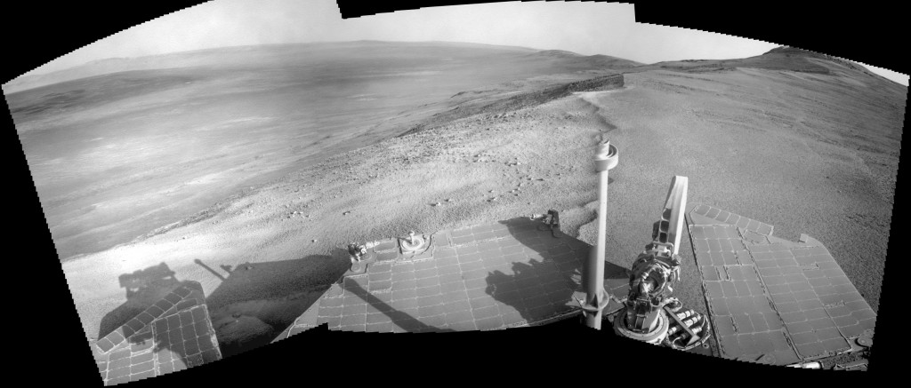
4736-navcam1P548547088EFFCZFQP2432L5M1_L2L5L5L7L7Sol 4736, May 21, 2017. Three Navcam frames look southeast from the head of Perserverance Valley. At right, a false-color Pancam image from Sol 4735 (Holger Isenberg) shows the ground near the rover, with rocks displaying what is likely fluting eroded by wind-blown sand. Click either image to enlarge it.

Opportunity raw images, its latest mission status, location map, and atmospheric opacity, known as tau.

Posted in Reports | Tagged , , , , , , | Comments Off

HiRISE: Sinuous ridge with a meander

tumblr_oq1w8y3CI51rlz4gso1_1280Sinuous ridge with a meander east of Meridiani Planum. Beautiful Mars series.

Posted in Reports | Tagged , , , , , , , , , | Comments Off

THEMIS: False color dunes in Noachis Terra

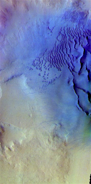
False color dunes in a Noachis crater (THEMIS_IOTD_20170522)THEMIS Image of the Day, May 22, 2017. Today’s false color image shows dunes on the floor of an unnamed crater in Noachis Terra. The blue false-color tint suggests the dunes are made of basaltic sand.

The THEMIS VIS camera contains 5 filters. The data from different filters can be combined in multiple ways to create a false color image. These false color images may reveal subtle variations of the surface not easily identified in a single band image.

More THEMIS Images of the Day by geological topic.

Posted in Reports | Tagged , , , , , , , , , | Comments Off

HiRISE: Ganges Chasma landslide

tumblr_oq0256xtKN1rlz4gso1_1280Ganges Chasma landslide. Beautiful Mars series.

Posted in Reports | Tagged , , , , , , , , , | Comments Off

Opportunity field report: May 18, 2017

03_sol4730-33_Navpan_progressSol 4734, May 18, 2017; Rover Field Report by Larry Crumpler, MER Science Team & New Mexico Museum of Natural History & Science: Opportunity has arrived at the head of Perseverance Valley, a possible water-cut valley here at a low spot along the rim of the 22-km diameter Endeavour impact crater. Investigations in the coming weeks will “endeavor”  to determine whether this valley was eroded by water or some other dry process like debris flows. It certainly looks like a water cut valley. But looks aren’t good enough. We need additional evidence to test that idea.

A short drive to the highest local point was done immediately after arrival and Opportunity has been working on a panorama from the overlook for the past couple of sols. The idea is to get a good overview of the valley from a high point before driving down it. But before we drive… [More at link]

Posted in Reports | Tagged , , , , , , | Comments Off

THEMIS: Lava tube skylights in Daedalia Planum

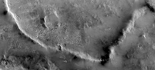
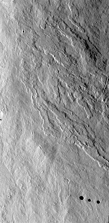
Lava tube skylights in Daedalia (THEMIS_IOTD_20170519)THEMIS Image of the Day, May 19, 2017. Today’s VIS image show lava flows in Daedalia Planum that originated from Arsia Mons. At lower right, note the three circular “skylights” — places where the roof of an underground lava tube has collapsed.

More THEMIS Images of the Day by geological topic.

Posted in Reports | Tagged , , , , , , , , , , , , | Comments Off

Curiosity update: Optical depth measurements

1670ML0086610000700648E01_DXXX-br2Sol 1700-01, May 17, 2017, update by MSL scientist Michael Battalio: Curiosity continues towards Vera Rubin Ridge with a 48 m drive. GEO decided for the touch-and-go option (instead of lengthening the drive like on Sol 1684) using APXS and MAHLI on “Ripple Pond,” a typical member of the Murray formation. Mastcam and ChemCam will follow up with observations of Ripple Pond. Mastcam will next target “Rhodes Cliff,” which is especially interesting as it is tilted to show the Murray formation layers. Following these observations, Curiosity will drive and capture standard imaging for targeting in the weekend plan. After the drive, ChemCam will perform an automated AEGIS activity to measure bright… [More at link]

Posted in Reports | Tagged , , , , , , , , , , , , , | Comments Off