Sol 743, September 9, 2014. The science team has dubbed the wide depression north of Amargosa Valley as Owens Valley; a five-frame Mastcam-34 composite shows part of it.
Sol 743 raw images (from all cameras), and Curiosity’s latest location map.
Sol 743, September 9, 2014. The science team has dubbed the wide depression north of Amargosa Valley as Owens Valley; a five-frame Mastcam-34 composite shows part of it.
Sol 743 raw images (from all cameras), and Curiosity’s latest location map.
 Possible graben in the Southern Highlands; a “graben” is a land depression that is flanked by two parallel faults.
Beautiful Mars series.
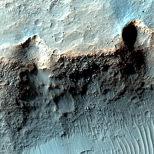 Possible clays along Lorica Crater wall. Beautiful Mars series.
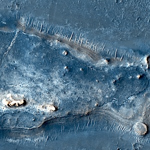 Fractured ground in northeast Syrtis Major Planum. Beautiful Mars series.
 THEMIS Image of the Day, September 9, 2014. The hills in this VIS image are part of Avernus Colles.
More THEMIS Images of the Day by geological topic.
Sol 744, September 8, 2014, update from USGS Scientist Ryan Anderson: “The weekend plan was successful: we got good data from the Homewood contact science target, plus a nice long 92.6 meter drive on Sol 743. The plan for Sol…” [More at link]
 On Sept. 21, 2014, the Mars Atmosphere and Volatile Evolution spacecraft will complete roughly 10 months of travel and enter orbit around the Red Planet. The orbit-insertion maneuver will be carried out as the spacecraft approaches Mars, wrapping up an interplanetary journey of 442 million miles (711 million kilometers). Six thruster engines will fire briefly for a “settling” burn that damps out deviations in pointing. Then the six main engines will ignite two by two in quick succession and will burn for 33 minutes to slow the craft, allowing it to be captured in an elliptical orbit. This milestone will mark… [More at link, including video]
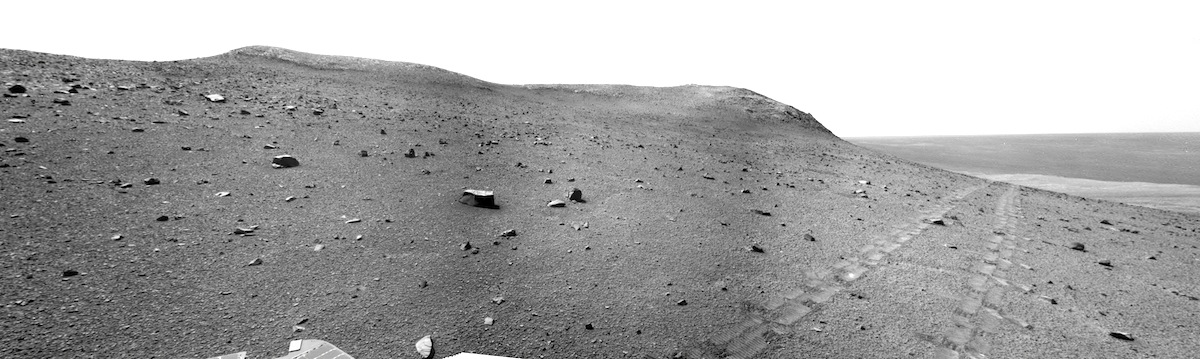
 Sol 743, September 8, 2014. Curiosity has entered Amargosa Valley, but rover drivers are keeping to its higher and less sandy parts. At left is Panamint Butte, draped in sand ripples (three-frame Navcam composite). The most trafficable route looks to drive to the left of the small butte at right (Jubilee Pass), but to stay clear of the sand on the flanks of Panamint Butte.
Sol 743 raw images (from all cameras), and Curiosity’s latest location map.
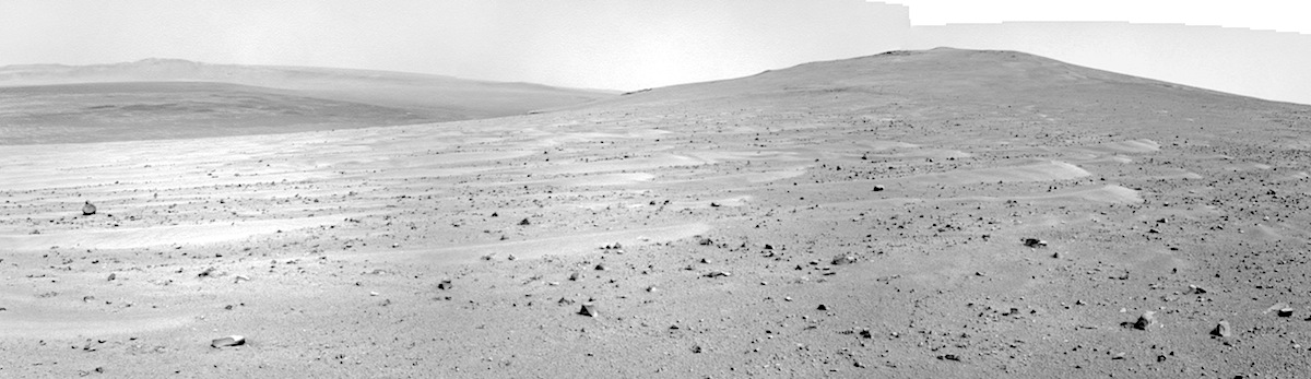
 Sol 3775, September 6, 2014. Two views, both three-frame Navcam composites, one looking generally north (above), the other southward. On the skyline above is the south-facing slope of Wdowiak Ridge, while Cape Tribulation is the high point looking south.