The rover’s hand-lens imager (MAHLI) captures a rock with a striated surface and material filling a fracture.
Sol 696 raw images (from all cameras), and Curiosity’s latest location map.
The rover’s hand-lens imager (MAHLI) captures a rock with a striated surface and material filling a fracture.
Sol 696 raw images (from all cameras), and Curiosity’s latest location map.
 THEMIS Image of the Day, July 23, 2014. The dunes in this VIS image are located on the floor of Lyot Crater.
More THEMIS Images of the Day by geological topic.
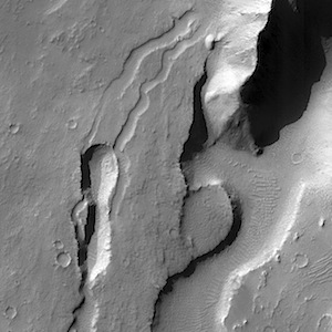 Valleys carved into southern Arsia Mons. Beautiful Mars series.
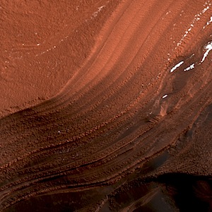 Such an angry red scarp. Beautiful Mars series.
 Looking west over sand ripples onto Meridiani Planum with the Navcam (three-frame composite). At left is part of Cape Tribulation.
Opportunity raw images, its latest mission status, and a location map. (A shortcut to Sol 3729 Navcam images is here.)
 Rough driving ahead, as the rover rolls toward Hidden Valley (dark area at top center), its route down off the caprock of Zabriskie Plateau (two-frame Navcam composite).
NASA description (left image): This image was taken by Navcam: Left B (NAV_LEFT_B) onboard NASA’s Mars rover Curiosity on Sol 696 (2014-07-22 06:37:57 UTC).
Sol 696 raw images (from all cameras), and Curiosity’s latest location map.
Sol 696, July 21, 2014, update on Curiosity from USGS scientist Ryan Anderson: “We’re slowly picking our way across the rugged cap-rock of Zabriskie Plateau. Over the weekend we drove 23.4 m while also managing to use every single…” [More at link]
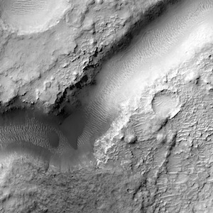
 THEMIS Image of the Day, July 22, 2014. The channels in this VIS image are part of Coloe Fossae, a series of linear depressions on the northeast margin of Terra Sabaea.
More THEMIS Images of the Day by geological topic.
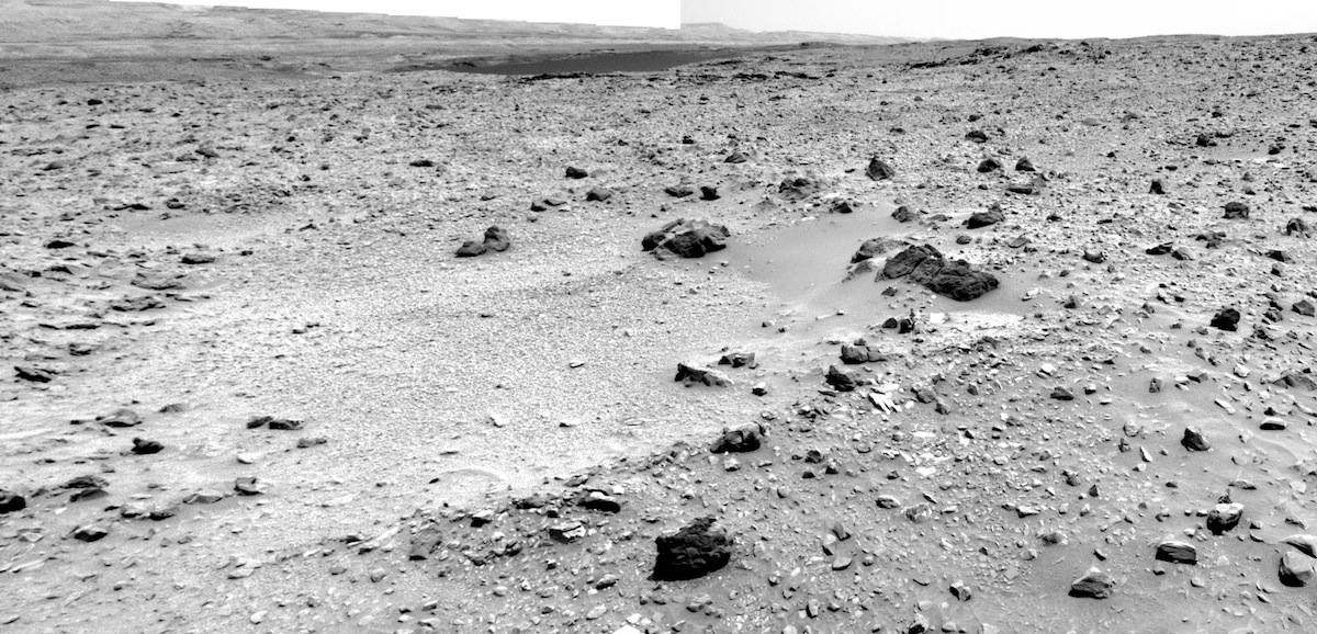 The dark patch at top center is a field of dark sand dunes viewed through Hidden Valley, which will be Curiosity’s pathway down off the Zabriskie Plateau as it heads for distant Mount Sharp (two-frame Navcam composite). The light area in the foreground is likely a small impact crater, now filled with wind-blown sand and dust.
NASA description (left frame): This image was taken by Navcam: Left B (NAV_LEFT_B) onboard NASA’s Mars rover Curiosity on Sol 695 (2014-07-21 05:19:14 UTC).
Sol 695 raw images (from all cameras), and Curiosity’s latest location map.