


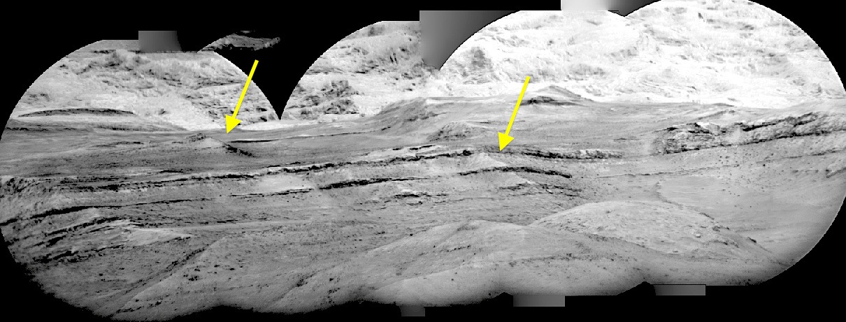
 Sol 1314, April 17, 2016. The Remote Micro-Imager (RMI) made this five-frame composite of layers in Mt. Sharp. The lower layers appear darker in color than the layers above, perhaps due to alteration by water during one or more of the several crater-lakes that came and went within Gale in the past. The layers may also show faults (arrows) that cut across the sedimentary layers. Click image to enlarge.
Sol 1314 raw images (from all cameras), and Curiosity’s latest location.