


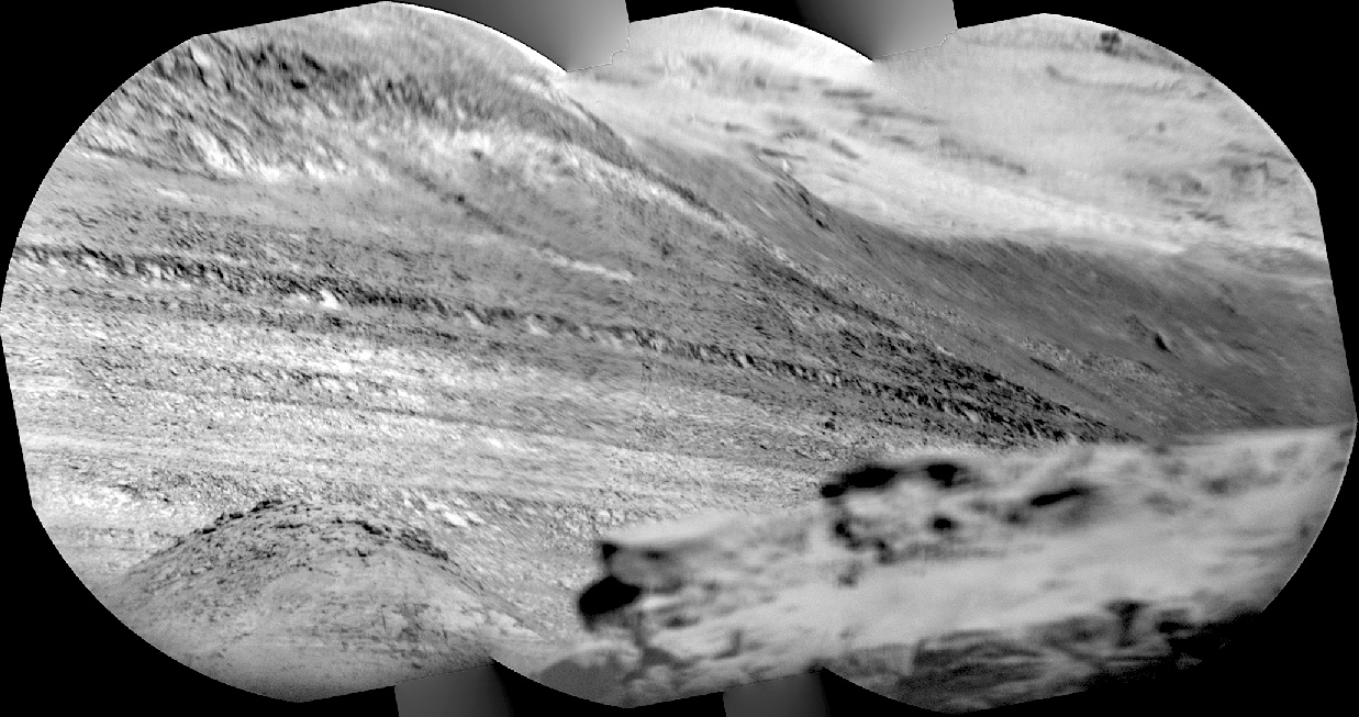
 Sol 1413, July 28, 2016. Curiosity’s Remote Micro-Imager (RMI) takes aim to the south-southwest. The view is over the Murray Buttes (foreground, out-of-focus) toward the distant slopes of Mt. Sharp, where the RMI records a few of its many layers.
The view shows mostly Mt. Sharp’s dark lower layers, which scientists think are water-altered sediments dating from when Gale Crater contained a lake (or lakes) in the past. At top right are the mound’s light-toned upper layers, probably wind-blown sediments with little or no alteration by water. Click image to enlarge it.
Sol 1413 raw images (from all cameras), and Curiosity’s latest location.