


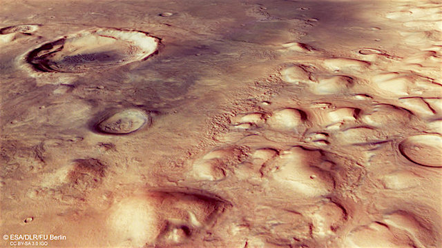
 This jumble of eroded blocks lies along the distinctive boundary between the Red Planet’s southern highlands and the northern lowlands, with remnants of ancient glaciers flowing around them. This boundary is one of the oldest and most prominent features on Mars, marking a height difference of several kilometres.
The scene presented here, captured by the high-resolution camera [HRSC] on ESA’s Mars Express on 29 May, is just one example of the terrain found along this ancient boundary, and focuses on part of the Colles Nili region.
‘Colles’ comes from the Latin word for ‘hill’, and indeed this region hosts a swath of such features. They are likely erosional remnants of a former plateau, as suggested with their similarity in height seen in the topography map.
Zooming in to the main colour image and perspective views shows that some of the mounds are surrounded by smooth, layered deposits gently sloping away from the sides of the hills. An even closer look reveals other finer features on the channel floors around the mounds and inside some of the impact craters: series of ridges and troughs.
Both the layered deposits and the ridges and troughs are thought to be associated with buried ice that has since been covered over by wind-blown dust and local debris from the eroding plateau, perhaps as an underlying ice sheet retreated. [More at link]