


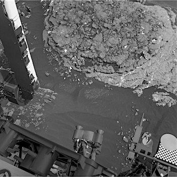
 Sol 1668-70, April 14, 2017, update by USGS scientist Ryan Anderson and Michael Battalio: Our latest drive put us in position in front of the interesting “Moosehead Lake” outcrop with lots of veins and grey patches: plenty to keep Curiosity busy over the weekend! The Sol 1668 plan starts off with a nice long science block. ChemCam has observations of targets “Sheldrake Island”, “Crabtree Neck”, “Waukeah Neck”, “Morancy Stream” and “Ogden Point”. This is followed by a dust devil survey and several Mastcam mosaics. These include one covering Moosehead Lake, a few frames to extend the coverage of the area near the rover, and a big 22 frame mosaic of the outcrop at our next stop. Mastcam will also take a picture of the ChemCam auto-targeted location from after the drive. After that MAHLI will take pictures of the targets “Morancy Stream” and “Sheldrake Island” and then APXS will analyze those… [More at link]
-
Recent Posts
Archives
Links
general
mission instruments
- CRISM: Compact Reconnaissance Imaging Spectrometer for Mars
- CTX: Context Camera
- HiRISE: High Resolution Imaging Science Experiment
- MARSIS: Mars Advanced Radar for Subsurface and Ionosphere Sounding
- SHARAD: Shallow Radar
- THEMIS: Thermal Emission Imaging System
missions
- All Mars missions list
- Curiosity rover
- ExoMars
- Hope (al-Amal) orbiter
- InSight
- Mars Atmosphere and Volatile Evolution Mission (MAVEN)
- Mars Exploration Rovers (MER)
- Mars Express (MEX)
- Mars Odyssey
- Mars Orbiter Mission (MOM) / Mangalyaan
- Mars Reconnaissance Orbiter (MRO)
- Mars Science Laboratory (MSL)
- Perseverance Rover
- Tianwen-1 orbiter/rover
news