


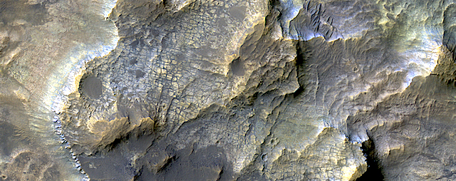
 This colorful image shows clays within the Eridania basin region. Many scientists using orbital data have proposed that a large lake may have once existed here during the Late Noachian through Early Hesperian time periods, and then much of the water drained out to the north via Ma’adim Vallis.
Understanding where and what kind of clay exists within this region using CRISM data can help scientists learn more about how long the postulated lake existed and the water chemistry within the lake. [More at link]