


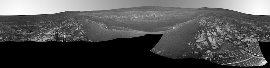
 This panorama combines several images from the navigation camera on NASA’s Mars Exploration Rover Opportunity to show the rover’s surroundings after surpassing 25 miles (40.23 kilometers) of total driving on Mars. The component images were taken on July 29, 2014, during the 3,737th Martian day, or sol, of Opportunity’s work on Mars, prior to that sol’s drive. The rover’s location was the point it reached with a drive of 157 feet (48 meters) on Sol 3735 (July 27, 2014), which brought Opportunity’s total odometry to 25.01 miles (40.25 kilometers)… [More at link]
-
Recent Posts
Archives
Links
general
mission instruments
- CRISM: Compact Reconnaissance Imaging Spectrometer for Mars
- CTX: Context Camera
- HiRISE: High Resolution Imaging Science Experiment
- MARSIS: Mars Advanced Radar for Subsurface and Ionosphere Sounding
- SHARAD: Shallow Radar
- THEMIS: Thermal Emission Imaging System
missions
- All Mars missions list
- Curiosity rover
- ExoMars
- Hope (al-Amal) orbiter
- InSight
- Mars Atmosphere and Volatile Evolution Mission (MAVEN)
- Mars Exploration Rovers (MER)
- Mars Express (MEX)
- Mars Odyssey
- Mars Orbiter Mission (MOM) / Mangalyaan
- Mars Reconnaissance Orbiter (MRO)
- Mars Science Laboratory (MSL)
- Perseverance Rover
- Tianwen-1 orbiter/rover
news