


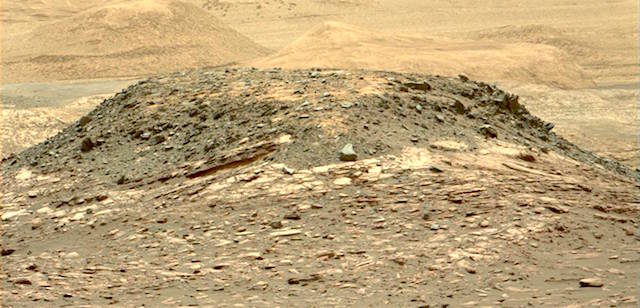
 Sol 1541, December 5, 2016, update by USGS scientist Lauren Edgar: The weekend plan returned some great remote sensing data, including the above Mastcam image of “Ireson Hill” to investigate the stratigraphy exposed in a distant butte. While we work on assessing the drill fault, the team decided to devote today’s plan to remote sensing and change detection. The plan starts with ChemCam observations of “Hunters Beach” and “Gorham Mountain” to investigate the chemistry of the Murray bedrock. Then we’ll acquire a Mastcam tau and crater rim extinction image to characterize the amount of dust in the… [More at link]
-
Recent Posts
Archives
Links
general
mission instruments
- CRISM: Compact Reconnaissance Imaging Spectrometer for Mars
- CTX: Context Camera
- HiRISE: High Resolution Imaging Science Experiment
- MARSIS: Mars Advanced Radar for Subsurface and Ionosphere Sounding
- SHARAD: Shallow Radar
- THEMIS: Thermal Emission Imaging System
missions
- All Mars missions list
- Curiosity rover
- ExoMars
- Hope (al-Amal) orbiter
- InSight
- Mars Atmosphere and Volatile Evolution Mission (MAVEN)
- Mars Exploration Rovers (MER)
- Mars Express (MEX)
- Mars Odyssey
- Mars Orbiter Mission (MOM) / Mangalyaan
- Mars Reconnaissance Orbiter (MRO)
- Mars Science Laboratory (MSL)
- Perseverance Rover
- Tianwen-1 orbiter/rover
news