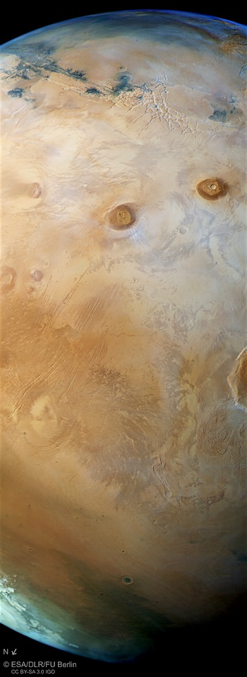
 Fifteen years ago, ESA’s Mars Express was launched to investigate the Red Planet. To mark this milestone comes a striking view of Mars from horizon to horizon, showcasing one of the most intriguing parts of the martian surface.
On 2 June 2003, the Mars Express spacecraft lifted off from Baikonur, Kazakhstan, on a journey to explore our red-hued neighbouring planet. In the 15 years since, it has become one of the most successful missions ever sent to Mars, as demonstrated by this image of the region known as the Tharsis province, shown here in its full glory.
Mammoth volcanoes, sweeping canyons, fractured ground: Tharsis is one of the most geologically interesting and oft-explored parts of the planet’s surface. Once an incredibly active region, displaying both volcanism and the shifting crustal plates of tectonics, it hosts most of the planet’s colossal volcanoes – the largest in the Solar System.
This view, taken by the High Resolution Stereo Camera aboard Mars Express in October 2017, shows Tharsis in all its glory.
It sweeps from the planet’s upper horizon — marked by the faint blue haze at the top of the frame — down across a web of pale fissures named Noctis Labyrinthus (a part of Valles Marineris stretching to the upper left corner of the image), Ascraeus and Pavonis Mons (two of Tharsis’ four great volcanoes at more than 20 km high), and finishes at the planet’s northern polar ice cap (in this perspective, North is to the lower left)… [More at link, including key map and elevation map]


