THEMIS: Wind-eroded ridges

Wind erosion (THEMIS_IOTD_20180717)THEMIS Image of the Day, July 17, 2018. Winds in this region have modified the surface, carving valleys into a poorly cemented material. The winds in this region blew toward the northeast. (Note: north is to the top of the image, and sunlight is coming from the right.) These linear valleys are called yardangs.

More THEMIS Images of the Day by geological topic.

Posted in Reports | Tagged , , , , , , , , , | Comments Off

Weather update from Gale Crater

Posted in Reports | Tagged , , , , , , , , | Comments Off

HiRISE: Cored island

tumblr_pbo9yix6gX1rlz4gso1_1280Cored island. This channel may have been used by both lava and water. One of the processes produced a crater-cored island and later, the downstream side was eroded away, leaving knobs and an inverted streamlined form.

Beautiful Mars series. [More at links]

Posted in Reports | Tagged , , , , , , , , , , | Comments Off

Curiosity: Drilling at Voyageurs

2111-mastcamNLB_584980616EDR_F0712876NCAM00309M_Sols 2111-2112, July 15-16, 2018. With Curiosity at the Voyageurs outcrop, the drill went to work. The Mastcam view above shows the drill site (arrow). Below is the Hazcam view of the drill at work, and at right is the Navcam view of the result. The tailings pile is barely visible, so the drill may not have gone very deep. All images enlarge when clicked.

Sol 2112 raw images (from all cameras).

FLB_584980118EDR_S0712876FHAZ00214M_

Posted in Reports | Tagged , , , , , , , , , | Comments Off

HiRISE: Down in Proctor Crater

tumblr_pbo9ibvxkT1rlz4gso2_1280Down in Proctor Crater. Proctor Crater is 168 kilometers in diameter, and its massive dune field has been imaged by us for several years to track changes over time.

Beautiful Mars series. [More at links]

Posted in Reports | Tagged , , , , , , , , , | Comments Off

THEMIS: Winding channels of Elysium Fossae

Winding channel in Elysium (THEMIS_IOTD_20180716)THEMIS Image of the Day, July 16, 2018. Today’s VIS image shows part of one of the Elysium Fossae on the western flank of the Elysium volcanic complex. The fossae have both a tectonic and volcanic origin.

The linear fractures, representing tectonic activity, are aligned southeast to northwest (the top of the image is north). The sinuous nature of the channel is due the flow of a liquid, most likely lava in this case.

More THEMIS Images of the Day by geological topic.


Posted in Reports | Tagged , , , , , , , , , , , | Comments Off

Curiosity update: Let the drill fest begin!

FRB_584716916EDR_F0712876FHAZ00206M_-br2Sols 2110-12, July 13, 2018, update by MSL scientist Lauren Edgar: Drilling on another planet is no easy feat, and each time we have the opportunity to do so on Mars feels pretty special. The focus of the weekend three-sol plan is to drill the target “Voyageurs,” which is part of an outcrop that shows a high hematite signature in orbital data.

The weekend plan kicks off with several Navcam and Mastcam observations of the atmosphere to continue to monitor the ongoing dust storm from our unique vantage point on the ground. Then ChemCam will analyze the “Voyageurs” target, followed by Mastcam multispectral imaging. Curiosity will… [More at link]

Posted in Reports | Tagged , , , , , , , , , | Comments Off

HiRISE: Clays in the Eridania Basin

ESP_055392_1510This colorful image shows clays within the Eridania basin region. Many scientists using orbital data have proposed that a large lake may have once existed here during the Late Noachian through Early Hesperian time periods, and then much of the water drained out to the north via Ma’adim Vallis.

Understanding where and what kind of clay exists within this region using CRISM data can help scientists learn more about how long the postulated lake existed and the water chemistry within the lake. [More at link]

Posted in Reports | Tagged , , , , , , , , , , | Comments Off

Curiosity update: Voyageurs

NRB_584639877EDR_F0712876NCAM07753M_-br2Sol 2109, July 12, 2018, update by MSL scientist Abigail Fraeman: I first became involved with Curiosity shortly after starting my third year of graduate school in the fall of 2011. My graduate advisor was selected to join the mission as a Participating Scientist, and he enlisted me to help analyze orbital data over Mt. Sharp as part of that role. In particular, I was tasked to examine data from the Compact Reconnaissance Imaging Spectrometer for Mars (CRISM) to see what minerals Curiosity might find when she landed and, importantly, where exactly she should drive to visit the best exposures.

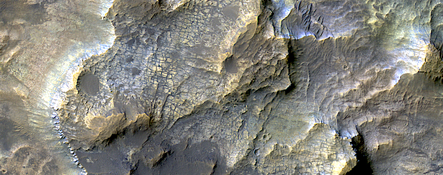
One of the most the significant things I found was the signature of the mineral hematite (Fe2O3) associated with the feature we now call Vera Rubin Ridge. Many collaborators and I spent the winter and spring of 2012 — the time between launch and landing — working out the geological implications of this discovery as best we could using orbital data, and beginning to ponder the specific observations Curiosity should make when she reached the ridge…. [More at link]
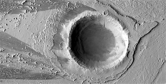
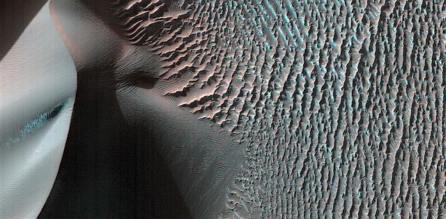
Posted in Reports | Tagged , , , , , , , , , , | Comments Off

HiRISE: Lava-coated craters

tumblr_pbmh8mHvyb1rlz4gso1_1280Lava-coated craters. The larger crater looks normal–dimpled depression with a protruding rim barely covered by lava which later deflated. The smaller depression looks deeper and steeper-sided, and the rim does not protrude, so it is probably below the level of even the deflated lava. So why did this deflate so much?

Beautiful Mars series. [More at links]

Posted in Reports | Tagged , , , , , , , , , , | Comments Off