THEMIS: Hephaestus Fossae’s enigmatic channels

Hephaestus Fossae (THEMIS_IOTD_20190717)
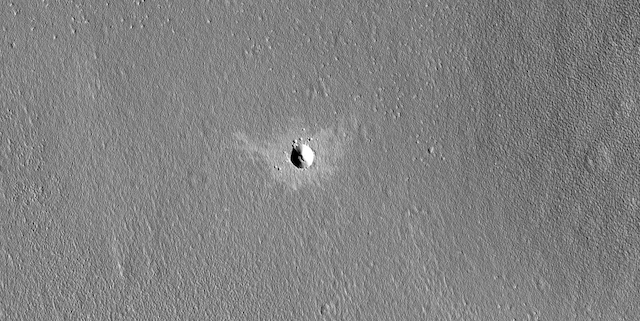
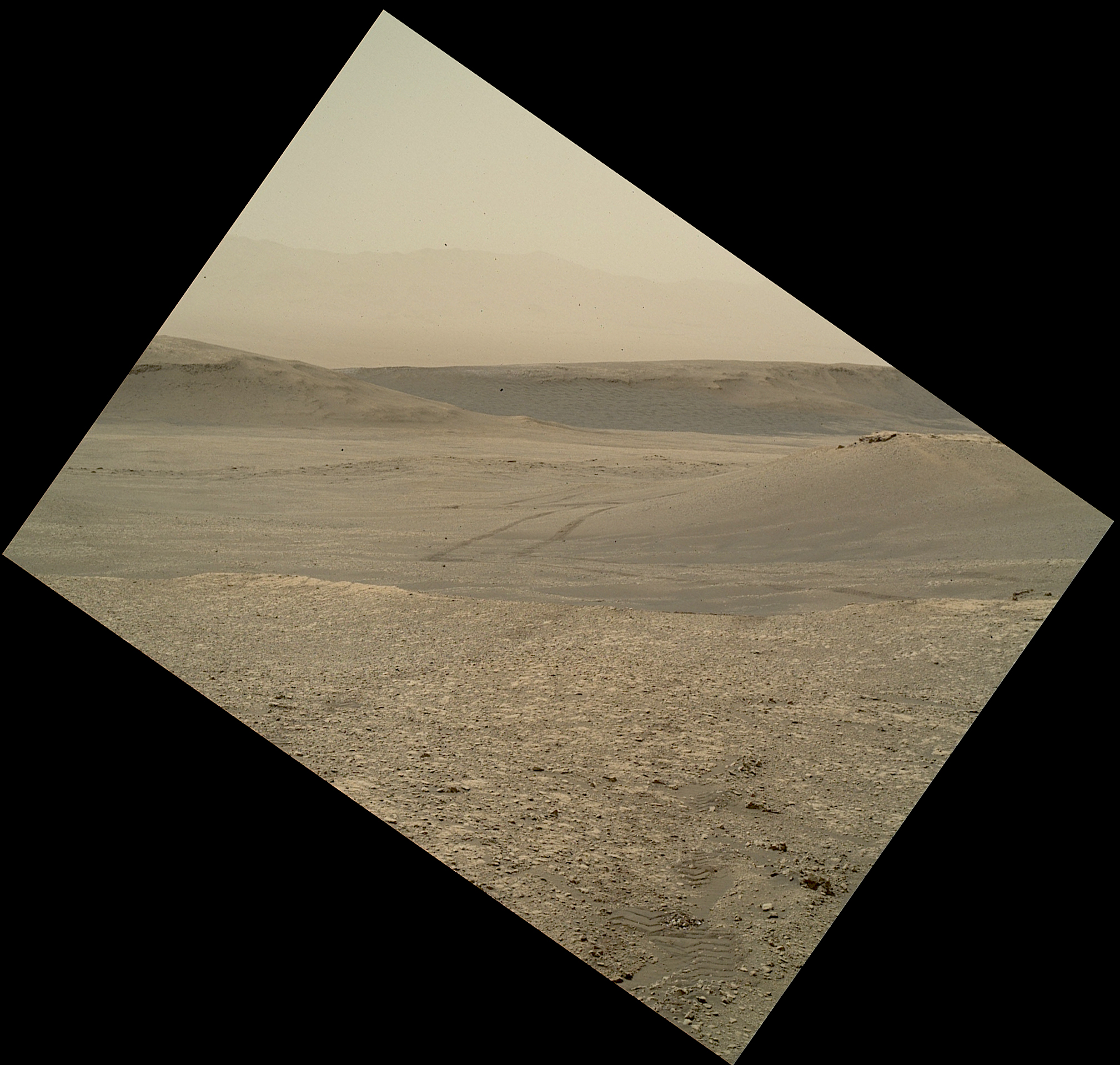
THEMIS Image of the Day, July 17, 2019. This VIS image is located in the central portion of Hephaestus Fossae. Hephaestus Fossae is a complex channel system in Utopia Planitia near Elysium Mons.

It has been proposed that the channel formed by the release of melted subsurface ice during the impact event that created a large crater south of this image.

Additionally, the nearby Elysium volcanic center created subsurface heating that may have played a part in creating both Hephaestus Fossae and Hebrus Valles to the north.

Explore more THEMIS Images of the Day by geological subject.

Posted in Reports | Tagged , , , , , , , , , , , | Comments Off

Curiosity update: Rolling southward!

NLB_616421485EDR_F0762080NCAM00257M_-br2Sols 2468-69, July 16, 2019, update by MSL scientist Catherine O’Connell-Cooper: Curiosity finished up our investigation at Harlaw Rise on the weekend, and commenced our drive to an area we are (informally) calling the “Southern Outcrop,” another of the ridge features that are so prominent in this part of Glen Torridon. This drive was split into a number of shorter drive segments. Our weekend drive brought us to a very rubbly workspace, with lots of small pebbles. These pebbles may be small but are geochemically interesting and add to our understanding of the geology here, so we are analyzing a pebble (about 4 cm along its long axis) called “Paible,” before continuing on our way southward. APXS and ChemCam will both investigate the chemistry, and Mastcam and MAHLI will take colour images, giving us a full suite of observations to help with interpretation of this target. Mastcam will be taking a large image of an area of brighter rocks called “Sandside Harbor” at the Southern Outcrop.

Post-drive imaging of the new workspace will support contact science if we find ourselves in an interesting location, and a routine end of drive image of the ground at the back of the front left wheel will catalog changes in rock, soil and pebble populations. On the night of the second sol, CheMin will do some routine housekeeping activities ahead of a potential drill campaign, atop the Southern Outcrop in the coming weeks… [More at link]

Posted in Reports | Tagged , , , , , , , , , , , , , , | Comments Off

HiRISE: A fresh crater in periglacial terrain

ESP_055246_2215A fresh crater in periglacial terrain. This appears to be a relatively fresh crater in what is called periglacial terrain. Could any changes in the surface be related to ice? (Periglacial refers to an area adjacent to a glacier or ice sheet or otherwise subject to repeated freezing and thawing.)

HiRISE Picture of the Day archive. [More at links]

Posted in Reports | Tagged , , , , , , , , , , | Comments Off

THEMIS: Wind-etched ground near Gordii Dorsum

Wind-etched ground (THEMIS_IOTD_20190716)THEMIS Image of the Day, July 16, 2019. Wind is one of the remaining active processes altering the surface of Mars. In regions of long term unidirectional winds, the dust and sand is winnowed away.

In places with poorly cemented surface materials the wind and entrained sand with blast the surface causing linear erosion like that seen in today’s VIS image. This image is located at the equator near Gordii Dorsum and shows evidence for wind erosion from two directions.

Explore more THEMIS Images of the Day by geological subject.

Posted in Reports | Tagged , , , , , , , , | Comments Off

Curiosity update: Finishing up at Harlaw Rise

NLB_616157882EDR_F0761786NCAM00353M_-br2Sols 2465-67, July 12, 2019, update by MSL scientist Ken Herkenhoff: The Sol 2463 drive went as planned, leaving the rover in position to examine what appears to be a small dome in the sedimentary rocks (visible on the left side of the scene above). To determine whether the layers really do bow upward here, we planned an oblique MAHLI mosaic and a Mastcam stereo mosaic. MAHLI will also acquire full suites of images of bedrock targets “Ecclefechan” and “Kirbuster” after ChemCam has measured their chemistry and hopefully cleared off some dust using its laser. ChemCam will also observe a small, brighter outcrop named “Hatton” on Sol 2465. Later that sol, Mastcam will image the sun just before sunset, and APXS will perform short integrations on Kirbuster and longer, overnight integrations on Ecclefechan.

On Sol 2466, Mastcam will image the sun and the Gale Crater rim just after noon to measure the dust content in the atmosphere. Then Mastcam will acquire 3 stereo mosaics, of the possible dome in front of the rover, of the “Aitken Pit” area to the left, and of the top of Harlaw Rise before the rover drives away. During the drive around the east side of Harlaw Rise, the rover will pause to acquire Left Mastcam and Navcam… [More at link]

Posted in Reports | Tagged , , , , , , , , , , , , , , , | Comments Off

Aerogel greenhouses for Mars habitats?

PIA23342_hiresRaising crops on Mars is far easier in science fiction than it will be in real life: The Red Planet is an inhospitable world. Among other challenges, subzero temperatures mean water can persist on the surface only as ice, and the planet’s atmosphere offers little protection to plants (or people) from the Sun’s radiation.

Of course, NASA has plans to eventually put humans on Mars, using lessons it will learn from its Artemis lunar explorations. And those humans will need to eat. Being able to produce food on Mars would help reduce the quantity of supplies consuming valuable space and fuel on crewed missions to the Red Planet. But figuring out how – and where – to produce that food, while also being exceedingly careful not to contaminate Mars with Earth-borne bacteria, are some of the challenges scientists and engineers face.

In a new paper in Nature Astronomy, researchers propose that a material called aerogel might help humans one day build greenhouses and other habitats at Mars’ mid-latitudes, where near-surface water ice has been identified. The study was funded by Harvard University’s Faculty of Arts and Sciences. (…)

In an experiment conducted by lead author Robin Wordsworth of Harvard, 2-3 centimeters of silica aerogel allowed light from a lamp tuned to simulate Martian sunlight to heat the surface beneath it by up to 150 degrees Fahrenheit (65 degrees Celsius) – enough to raise temperatures on the Martian surface and melt water ice. [More at links]

Posted in Reports | Tagged , , , | Comments Off

HiRISE: Springtime for Russell Crater

ESP_055240_1255Springtime for Russell Crater. Russell Crater is another favorite of ours, not only for its beauty, but also for the information it provides us for any changes due to sublimation, when a solid state changes directly to a gaseous one.

HiRISE Picture of the Day archive. [More at links]

Posted in Reports | Tagged , , , , , , , , , , , , , | Comments Off

THEMIS: Hills of Arena Colles

Arena Colles (THEMIS_IOTD_20190715)THEMIS Image of the Day, July 15, 2019. Today’s VIS image shows part of Arena Colles. The term colles means hills. Arena Colles is located on the margin where Terra Sabaea steps down in elevation into Utopia Planitia.

Explore more THEMIS Images of the Day by geological subject.

Posted in Reports | Tagged , , , , , , , , , , , | Comments Off

HiRISE spots Curiosity at Woodland Bay

PIA23341-16A dramatic Martian landscape can be seen in a new image taken from space, showing NASA’s Curiosity rover examining a location called “Woodland Bay.” It’s just one of many stops the rover has made in an area referred to as the “clay-bearing unit” on the side of Mount Sharp, a 3-mile-tall (5-kilometer-tall) mountain inside of Gale Crater.

The image was taken on May 31, 2019, by the High Resolution Imaging Science Experiment (HiRISE) camera aboard NASA’s Mars Reconnaissance Orbiter (MRO). In the image, Curiosity appears as a bluish speck. Vera Rubin Ridge cuts across the scene north of the rover, while a dark patch of sand lies to the northeast.

Look carefully at the inset image, and you can make out what it is likely Curiosity’s “head,” technically known as the remote sensing mast. A bright spot appears in the upper-left corner of the rover. At the time this image was acquired, the rover was facing 65 degrees counterclockwise from north, which would put the mast in about the right location to produce this bright spot… [More at link]

Posted in Reports | Tagged , , , , , , , , , , , , , , , , , | Comments Off

Curiosity: MAHLI looks away —

2463-mahliSol 2463, July 11, 2019. Curiosity’s controllers directed the Mars Hand Lens Imager (MAHLI) — usually aimed to make close-up views of rocks, outcrops, and other nearby features — to shoot a frame looking off toward Vera Rubin Ridge and the inner wall of Gale Crater, faintly visible far beyond. Note the rover’s wheel tracks in the middle distance. Click the image to enlarge it.

Sol 2463 raw images (from all cameras).

Posted in Reports | Tagged , , , , , , , , , , , | Comments Off