HiRISE; Exposed bedrock, Koval’sky impact basin

ESP_050314_1510This image shows partially exposed bedrock within the Koval’sky impact basin, which is on the outskirts of the extensive lava field of Daedalia Planum. Daedalia Planum is located southwest of Arsia Mons, which may be the source responsible for filling the crater with lava flows and ash deposits.

On one side, we see bright bedrock with scattered dark blue spots. The dark blue spots are boulders shedding from the outcrops. The color range of the bedrock provides some information on its composition. The blue color is indicative of the presence of iron-rich minerals that are generally not oxidized (i.e., rusted), unlike most of the ruddy Martian surface. Volcanic rocks are… [More at link]

Posted in Reports | Tagged , , , , , , , , , , | Comments Off

THEMIS: North polar ice cap troughs and layers

North polar ice cap layers THEMIS Art #135 (THEMIS_IOTD_20170628)THEMIS Image of the Day, June 28, 2017. Do you see what I do? Looks like a person’s profile at the bottom of this image. (THEMIS Art #135)

More THEMIS Images of the Day by geological topic.

Posted in Reports | Tagged , , , , , , , , , , | Comments Off

Curiosity update: More touch and go on the way to Vera Rubin Ridge

1732ML0090520020701709E01_DXXX-br2Sol 1739-40, June 26, 2017, update by MSL scientist Abigail Fraeman: This past weekend, Curiosity continued to journey east along the contact between the lower portion of Vera Rubin Ridge and the Murray formation with a drive that was a little over 20 m long. Today we worked on planning two sols, Sol 1739 and Sol 1740. On the first sol, we will take MAHLI and APXS observations of a target named “Rice Point” in our continuing quest to characterize the variability of typical Murray bedrock as we ascend Mt. Sharp. We will also take some remote sensing observations to document changes in texture and chemistry of the rocks in front of us, as well as some nearby sand. We have ChemCam LIBS observations of targets named “Hamilton Pond,” “Whalesback,” and Rice Point… [More at link]

Posted in Reports | Tagged , , , , , , , , , , , , , , | Comments Off

HiRISE: Mojave Crater far-flung impact ejecta

tumblr_oqbn0wSBHL1rlz4gso2_1280Distal reaches of Mojave Crater impact ejecta. Beautiful Mars series.

Posted in Reports | Tagged , , , , , , , , , | Comments Off

THEMIS: Lava channel on Hecates Tholus

Lava channel on Hecates Tholus THEMIS Art #134 (THEMIS_IOTD_20170627)THEMIS Image of the Day, June 27, 2017. Do you see what I see? Is that a snake slithering down the image? (THEMIS Art #134)

More THEMIS Images of the Day by geological topic.

Posted in Reports | Tagged , , , , , , , , , , , , | Comments Off

HiRISE: The Niagara Falls of Mars

ESP_050406_1585Various researchers are often pre-occupied with the quest for flowing water on Mars. However, in this image, we see one of many examples from Mars where lava (when it was molten) behaved in a similar fashion to liquid water.

In a 3D image from the Context Camera, we can see the northern rim of a 30-kilometer diameter crater situated in the western part of the Tharsis volcanic province. (See our own 3D image as well.) The image shows that a lava flow coming from the north-northeast surrounded the crater rim, and rose to such levels that it breached the crater rim at four locations to produce… [More at link]

Posted in Reports | Tagged , , , , , , , , | Comments Off

THEMIS: Frost and south polar trough layers

South polar frost and trough THEMIS Art #133 (THEMIS_IOTD_20170626)THEMIS Image of the Day, June 26, 2017. Do you see what I see? Don’t be afraid, but it looks like a ghost! (THEMIS Art #133)

More THEMIS Images of the Day by geological topic.

Posted in Reports | Tagged , , , , , , , , , , , | Comments Off

Curiosity update: A roving astronomer

NRB_551440685EDR_F0640996NCAM00354M_-br2Sol 1736-39, June 23, 2017, update by MSL scientists Michael Battalio and Mark Salvatore: Curiosity has presented us with another beautiful workspace following a 16.6 meter drive.  The majority of this week’s activities were focused on imaging Vera Rubin Ridge to observe its stratigraphic and structural relationship to the underlying Murray formation.  This weekend’s plan is a bit of a deviation from that, as we will be making numerous measurements of the local Murray formation.  These “local” observations will be extremely valuable over the coming weeks, as Curiosity potentially transitions between two different geologic units (the Murray formation and Vera Rubin Ridge).  The nature of this transition will hold important clues into the origin of the ridge and the evolution of Gale Crater as a whole.

Curiosity will first use ChemCam to probe the composition of three rocky targets, followed by acquiring high-resolution Mastcam images to document the targets.  The first target, known as “Winter Harbor,” is situated in front of the rover.  This target is a benign, flat, and finely layered piece of the Murray formation. Next, ChemCam will target “Beaver Dam Pond,” which appears to be a block of the Murray formation that… [More at link]

Posted in Reports | Tagged , , , , , , , , , , , , , | Comments Off

Curiosity: RMI scopes out part of the ridge

1734-rmiSol 1734, June 22, 2017. To make a mosaic that measures 10 frames wide by two high, the Curiosity’s Remote Micro-Imager shot 20 frames profiling one part of Vera Rubin Ridge. The mission control directed the rover to drive 16 meters (53 feet) to the east-northeast. (Click image to enlarge it.)

Sol 1734 raw images (from all cameras), and Curiosity’s latest location.

Posted in Reports | Tagged , , , , , , , , , , | Comments Off

Opportunity: Studying the channel near the head of Perseverance Valley

pia21711-16
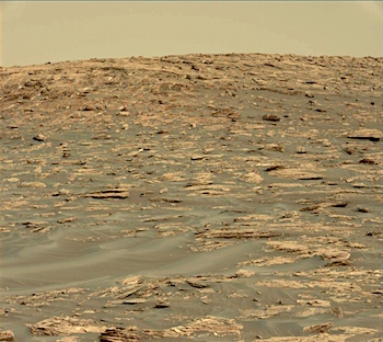
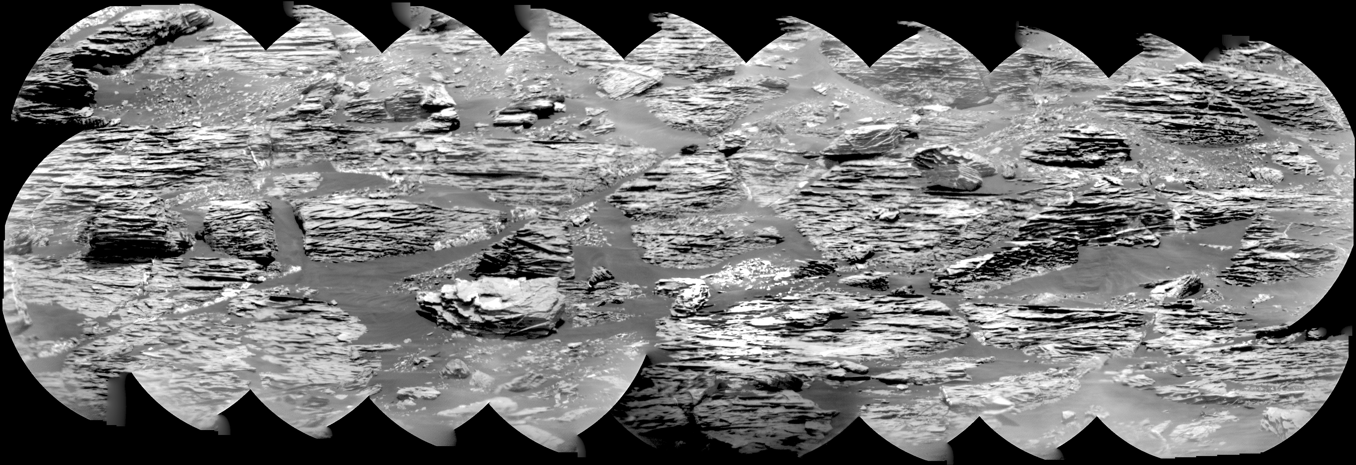
NASA’s senior Mars rover, Opportunity, is examining rocks at the edge of Endeavour Crater for signs that they may have been either transported by a flood or eroded in place by wind.

Those scenarios are among the possible explanations rover-team scientists are considering for features seen just outside the crater rim’s crest above “Perseverance Valley,” which is carved into the inner slope of the rim.

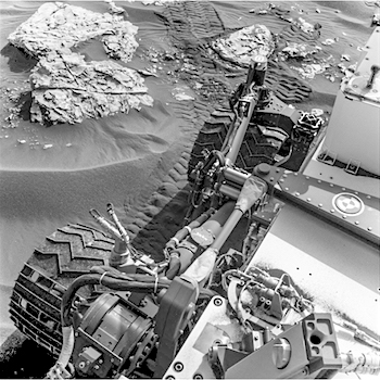
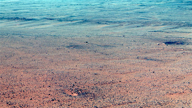
The team plans to drive Opportunity down Perseverance Valley after completing a “walkabout” survey of the area above it. The rover’s drives now use steering motors on only the rear wheels, following a temporary jam of the left-front wheel’s steering actuator this month. Opportunity has not used its right-front wheel’s steering actuator since 2005, the year after it landed on Mars.

The mission has been investigating sites on and near the western rim of Endeavour Crater since 2011. The crater is about 14 miles (22 kilometers) across.

“The walkabout is designed to look at what’s just above Perseverance Valley,” said Opportunity Deputy Principal Investigator Ray Arvidson of Washington University in St. Louis. “We see a pattern of striations running east-west outside the crest of the rim.”

A portion of the crest at the top of Perseverance Valley has a broad notch. Just west of that, elongated patches of rocks line the sides of a slightly depressed, east-west swath of ground, which might have been a drainage channel billions of years ago.

“We want to determine whether these are in-place rocks or transported rocks,” Arvidson said… [More at link]
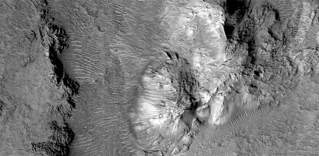
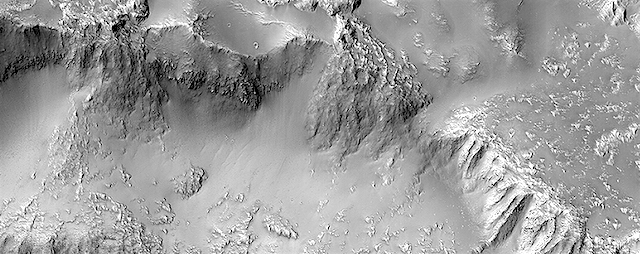
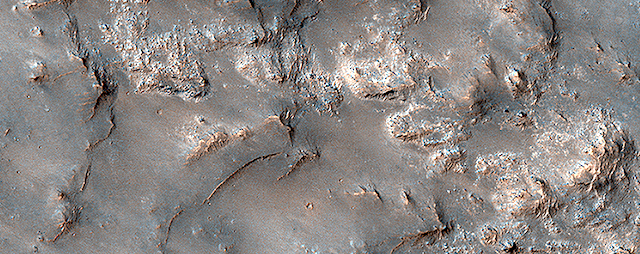
Posted in Reports | Tagged , , , , , , , | Comments Off