THEMIS: Coprates Chasma in false color

Coprates Chasma deposits (THEMIS_IOTD_20170117)
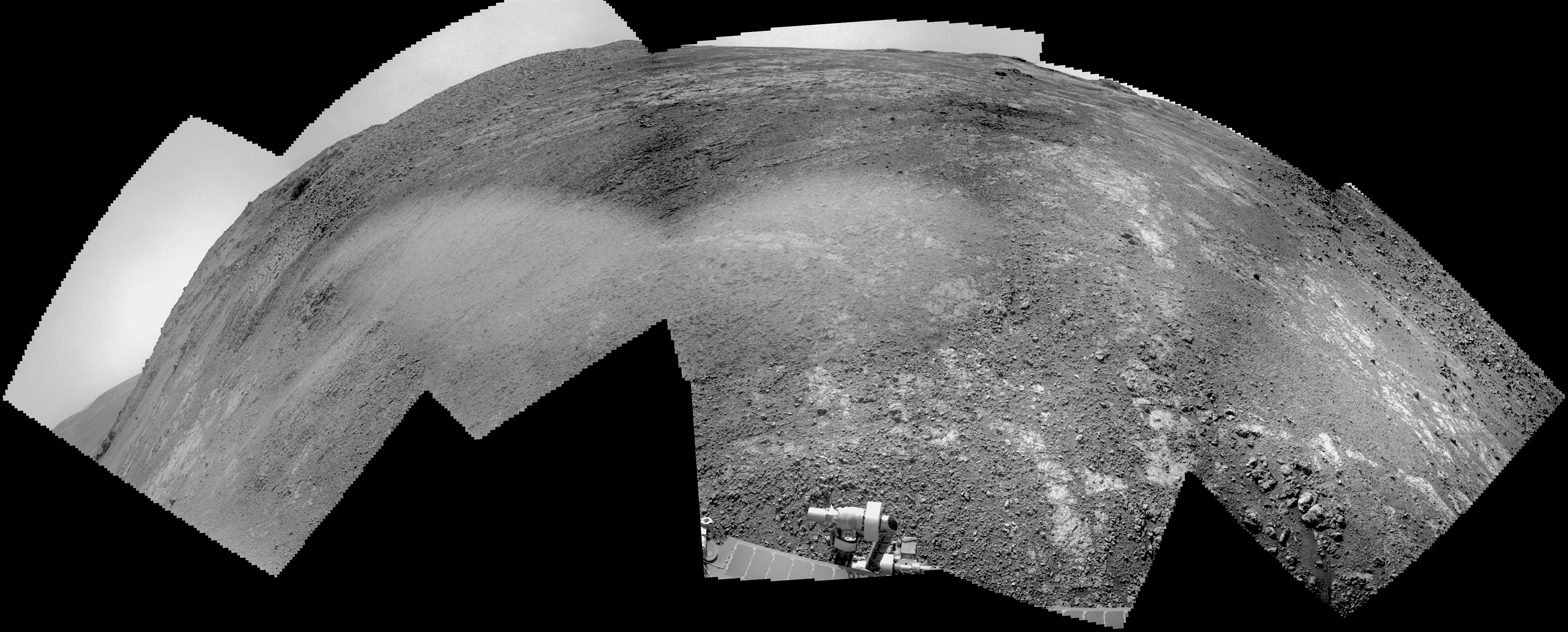
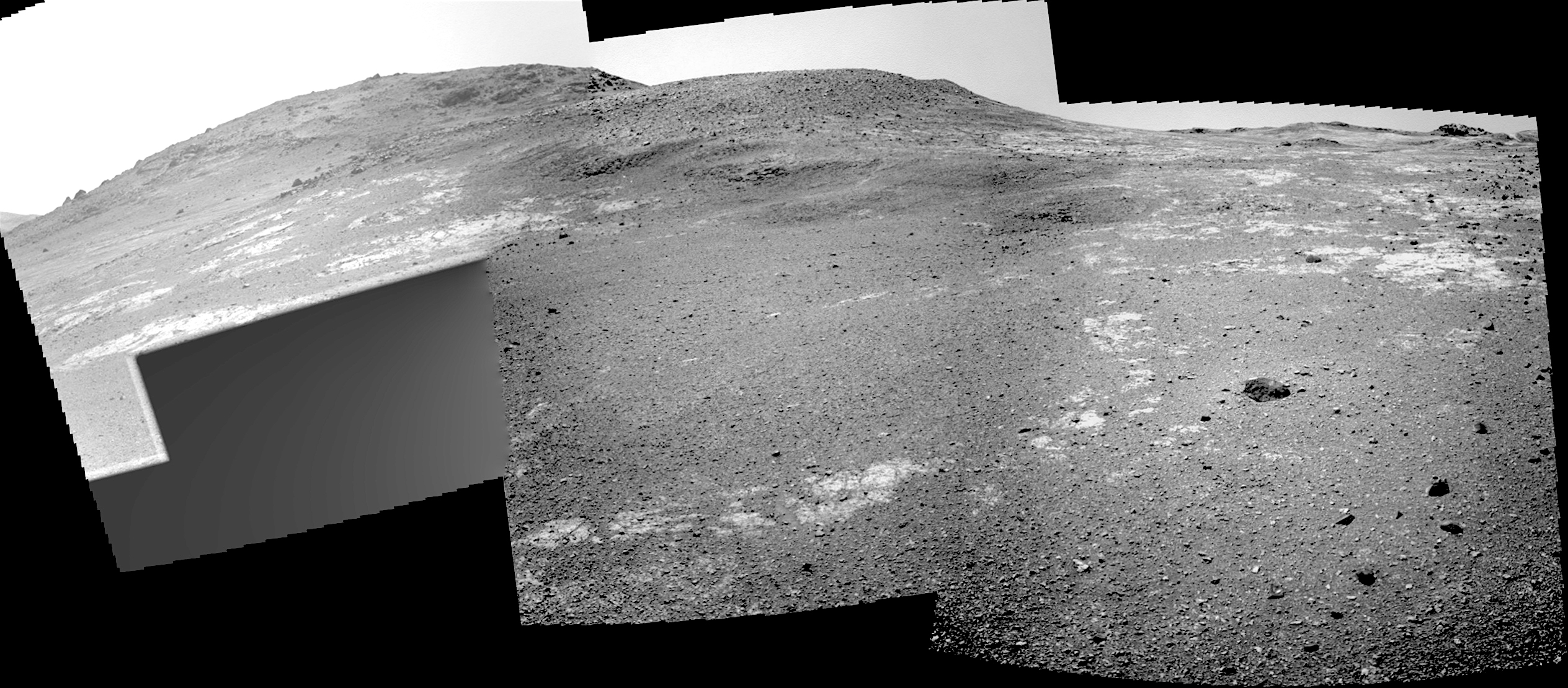
THEMIS Image of the Day, January 17, 2017. Today’s false color image shows part of the interior of Coprates Chasma. Coprates is one segment of the gigantic equatorial rift valley, Valles Marineris.

The THEMIS VIS camera contains 5 filters. The data from different filters can be combined in multiple ways to create a false color image. These false color images may reveal subtle variations of the surface not easily identified in a single band image.

More THEMIS Images of the Day by geological topic.

Posted in Reports | Tagged , , , , , , | Comments Off

Opportunity: Soft soil, then firmer ground

46114-navcam1F537798628EFFCUHJP1299R0M_Sol 4614, January 16, 2017. Above, a wide-angle Navcam composite (3.7 MB) from the rover up to the rim crest.

At right: Opportunity’s wheels hit soft ground again, before the continued driving reached a place with better trafficability. Click either image to enlarge it.

Opportunity raw images, its latest mission status, a location map, and atmospheric opacity, known as tau.

Posted in Reports | Tagged , , , , , , , | Comments Off

HiRISE: Relatively dust-free lavas, Asia Mons

tumblr_ojnftjRHCC1rlz4gso1_1280Relatively dust free lavas from Arsia Mons. Beautiful Mars series.

Posted in Reports | Tagged , , , , , , , , , , | Comments Off

THEMIS: Terra Sirenum dunes & gullies

Gullies and dunes in Terra Sirenum (THEMIS_IOTD_20170116)THEMIS Image of the Day, January 16, 2017. Today’s VIS image is of an unnamed crater in Terra Sirenum. There are gullies dissecting part of the crater rim, and small dunes on the crater floor.

More THEMIS Images of the Day by geological topic.

Posted in Reports | Tagged , , , , , , , , , | Comments Off

Curiosity update: A 4-sol plan

NLB_537583377EDR_F0600888NCAM00654M_Sol 1579-82, January 13, 2017, update by USGS scientist Ken Herkenhoff: After a 25-meter drive on Sol 1578, MSL is surrounded by more dark sand than usual, but there is enough rock exposed that we had a lot of science targets to choose from today.  Due to the US holiday on Monday, we are planning 4 sols today.  The first sol will include only REMS atmospheric observations while the rover recharges after the SAM methane measurement the night before, but the rest of the plan is packed!  Sol 1580 starts with ChemCam passive (no laser) measurements of the sky and calibration targets.  Then we’ll use the laser to zap rock… [More at link]

Posted in Reports | Tagged , , , , , , , , , , , , , , , , , | Comments Off

Curiosity update: Investigating sedimentary structures

NRB_537496217EDR_F0600684NCAM00375M_Sol 1578, January 12, 2017, update by USGS scientist Lauren Edgar: Curiosity had a successful drive of 45 m on Sol 1577.  We’re continuing to characterize the Murray formation by investigating changes in composition and sedimentary structures as we ascend Mt. Sharp.  Today’s plan provided another opportunity for touch and go contact science, starting with MAHLI imaging of the “Megunticook” outcrop.  This outcrop shows some interesting textures, as seen in the above Navcam image.  After MAHLI imaging of the outcrop, we’ll acquire ChemCam LIBS on the same target.  Then Mastcam will be… [More at link]

Posted in Reports | Tagged , , , , , , , , , | Comments Off

HiRISE: Smooth and fractured deposits in Eridania valleys

ESP_047916_1420The ancient highland channels in this image empty into the Eridania Basin (not visible), a large topographically low enclosure with smooth-appearing terrains that may have once contained a large paleolake or ancient sea.

Water in these channels flowed to the east into Ariadnes Basin, a smaller basin located within the confines of Eridiana. Light-toned knobs are exposed in the northern channel, while the other channels are partially filled with smooth appearing lobe-shaped surface flows that are extensively fractured when viewed at high-resolution. [More at link]

Posted in Reports | Tagged , , , , , , , , , , | Comments Off

Curiosity: Rugged rock, then more sand ahead

1578MH0001900010601269C00_DXXXFRB_537582701EDR_F0600888FHAZ00302M_Sol 1578, January 13, 2017. Curiosity used the MAHLI to investigate Megunticook rock outcrop (above), then moved in for a closeup (below). Both images enlarge when clicked.

At right, after driving onward, the Hazcam shows the rover has reached a point where the ground surface is more sand than rock.

Sol 1578 raw images (from all cameras), and Curiosity’s latest location.

1578MH0001660010601281C00_DXXX

Posted in Reports | Tagged , , , , , , , , , | Comments Off

Opportunity: Rolling a little higher

4611-navcam1F537526208EFFCUHHP1212R0M_Sol 4611, January 12, 2017. Opportunity rolled about a meter (yard) higher on Sol 4610, then shot a composite with the Navcam. Today’s composite is incomplete on the left, but it clearly shows the profile of Beacon Rock in the center frame. In driving up to the rim crest, the rover will likely aim to pass to the right of Beacon Rock. At right is the front Hazcam view. (Both images enlarge when clicked.)

Opportunity raw images, its latest mission status, a location map, and atmospheric opacity, known as tau.

Posted in Reports | Tagged , , , , , , , | Comments Off

THEMIS: Faulting & graben in Claritas Fossae

Faulting in Claritas Fossae (THEMIS_IOTD_20170113)THEMIS Image of the Day, January 13, 2017. Today’s VIS image shows graben called Claritas Fossae. These are caused when the ground is pulled apart, and the land between parallel faults drops down.

More THEMIS Images of the Day by geological topic.

Posted in Reports | Tagged , , , , , , , , , , | Comments Off