Curiosity update: Thanksgiving at Precipice

1526ML0077840040604409E01_DXXX-br2
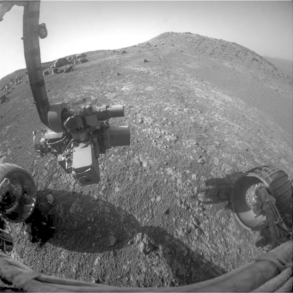
Sol 1531-33, November 23, 2016, update by USGS scientist Ryan Anderson: Today’s plan covers sols 1531-1533, which will take us through the Thanksgiving holiday weekend. We are in place at our next drill location “Precipice” so there will be no driving in the plan, just a lot of science and preparation for drilling!

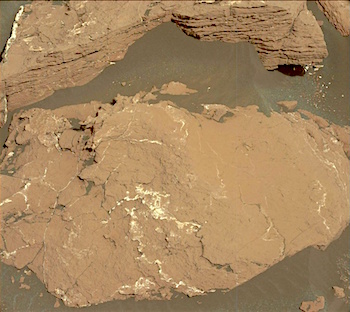
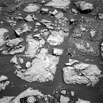
Sol 1531 will start off with ChemCam observations of Precipice as well as the targets “Frenchman Bay” and “Hunter’s Beach”, followed by Mastcam documentation of all three targets. I also managed to fit a request for some Navcams of Mt. Sharp in the Sol 1531 science block to enable some long distance RMI observations next week. After the science block, the rover will do the “pre-load test” on our drilling target to improve the accuracy of the drill next week. Precipice will also be brushed off, and APXS will settle in for an overnight measurement. [More at link]
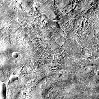
Posted in Reports | Tagged , , , , , , , , , , , , | Comments Off

MARCI weather report, November 14-20, 2016

Screen Shot 2016-11-23Dust-lifting activity was fairly typical for this time of martian season. In the southern hemisphere, repeated dust activity over southern Aonia contributed to a cloud of dust further to the west. Dust hazes were also observed over the southern portions of Sirenum, Promethei, and Cimmeria. During that time, dust and water-ice clouds associated with the north polar hood continued to propagate eastward. Cloud ripples, scientifically known as lee waves, were spotted trailing the topographic highs of Tempe, Deuteronilus, and the Phlegra Montes. Looking to the equatorial latitudes… [More at link, including video]

Posted in Reports | Tagged , , , , , , , , , , , , , | Comments Off

ExoMars: Schiaparelli inquest makes progress

ESA ExoMars 2016Good progress has been made in investigating the ExoMars Schiaparelli anomaly of 19 October. A large volume of data recovered from the Mars lander shows that the atmospheric entry and associated braking occurred exactly as expected.

The parachute deployed normally at an altitude of 12 km and a speed of 1730 km/h. The vehicle’s heatshield, having served its purpose, was released at an altitude of 7.8 km.

As Schiaparelli descended under its parachute, its radar Doppler altimeter functioned correctly and the measurements were included in the guidance, navigation and control system. However, saturation – maximum measurement – of the Inertial Measurement Unit (IMU) had occurred shortly after the parachute deployment. The IMU measures the rotation rates of the vehicle. Its output was generally as predicted except for this event, which persisted for about one second – longer than would be expected.

When merged into the navigation system, the erroneous information generated an estimated altitude that was negative – that is, below ground level. This in turn successively triggered a premature release of the parachute and the backshell, a brief firing of the braking thrusters and finally activation of the on-ground systems as if Schiaparelli had already landed. In reality, the vehicle was still at an altitude of around 3.7 km…. [More at link]

Posted in Reports | Tagged , , , , , , , | Comments Off

THEMIS: Eroded sediments in Ophir Chasma

Eroded deposits in Ophir Chasma (THEMIS_IOTD_20161123)THEMIS Image of the Day, November 23, 2016. Today’s false color image shows part of Ophir Chasma. The mounds on the floor are of unknown origin and contain layers, probably laid down in past climate cycles. They appear to have been eorded by the wind.

The THEMIS VIS camera contains 5 filters. The data from different filters can be combined in multiple ways to create a false color image. These false color images may reveal subtle variations of the surface not easily identified in a single band image.

More THEMIS Images of the Day by geological topic.

Posted in Reports | Tagged , , , , , , , , , , | Comments Off

Curiosity update: Fifteen kilometers!

NLB_532969304EDR_F0592830CCAM15903M_-br2Sol 1528-30, November 18, 2016, update by USGS scientist Ryan Anderson: Our weekend plan went as expected, including a ~16 meter drive which brings us to our next drill target: “Precipice”. That drive also brings our total drive distance from Bradbury Landing to just over 15 km! We have a three sol plan today as we head into the long holiday weekend and prepare for drilling next week.

On Sol 1528, Mastcam has a 3×10 mosaic to provide context for the drill site, followed by ChemCam images of the drill bit and a MARDI twilight image of the ground beneath the rover. On the following sol, Navcam and Mastcam start the day with a set of atmospheric observations to watch for dust devils and measure the amount of dust in… [More at link]

Posted in Reports | Tagged , , , , , , , , , , , , , | Comments Off

Curiosity: Mastcam on Murray Formation bedrock

1526-mastcam34Sol 1526, November 21, 2016. Curiosity’s 34mm (wide-angle) Mastcam shot a six-frame portrait of the bedrock and sand lying beside the rover. The rock in the center is Precipice. Mission scientists did this to document the rock veins and sedimentary structure in this portion of the Murray Formation. Click the image (3.4 MB) to enlarge it.

Sol 1526 raw images (from all cameras), and Curiosity’s latest location.

Posted in Reports | Tagged , , , , , , , , , , | Comments Off

HiRISE: Parallel cracks in Centauri Montes region

tumblr_oh200sE4b41rlz4gso1_1280Parallel cracks in Centauri Montes region. Beautiful Mars series.

Posted in Reports | Tagged , , , , , , , , | Comments Off

SHARAD finds ice deposit in Utopia Planitia with as much water as Lake Superior

PIA21136_hiresFrozen beneath a region of cracked and pitted plains on Mars lies about as much water as what’s in Lake Superior, largest of the Great Lakes, researchers using NASA’s Mars Reconnaissance Orbiter have determined.

Scientists examined part of Mars’ Utopia Planitia region, in the mid-northern latitudes, with the orbiter’s ground-penetrating Shallow Radar (SHARAD) instrument. Analyses of data from more than 600 overhead passes with the onboard radar instrument reveal a deposit more extensive in area than the state of New Mexico. The deposit ranges in thickness from about 260 feet (80 meters) to about 560 feet (170 meters), with a composition that’s 50 to 85 percent water ice, mixed with dust or larger rocky particles.

PIA21137_hiresAt the latitude of this deposit — about halfway from the equator to the pole — water ice cannot persist on the surface of Mars today. It sublimes into water vapor in the planet’s thin, dry atmosphere. The Utopia deposit is shielded from the atmosphere by a soil covering estimated to be about 3 to 33 feet (1 to 10 meters) thick.

“This deposit probably formed as snowfall accumulating into an ice sheet mixed with dust during a period in Mars history when the planet’s axis was more tilted than it is today,” said Cassie Stuurman of the Institute for Geophysics at the University of Texas, Austin. She is the lead author of a report in the journal Geophysical Research Letters. [More at links]

Posted in Reports | Tagged , , , , , , , | Comments Off

THEMIS: Nili Fossae in false color

Nili Fossae in false color THEMIS_IOTD_20161122)THEMIS Image of the Day, November 22, 2016. Today’s false color image shows part of Nili Fossae. This region of Mars lies near the Isidis impact basin. Not far away is one of eight potential landing sites for NASA’s Mars 2020 rover.

The THEMIS VIS camera contains 5 filters. The data from different filters can be combined in multiple ways to create a false color image. These false color images may reveal subtle variations of the surface not easily identified in a single band image.

More THEMIS Images of the Day by geological topic.

Posted in Reports | Tagged , , , , , , , | Comments Off

Opportunity: Fore and aft

1F532919735EFFCTNUP1211R0M1Sol 4559, November 20, 2016. On Sol 4559, Opprtunity drove 10 meters (33 feet) downhill toward the southeast. This took the rover between the “garden” of wind-eroded rocks (left) and Pompy’s Tower (right).

Top right is the view from the front Hazcam looking back upslope, with the rover’s tracks faintly visible as two lines of disturbed soil. Below right is the rear Hazcam’s view downslope.  Click either image to enlarge it.

1R532919874EFFCTNUP1312R0M1Opportunity raw images, its latest mission status, a location map. and atmospheric opacity, known as tau.

Posted in Reports | Tagged , , , , , , , | Comments Off