HRSC: Mawrth Vallis mosaic

Mawrth_Vallis_martian_mosaic
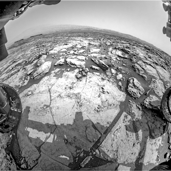
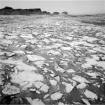
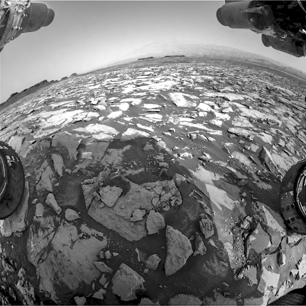
Sculpted by ancient water flowing on the surface, Mawrth Vallis is one of the most remarkable outflow channels on Mars. The valley, once a potentially habitable place, is one of the main features of a region at the boundary between the southern highlands and the northern lowlands.

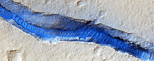
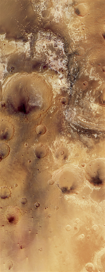
Mawrth Vallis takes centre stage in this image, a bird’s eye view of a 330 000 sq km area surrounding the valley. With a length of 600 km and a depth of up to 2 km, it is one of the biggest valleys on Mars. Huge amounts of water once passed through it, from a higher elevation region, part of which is shown in the lower right of the image, into the northern plains, in the top left.

Among the remarkable features are the large exposures of light-toned phyllosilicates (weathered clay minerals) that lie along its course. Phyllosilicates on Mars are evidence of the past presence of liquid water and point to the possibility that habitable environments could have existed on the planet up until 3.6 billion years ago.

A dark cap rock, remains of ancient volcanic ash, covers many of the clays and could have protected traces of ancient microbes in the rocks from radiation and erosion. This makes Mawrth Vallis one of the most interesting regions for geologists and astrobiologists alike. It is one of the candidate landing sites for ExoMars 2020, a joint mission between ESA and Russia, with the primary goal of finding out if life once existed on Mars. [More at link]

Posted in Reports | Tagged , , , , , , , , , , , , | Comments Off

THEMIS: Lava flow and crater, Daedalia Planum

Lava and crater in Daedalia (THEMIS_IOTD_20160926)THEMIS Image of the Day, September 26, 2016. Today’s VIS image shows a small portion of Daedalia Planum. Daedalia Planum was created by lava flows from Arsia Mons.

More THEMIS Images of the Day by geological topic.

Posted in Reports | Tagged , , , , , , , , , , | Comments Off

Curiosity update: Change of plans

FLB_527905995EDR_F0580264FHAZ00302M_-br2Sol 1470-72, September 23, 2016, update by USGS scientist Ryan Anderson: Our drive went nicely and we are already about halfway to our next drill site! Our original plan to head toward an outcrop called “Karasburg” had to be changed because it turned out to be covered in sand and not very steep, making it a less-desirable science target. So instead we are heading toward a location where (we hope) the stratigraphy will be better-exposed.

For this weekend’s plan, we start out on sol 1470 with a Navcam dust devil search and atmospheric observation, plus ChemCam of the targets “Chiagne”, “Chibemba”, and “Chibanda”. Mastcam will document those three targets, as well as the location of the automated ChemCam observation that was collected after yesterday’s drive. Mastcam also has three mosaics: a 6×3 of the Karasburg outcrop, a 4×1 of a location called “Longojo”, and a 5×2 extension of the drive direction mosaic. [More at link]

Posted in Reports | Tagged , , , , , , , , , , , , , | Comments Off

HiRISE: Intersecting channels near Olympica Fossae

ESP_045091_2045This complicated area contains various types of channels, pits and fractures. We can determine the relative ages of the pits and channels based on which features cross-cut others. Older channels appear smooth-edged and shallow. Younger channels and pits are deeper and more sharp-edged, as well as less sinuous than the shallower channels.

What caused this array of various channels and intersecting pits?

This region is covered in vast lava flows. The collapse pits here may be collapsed lava tubes or where overlying rock “drained” into voids created by extensional faulting. [More at link]

Posted in Reports | Tagged , , , , , , , , , , | Comments Off

Opportunity: Pancam checks Spirit Mound

4502-pancam1P527850174ESFCT00P2560L1M1Sol 4502, September 22, 2016. Above is a Pancam composite showing part of Spirit Mound and one of the small rocky “ridges” leading away from it. Pancam took a fully filtered set of images for the two leftmost frames (false-colored by Holger Isenberg), and just single-filtered frames for the rest. (More Pancam frames on this rocky area may follow on later sols.)

1P527850217ESFCT00P2561L1M1At right are two Pancam shots, both less than full-frame, on boulders lying close to Spirit Mound. The two boulders and many rocks near them show ventifacts — sculpting by windblown dust.

All images enlarge when clicked.

Opportunity raw images, its latest mission status, a location map. and atmospheric opacity, known as tau.

Posted in Reports | Tagged , , , , , , , , , | Comments Off

THEMIS: Wind streaks on Daedalia Planum

Wind streaks big and small (THEMIS_IOTD_20160923)THEMIS Image of the Day, September 23, 2016. This VIS image shows part of Daedalia Planum as well as several windstreaks. There is a large streak in the bottom half of the frame from a large crater off the image to the right. The “tail” of the windstreak is on the downwind side of the crater.

More THEMIS Images of the Day by geological topic.

Posted in Reports | Tagged , , , , , , , , , | Comments Off

HiRISE: Wind-scoured lava flows of Pavonis Mons

ESP_045777_1765This image shows a circular impact crater and an oval volcanic caldera on the southern flank of a large volcano on Mars called Pavonis Mons.

The caldera is also the source of numerous finger-like lava flows and at least one sinuous lava channel. Both the caldera and the crater are degraded by aeolian (wind) erosion. The strong prevailing winds have apparently carved deep grooves into the terrain.

When looking at the scene for the first time, the image seems motion blurred. However, upon a closer look, the smaller, young craters are pristine, so the… [More at link]

Posted in Reports | Tagged , , , , , , , , , | Comments Off

Curiosity update: Leaving Murray Buttes

NRB_527820534EDR_F0580000NCAM00253M_Sol 1469, September 22, 2016, update by USGS scientist Ken Herkenhoff: MSL drove over 87 meters on Sol 1468, toward an outcrop named “Karasburg.”  The Sol 1469 plan includes another drive toward Karasburg, after ChemCam and Mastcam sample a local bedrock target named “Cacolo” and a patch of brighter material dubbed “Malembo.”  Mastcam will also acquire mosaics of the Karasburg area both before and after the drive.  Following the… [More at link]

Posted in Reports | Tagged , , , , , , , , , , , , | Comments Off

Curiosity: Murray Buttes outliers

1468-navcamFRB_527820412EDR_F0580000FHAZ00304M_Sol 1468, September 22, 2016. Three Navcam frames (1.7 MB) show the ground ahead, as Curiosity drives away from the Murray Buttes. Yet the rover is not entirely beyond the buttes, as outliers stand at left and also in line with Mt. Sharp. At right, the Hazcam view. Click either image to enlarge it.

Sol 1468 raw images (from all cameras), and Curiosity’s latest location.

Posted in Reports | Tagged , , , , , , , , , | Comments Off

HiRISE: River of sand

ESP_045081_1875A dominant driver of surface processes on Mars today is aeolian (wind) activity. In many cases, sediment from this activity is trapped in low-lying areas, such as craters. Aeolian features in the form of dunes and ripples can occur in many places on Mars depending upon regional wind regimes.

The Cerberus Fossae are a series of discontinuous fissures along dusty plains in the southeastern region of Elysium Planitia. This rift zone is thought to be the result of combined volcano-tectonic processes. Dark sediment has… [More at link]

Posted in Reports | Tagged , , , , , , , , | Comments Off