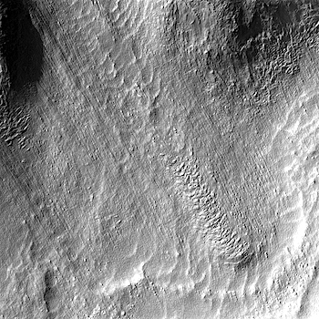
THEMIS Image of the Day, September 20, 2016. Today’s VIS image shows a landslide deposit from the cliffside along Tiu Valles. The mesas at the bottom of the image are part of Hydraotes Chaos.
More THEMIS Images of the Day by geological topic.
THEMIS Image of the Day, September 20, 2016. Today’s VIS image shows a landslide deposit from the cliffside along Tiu Valles. The mesas at the bottom of the image are part of Hydraotes Chaos.
More THEMIS Images of the Day by geological topic.
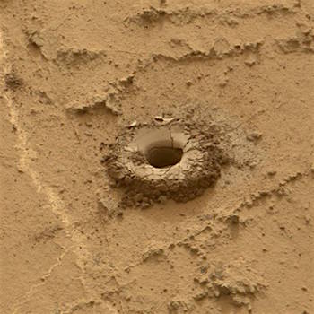 Sol 1466, September 19, 2016, update by USGS scientist Ryan Anderson: The second attempt to drill into Quela was successful, but there was a timing issue during sample manipulation in CHIMRA that resulted in premature halting of the Sol 1465 sequence. So on Sol 1466 we’ll pick up where MSL stopped and sieve the new sample, dump the unsieved fraction, and drop some of the sieved sample into CheMin. But first, ChemCam will acquire… [More at link]
 Sol 4498, September 18, 2016. Opportunity drove about 28 meters (about 90 feet) down the slope toward Spirit Mound, with the Pancam (above) shooting a three-frame composite (2.2 MB). Below is the Navcam’s wider view (1.5 MB), which shows a few large boulders (background right) out on the floor of Endeavour Crater. Both images enlarge when clicked.
Opportunity raw images, its latest mission status, a location map. and atmospheric opacity, known as tau.

 Sol 1463, September 17, 2016. While the rover’s science team focuses mainly on the drill site, the color Mars Hand-Lens Imager (MAHLI) and the grayscale Navcam take a look at the scenery ahead. Above, MAHLI’s view (3.2 MB); below, the Navcam’s four-frame composite. Both images enlarge when clicked.
Sol 1463 raw images (from all cameras), and Curiosity’s latest location.

 THEMIS Image of the Day, September 19, 2016. This VIS image shows some of the extensive lava flows that comprise Solis Planum. [Local time is soon after sunrise, so lighting is coming from the right.]
More THEMIS Images of the Day by geological topic.
 Sol 1462, September 16, 2016, update by USGS scientist Ryan Anderson: Unfortunately the Sol 1461 drilling activities did not complete as expected, so the Sol 1462 plan was focused on trying to understand the problem while also doing some remote sensing. The plan starts off with Mastcam multispectral observations of the target “Ekunha” on the nearby butte. ChemCam will analyze the targets “Cuasa” and “Cuimba”, and then Mastcam will document those targets and… [More at link]
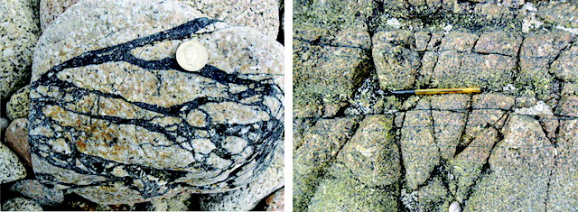 A new study shows that rocks formed by the grinding together of other rocks during earthquakes are rich in trapped hydrogen — a finding that suggests similar seismic activity on Mars may produce enough hydrogen to support life.
Researchers from Yale, the University of Aberdeen, and Brock University studied rock formations around active fault lines in the Outer Hebrides, off the coast of Scotland. Their analysis appears in the journal Astrobiology.
“Previous work has suggested that hydrogen is produced during earthquakes when rocks fracture and grind together. Our measurements suggest that enough hydrogen is produced to support the growth of microorganisms around active faults,” said Yale geologist Sean McMahon, first author of the study.
While humans and other animals get their energy mainly from the reaction between oxygen and sugar, bacteria use a wide array of alternative reactions to obtain energy. The oxidation of hydrogen gas, for example, generates enough energy for bacteria deep in the Earth’s subsurface.
“Mars is not very seismically active, but our work shows that ‘Marsquakes’ could produce enough hydrogen to support small populations of microorganisms, at least for short periods of time,” McMahon said. “This is just one part of the emerging picture of the habitability of the Martian subsurface, where other sources of energy for life may also be available. The best way to find evidence of life on Mars may be to examine rocks and minerals that formed deep underground around faults and fractures, which were later brought to the surface by erosion.” [More at links]
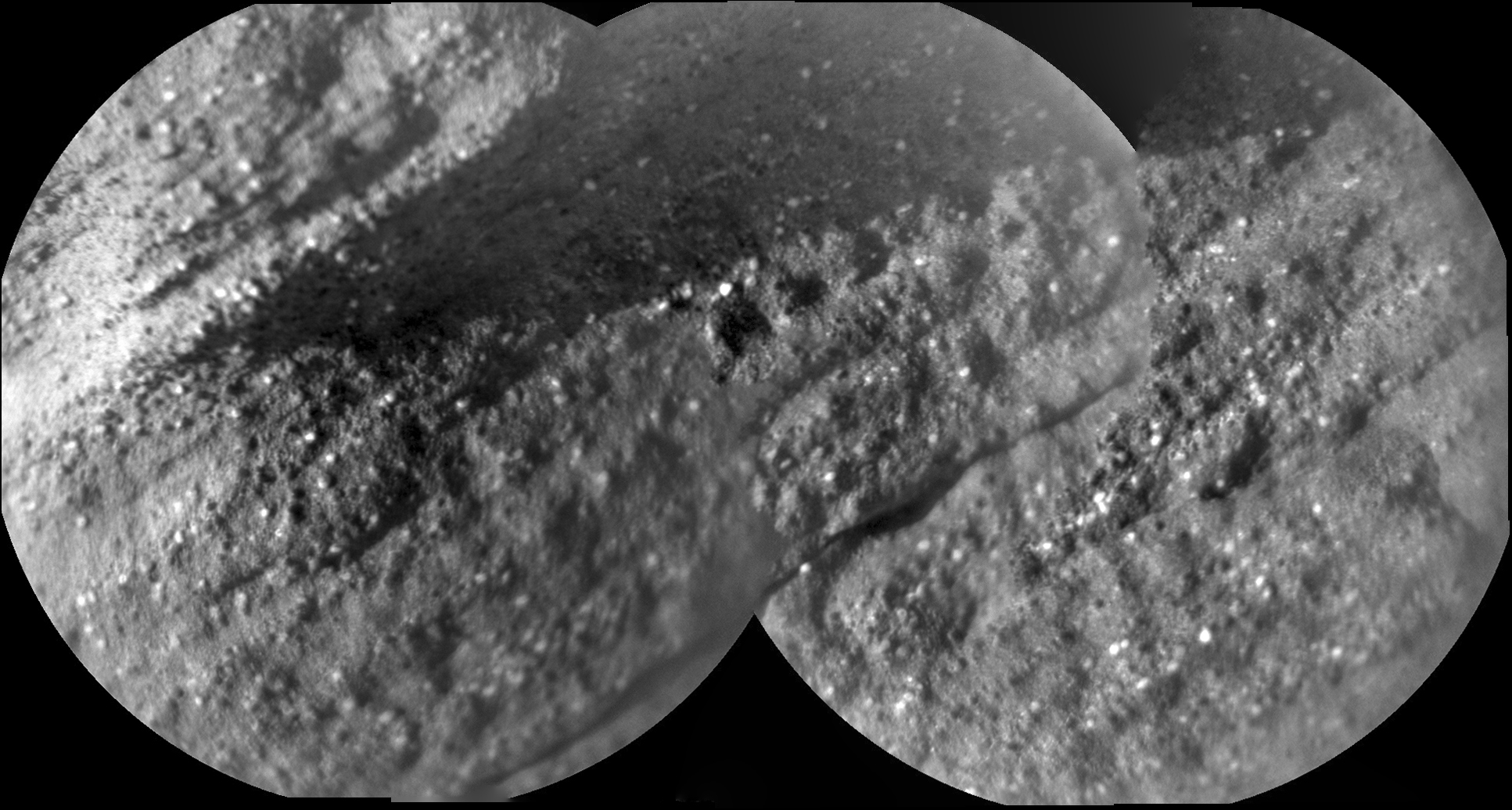 Sol 1462, September 16, 2016. With Curiosity parked at the Quela drill target, the ChemCam’s Remote Micro-Imager shot a three-frame composite (1 MB) focused on a blocky rockfall. The rock’s sedimentary layers include numerous light-toned bits, but these appear to collect more in some layers than in others. (Click image to enlarge it.)
Sol 1462 raw images (from all cameras), and Curiosity’s latest location.
 Sol 4495, September 15, 2016. The rover is continuing its drive downhill, going about 43 meters (140 feet). The light-toned bump dead ahead is dubbed Spirit Mound. Scientists are interested in seeing if at Spirit Mound Opportunity can find the lowermost part of the Cape Tribulation rim material. And if it can, they want to find out how these rocks relate to rock units seen before at lower elevations along the north rim of Endeavour Crater. Above, the Navcam view to the east, below a Pancam pair looking at Spirit Mound (better views to come); click either image to enlarge it.
Opportunity raw images, its latest mission status, a location map. and atmospheric opacity, known as tau.