MARCI weather report, May 13-19, 2019

MARCI-May-16-2019Afternoon condensate water-ice clouds continued to be the dominant feature over all the major Martian volcanoes this past week. A few arcuate dust storms were observed along the edge of the seasonal north polar ice cap. On the other side of the red planet, transient dust storms and water-ice clouds were spotted over the mid-to-high southern latitudes throughout the week… [More at link, including video]
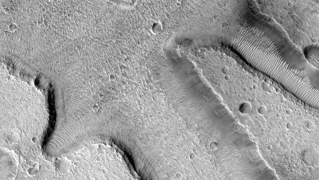
Posted in Reports | Tagged , , , , , , , , , , , , , , | Comments Off

The transition between sand ripples and megaripples on Mars

figure_1[Editor’s note: From a paper by James Zimbelman recently published in Icarus.]

The transition between sand ripples and megaripples on Mars

• HiRISE images of small sand dunes and megaripples in Gamboa and Matara craters on Mars suggest that there may be a transition from sand ripples to megaripples.

HiRISE images of small sand dunes and megaripples in Gamboa and Matara craters on Mars raise intriguing questions regarding the relationship between sand ripples and megaripples. The observations suggest that there might be a progressive transition from sand ripples to megaripples, something worthy of consideration by the community as analysis of HiRISE images continues. [More at link]

Posted in Reports | Tagged , , , , | Comments Off

HiRISE: Terrain near Idaeus Fossae

ESP_054899_2160Terrain near Idaeus Fossae. Many valleys occur all over Mars that reveal an extensive ancient history of liquid water erosion. While these valley systems are typically now covered with fine soils and sand dunes, the overall scale and shape of the valleys reveals much about the ancient climate.

HiRISE Picture of the Day archive. [More at links]

Posted in Reports | Tagged , , , , , , , , , , , | Comments Off

THEMIS: Polar cap’s edge in false color

Polar cap edge in false-color (THEMIS_IOTD_20190522)THEMIS Image of the Day, May 22, 2019. Today’s false-color image shows the margin between the north polar cap and the surrounding plains (lower right). The polar cap was created by alternating layers of ice and dust, deposited over millions of years during different seasons.

The THEMIS VIS camera contains 5 filters. The data from different filters can be combined in multiple ways to create a false color image. These false color images may reveal subtle variations of the surface not easily identified in a single band image.

Explore more THEMIS Images of the Day by geological subject.

Posted in Reports | Tagged , , , , , , , , , , | Comments Off

Curiosity update: Back to work after a weekend at the beach

NRB_611622239EDR_F0751916NCAM00266M_-br2Sol 2413, May 20, 2019, update by MSL scientist Mariah Baker: After spending the weekend playing in the sand of a nearby ripple field, Curiosity is back on the move, searching for our next drill target. Since nothing in our current workspace stuck out as an obvious drill candidate, we planned a ~10 meter drive south towards an area that may be more promising.

But there is still lots to get done here before we leave, including targeting “Galashiels” with APXS and more distant “Hallaig” with the ChemCam LIBS instrument in order to characterize the chemical composition of these rocks. Although unreachable from our current position, “Hallaig” is being considered for drilling pending the ChemCam results. Tosol’s plan also included a Mastcam stereo mosaic of the southern side of the Vera Rubin Ridge, which displays an interesting rubbly texture. The rover’s current location is the closest we will ever get to this side of the ridge, so… [More at link]

Posted in Reports | Tagged , , , , , , , , , , , , , , | Comments Off

Send your name to Mars with NASA’s 2020 rover

mars2020-sendname-homeAlthough it will be years before the first humans set foot on Mars, NASA is giving the public an opportunity to send their names – etched on microchips – to the Red Planet with NASA’s Mars 2020 rover, which represents the initial leg of humanity’s first round trip to another planet. The rover is scheduled to launch as early as July 2020, with the spacecraft expected to touch down on Mars in February 2021.

The rover, a robotic scientist weighing more than 2,300 pounds (1,000 kilograms), will search for signs of past microbial life, characterize the planet’s climate and geology, collect samples for future return to Earth, and pave the way for human exploration of the Red Planet.

“As we get ready to launch this historic Mars mission, we want everyone to share in this journey of exploration,” said Thomas Zurbuchen, associate administrator for NASA’s Science Mission Directorate (SMD) in Washington. “It’s an exciting time for NASA, as we embark on this voyage to answer profound questions about our neighboring planet, and even the origins of life itself.” [More at link]

Posted in Reports | Tagged , , , , , , | Comments Off

HiRISE: Mounds in depressions in Deuteronilus Mensae

ESP_054896_2240Mounds in depressions in Deuteronilus Mensae. The objective of this observation is to determine the nature of round mounds in depressions. The depressions may be part of the ribbed upper plains unit. Some of the edges of the depressions are upturned. The mounds appear to be smooth.

HiRISE Picture of the Day archive. [More at links]

Posted in Reports | Tagged , , , , , , , , , , , , | Comments Off

THEMIS: Inuvik Crater in false color

Inuvik Crater in false color (THEMIS_IOTD_20190521)THEMIS Image of the Day, May 21, 2019. Today’s false-color image shows Inuvik Crater, located near the north polar cap.

The THEMIS VIS camera contains 5 filters. The data from different filters can be combined in multiple ways to create a false color image. These false color images may reveal subtle variations of the surface not easily identified in a single band image.

Explore more THEMIS Images of the Day by geological subject.

Posted in Reports | Tagged , , , , , , , , , , | Comments Off

Curiosity: Ripples along the ridge

2412-navcamSol 2412, May 20, 2019. So that Curiosity can investigate the nearby sand ripple targets, mission controllers have been driving the rover on the edge of the sands that lie in a wind shadow along the south side of Vera Rubin Ridge.

In this composite of seven Navcam frames, the ridge forms the skyline at left and center, with the lower slopes of Mt. Sharp visible in the distance at right. In the foreground, parts of the clay-bearing unit are visible as they poke through the loose sand. Click the image to enlarge it.

Sol 2412 raw images (from all cameras).

Posted in Reports | Tagged , , , , , , , , , , , | Comments Off

HiRISE: Ridges in southern Claritas Fossae

ESP_054888_1380Ridges in southern Claritas Fossae. The objective of this observation is to determine the nature of a small field of curved ridges. They may be inverted streams. Claritas Fossae is a densely-dissected highland terrain on the Tharsis Rise of Mars, located immediately south of the Tharsis Montes.

HiRISE Picture of the Day archive. [More at links]

Posted in Reports | Tagged , , , , , , , , , | Comments Off