HiRISE: Hellas Planitia floor

tumblr_ob8mmwxYQq1rlz4gso1_1280Hellas Planitia floor. Beautiful Mars series.

Posted in Reports | Tagged , , , , , , , , | Comments Off

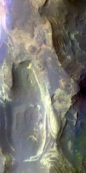
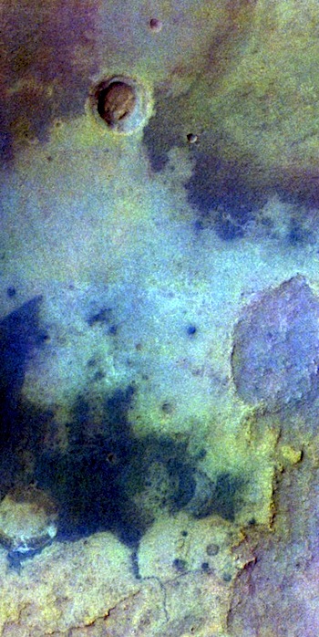
THEMIS: Terby Crater’s unread geo-history book

Layers of history in Terby Crater (THEMIS_IOTD_20160803)THEMIS Image of the Day, August 3, 2016. Today’s false color image shows the northern part of Terby Crater. This image shows the layered deposits that fill the crater. The THEMIS camera contains 5 filters. The data from different filters can be combined in multiple ways to create a false color image. These false color images may reveal subtle variations of the surface not easily identified in a single band image.

More THEMIS Images of the Day by geological topic.

Posted in Reports | Tagged , , , , , , , , , , | Comments Off

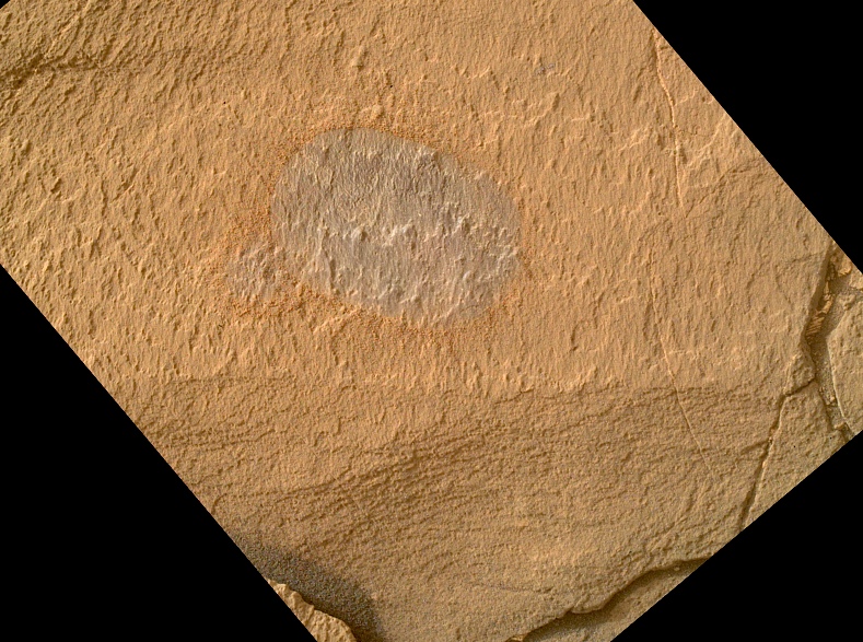
Curiosity: Brushing Marimba

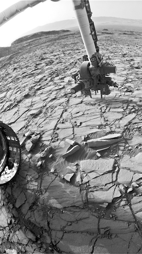
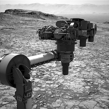
1418-mahli-marimbaFRB_523389360EDR_F0561236FHAZ00208M_Sol 1418, August 2, 2016. As Curiosity’s  instrument arm swings into action and settles on the Marimba target (Hazcam, right), the rock surface is tested for “drillability” (it stays put, in other words) and then it is brushed to clean the surface (MAHLI, above).

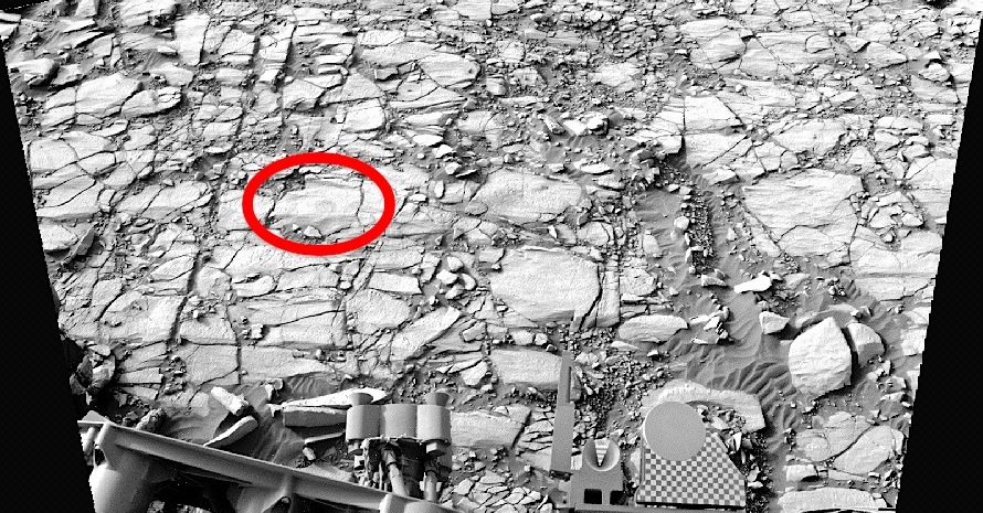
Below, the red oval shows Marimba’s location near the rover (Navcam). All images enlarge when clicked.

Sol 1418 raw images (from all cameras), and Curiosity’s latest location.

1418-navcam-marimba

Posted in Reports | Tagged , , , , , , , , , , , | Comments Off

HiRISE: Crater on north polar layered deposits

tumblr_ob8mgk7TAJ1rlz4gso2_1280109-meter diameter crater on north polar layered deposits.

Beautiful Mars series.

Posted in Reports | Tagged , , , , , , , , , , | Comments Off

Curiosity update: Preparing to drill Marimba

NLB_523287410EDR_F0561236NCAM00271M_-br2Sol 1418, August 1, 2016, update by USGS scientist Ryan Anderson: Today’s plan was all about setting up for our next drill hole. Originally there was going to be no science block at all, but we ended up with a little bit more power than expected, so we managed to fit in a ChemCam observation of the expected drill target, called “Marimba” along with Mastcam documentation.  Once that was done, the rover dumped its sieved sample from our previous drill at “Oudam” and did some contact science on Marimba. [More at link]

Posted in Reports | Tagged , , , , , , , , , , , , | Comments Off

THEMIS: Hellas basin’s Ausonia Montes

Ausonia Montes in the Hellas basin (THEMIS_IOTD_20160802)THEMIS Image of the Day, August 2, 2016. Today’s false color images show part of Ausonia Montes. The THEMIS camera contains 5 filters. The data from different filters can be combined in multiple ways to create a false color image. These false color images may reveal subtle variations of the surface not easily identified in a single band image.

More THEMIS Images of the Day by geological topic.

Posted in Reports | Tagged , , , , , , , , | Comments Off

Curiosity: On the Murray bedrock

1417-navcam-3Sol 1417, August 1, 2016. Three Navcam frames looking toward the west-northwest reveal that the Murray Formation bedrock is well exposed over a large expanse. Click image to enlarge it.

Sol 1417 raw images (from all cameras), and Curiosity’s latest location.

Posted in Reports | Tagged , , , , , , , , , , | Comments Off

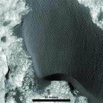
Large aeolian ripples on Mars

namib_dunePlanetary Geomorphology Image of the Month, July 30, 2016: Ryan C. Ewing (Texas A&M University).  Ripples cover the surfaces of sand dunes on Earth and Mars. On Earth, ripples formed in typical aeolian sand (e.g., 0.1 and 0.3 mm) range in wavelength between 10 and 15 cm and display a highly straight, two-dimensional crestline geometry. Ripples are thought to develop through a process dominated by the ballistic impacts of saltating sand grains in which wavelength selection occurs through the interplay of grain size, wind speed, the saltation trajectories of the sand grains, and ripple topography.

High Resolution Imaging Science Experiment (HiRISE) images of the surface of Mars show ripples forming at much longer wavelengths ranging between 1 and 5 m and with a variable planform geometry ranging from two-dimensional to sinuous… [More at link]

Posted in Reports | Tagged , , , , | Comments Off

THEMIS: Sediments on the plains of Argyre

History in Argyre layers (THEMIS_IOTD_20160801)THEMIS Image of the Day, August 1, 2016. Today’s false color image shows plains northwest of Argyre Plainitia. The THEMIS camera contains 5 filters. The data from different filters can be combined in multiple ways to create a false color image. These false color images may reveal subtle variations of the surface not easily identified in a single band image.

More THEMIS Images of the Day by geological topic.

Posted in Reports | Tagged , , , , , , , , | Comments Off

Curiosity update: Approaching next drill target

NLB_523024685EDR_F0561122NCAM00353M_Sol 1416-17, July 29, 2016, update from USGS scientist Ken Herkenhoff: MSL drove another 44 meters on Sol 1414, into an area with larger blocks of bedrock.  This looks like a good area to drill into the Murray Formation, so nearby targets were selected and we are planning a short drive to position the vehicle for drilling.  But first, ChemCam and Mastcam will observe bedrock targets “Chibia” and “Dondo.”  Mastcam will also measure the dust in the atmosphere and take an image of the Sol 1414 ChemCam… [More at link]

Posted in Reports | Tagged , , , , , , , , , , , , | Comments Off