Curiosity update: ‘Entering the valley’

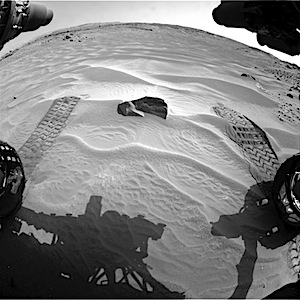
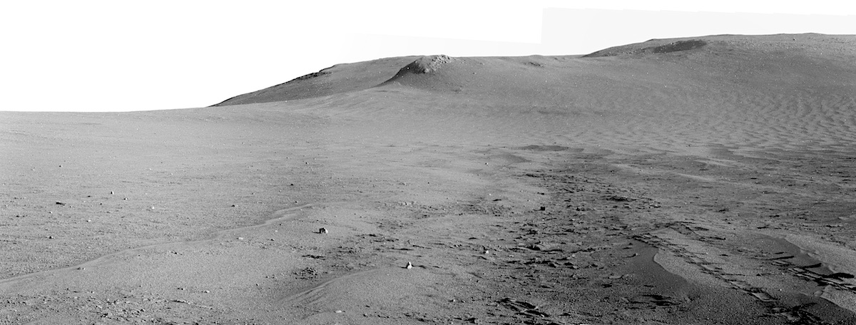
Sol 707, August 1, 2014, update on Curiosity from MSL Scientist Lauren Edgar: “Curiosity has just entered Hidden Valley! For a view into the valley and information about our plans for exploring the geology, check out the recent…” [More at link]

Posted in Reports | Tagged , , , , , , , | Comments Off

HiRISE: Candidate landing site for 2020 mission

tumblr_n9g347S9yE1rlz4gso2_1280Candidate landing site for 2020 mission. Beautiful Mars series.

Posted in Reports | Tagged , , , , , , , , | Comments Off

CRISM: Mesospheric cloud above Valles Marineris

lmb00002cd5_mesocloudCRISM is primarily known for spectrally mapping the surface of Mars, but it can also look at ices and aerosols in the atmosphere as well! The image shows a limb (meaning a view of the horizon) of the planet where the surface can be seen at the bottom with an orange tint, a cloud can be seen in the atmosphere, and space is seen above in black. In order to make these observations, the MRO spacecraft must pitch onto its side so CRISM no longer looks down at the surface, but instead out onto the horizon of the planet… [More at link]

Posted in Reports | Tagged , , , , , , | Comments Off

THEMIS: Dark dunes

Dark dunes (THEMIS_IOTD_20140804)THEMIS Image of the Day, August 4, 2014. The small, dark dunes in this VIS image are located on the northern plains.

More THEMIS Images of the Day by geological topic.

Posted in Reports | Tagged , , , , , , , , , , | Comments Off

Curiosity: Sol 706, August 1, 2014

FRB_460172740EDR_F0400200FHAZ00302M_Testing the sands of Hidden Valley. In the foreground lie small-scale patterns among the sand ripples. These may be wholly natural — or caused by wind around the rover, as wheel tracks show Curiosity has already stood over them before rolling back.

NASA description: This image was taken by Front Hazcam: Right B (FHAZ_RIGHT_B) onboard NASA’s Mars rover Curiosity on Sol 706 (2014-08-01 13:57:39 UTC).

Sol 706 raw images (from all cameras), and Curiosity’s latest location map.

Posted in Reports | Tagged , , , , , , , , | Comments Off

Sandy valleys lie ahead in Curiosity’s path

PIA18408_modestThe main map here shows the assortment of landforms near the location of NASA’s Curiosity Mars rover as the rover’s second anniversary of landing on Mars nears. The gold traverse line entering from upper right ends at Curiosity’s position as of the 705th Martian day, or sol, of the mission on Mars (July 31, 2014). The inset map shows the mission’s entire traverse from the landing on Aug. 5, 2012, PDT (Aug. 6, UTC) to Sol 705, and the remaining distance to long-term science destinations near Murray Buttes, at the base of Mount Sharp. The label “Aug. 5, 2013″ indicates where Curiosity was one year after landing… [More at link]

Posted in Reports | Tagged , , , , , , , , , , , , , , | Comments Off

Opportunity: Sol 3739, July 31, 2014

3739-pancam-pan-1200The Pancam looked south toward the yet-untouched lower slopes of Cape Tribulation (three-frame composite). The filter used (left-side #7) favored blue wavelengths, so the reddish ground appears dark. Note the rover tracks at right, which halt abruptly like an unfinished stub of railroad track. These show how far south Opportunity traveled before mission controllers turned it around on Sol 3737 and drove back north about 30 meters (100 feet) to examine mineral details in a bypassed outcrop.

Opportunity raw images, its latest mission status, and a location map. (A shortcut to Sol 3739 Pancam images is here.)

Posted in Reports | Tagged , , , , , | Comments Off

Curiosity nears mountain base outcrop

pia18409-640As it approaches the second anniversary of its landing on Mars [August 12], NASA’s Curiosity rover is also approaching its first close look at bedrock that is part of Mount Sharp, the layered mountain in the middle of Mars’ Gale Crater. The mission made important discoveries during its first year by finding evidence of ancient lake and river environments. During its second year, it has been driving toward long-term science destinations on lower slopes of Mount Sharp. Those destinations are in an area beginning about 2 miles (3 kilometers) southwest of the rover’s current location, but an appetizer outcrop of a base layer of the mountain lies much closer….” [More at link, including link for 360° panorama]

Posted in Reports | Tagged , , , , , , , | Comments Off

Curiosity update: ‘Scenic route’

Sol 706, July 31, 2014, update on Curiosity from MSL Scientist Lauren Edgar: “Today we planned contact science (APXS and MAHLI) on a rock target named Thimble, and an extra MAHLI image of an adjacent rock named Poleta. These…” [More at link]

Posted in Reports | Tagged , , , , , , , , , , | Comments Off

HiRISE: Cones with summit depressions

tumblr_n9g2s3XlDW1rlz4gso1_1280Cones with summit depressions near the north wall of Coprates Chasma. Beautiful Mars series.

Posted in Reports | Tagged , , , , , , , , , , , | Comments Off