Curiosity: Gometra in the RMI’s sights

2286-rmi
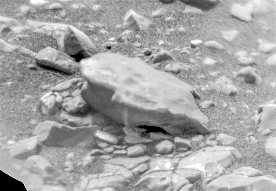
Sol 2286, January 10, 2019. The target dubbed Gometra, possibly a meteorite, was imaged by the Remote Micro-Imager (RMI). (An earlier but similar view of Gometra is here). Click the image to enlarge it.

Sol 2286 raw images (from all cameras).

Posted in Reports | Tagged , , , , , , , , , | Comments Off

THEMIS: Central peaks of Hale Crater

Central peaks in Hale Crater (THEMIS_IOTD_20190111)THEMIS Image of the Day, January 11, 2019. Today’s VIS image shows part of the floor of Hale Crater and the elongate axis of the central peak mountains.

Hale Crater is an example of an oblique impact crater. The mountain chain trends from the southeast towards the northwest, increasing in height towards the northwest.

The incoming meteor struck the surface along this trend, forming an oval crater and displacing the impact energy forward to create the central mountain range. Hale Crater is located near the northern part of Argye Plainitia.

See more THEMIS Images of the Day by geological subject.

Posted in Reports | Tagged , , , , , , , , , , | Comments Off

Curiosity update: Starting the wrap-up at Rock Hall

FLA_600259347EDR_F0731206FHAZ00341M_-br2Sols 2286-87, January 10, 2019, update by MSL scientist Catherine O’Connell-Cooper: Our onboard instruments SAM (Sample Analysis at Mars) and CheMin (Chemistry and Mineralogy) have come to the end of their investigation of the Rock Hall target, likely to be our last drill location on the Vera Rubin Ridge, so this 2-sol plan is the beginning of the drill operation wrap up. On the first sol (2286) SAM will “doggie bag” some sample, saving it for further experimentation in future weeks. The second sol of the plan (2287) will centre on preparations to “dump” the remaining sample from the drill onto the ground in the weekend plan, so that it can be analyzed by APXS, MAHLI, Mastcam and ChemCam. For example, Mastcam will image the Rock Hall drill hole, to monitor the degree of movement of the drill fines in the 3 weeks since our drilling… [More at link]

Posted in Reports | Tagged , , , , , , , , , , , , , , | Comments Off

Mars Express: 15 years imaging the Red Planet

On 25 December 2003, ESA’s Mars Express entered orbit around the Red Planet. The spacecraft began returning the first images from orbit using its High Resolution Stereo Camera just a couple of weeks later, and over the course of its fifteen year history has captured thousands of images covering the globe.

This video compilation highlights some of the stunning scenes revealed by this long-lived mission. From breathtaking horizon-to-horizon views to the close-up details of ice- and dune-filled craters, and from the polar ice caps and water-carved valleys to ancient volcanoes and plunging canyons, Mars Express has traced billions of years of geological history and evolution. [More at link]

Posted in Reports | Tagged , , , , , , , | Comments Off

THEMIS: Tectonics meets volcanism in Claritas Fossae

Tectonics meets volcanism in Claritas Fossae (THEMIS_IOTD_20190110)THEMIS Image of the Day, January 10, 2019. This VIS image shows part of Claritas Fossae. The linear features (fossae) are faults.

This region of Mars had very active tectonism and volcanism, resulting in the huge volcanos like Arsia Mons and deep chasmata of Valles Marineris. Claritas Fossae is located between the lava plains of Solis and Daedalia Planums.

See more THEMIS Images of the Day by geological subject.

Posted in Reports | Tagged , , , , , , , , , , , , | Comments Off

InSight update, Sols 25-42, by Emily Lakdawalla, The Planetary Society

20190109_actualites_Install_SEIS_LVL_GIF_f840In the weeks since my last update, InSight has methodically worked through most of the long list of activities required to set up its sensitive seismometer experiment, SEIS. Engineers have leveled the seismometer and worked on cable management. Most significantly for the science mission, they have balanced the Very Broad Band sensors — 3 of SEIS’ 6 seismic sensors — and confirmed that they are generating good data. This is a huge milestone and a huge relief for the science team, project scientist Bruce Banerdt told me. (…)

Over the next couple of weeks, they will complete cable management work and place the wind and thermal shield over the instrument. The mission is still on track to be gathering good-quality science data by February. In the meantime, the science team is already writing up results; they are submitting more than 50 abstracts to the Lunar and Planetary Science Conference, to be held in March. (Most of these will concern environment and weather measurements, but some will be placeholders for future seismometer results.) [More at link]

Posted in Reports | Tagged , , , , , , , , , | Comments Off

Curiosity update: A spectra-cular Monday on Mars

FRA_600077167EDR_F0731206FHAZ00341M_-br2Sols 2284-85, January 7, 2019, update by MSL scientist Mariah Baker: Today was a very smooth planning day on Mars, with the first scheduled science block in the plan being entirely filled by various spectroscopic ChemCam observations. The ChemCam instrument has the capabilities to be used in both passive and active modes, both of which were included in today’s plan. ChemCam active observations, which require shooting a laser at specific rock targets and analyzing the resulting plasmas, will be acquired for “Coatbridge” and “Pitscurrie,” two small rock outcrops in the rover’s vicinity. Altogether, these observations will help us determine the spectral characteristics of the local geology, and the associated Mastcam documentation images of Coatbridge and Pitscurrie will provide geologic context for these measurements. The second scheduled science block, which coincided with an extended stretch of REMS monitoring, was dedicated to environmental observations such as Navcam movies looking for dust devils and clouds… [More at link]

Posted in Reports | Tagged , , , , , , , , , , , | Comments Off

Do slope streaks show global-scale water processes on Mars today?

figure-1[Editor’s note: From a paper by Anshuman Bhardwaj and three co-authors recently published in Reviews of Geophysics.]

Are Slope Streaks Indicative of Global‐Scale Aqueous Processes on Contemporary Mars?

• We provide a systematic survey and evaluation of the literature covering morphological characteristics of slope streaks
• We present a novel analog environment, Salar de Uyuni in the Bolivian Altiplano, where slope streaks are formed solely by deliquescence
• We offer perspectives on the probable mechanisms driving global‐scale slope streak formation on contemporary Mars

Slope streaks are prevalent surface features on contemporary Mars. They have dark albedo and are abundant in the equatorial and subequatorial latitudes. The exact mechanisms behind their formation and development are still unknown, and several hypotheses have been proposed based on the physicochemical and geomorphological properties of slope streaks.

These features generate a common interest because several hypotheses have linked them with transiently flowing liquid water on the Martian surface. Such probable linkages with Martian liquid water can have wide implications for understanding habitability conditions and ongoing water cycles on Mars and for evolving planetary protection policies to prevent possible contamination of Martian surface during future missions.

Therefore, here we perform a systematic evaluation of the literature covering morphological and flow characteristics of slope streaks for water‐driven or dry dust avalanche mechanisms. We discuss the probable limitations of the various proposed models for slope streak development and provide perspectives on the plausible processes driving global‐scale slope streak formations on Mars.

Continuously improving satellite and rover observations of Martian surface, topography, climate, and minerals are bound to improve our understanding of slope streaks in the coming years. [More at link]

Posted in Reports | Tagged , , , , , | Comments Off

Weather at Gale Crater

Posted in Reports | Tagged , , , , , , , | Comments Off

THEMIS: Something odd in Noachis Terra

Something odd in Noachis Terra (THEMIS_IOTD_20190109)THEMIS Image of the Day, January 9, 2019. This VIS image shows a portion of Noachis Terra to the northeast of Argyre Planitia.

In the middle of the image is an unnamed crater that is not even close to being round. Instead the crater has a rim that bulges out on the west side. The ejecta is still visible, so this is an impact crater, but the odd shape points to surface properties that affected the crater formation.

In regions with large amount of tectonic features, the subsurface faults and structures can displace impact energy along the planes of the subsurface faults. In uniform subsurfaces the energy propagates uniformly as a spherical wave. Meteor Crater in northern Arizona is an earth example of such subsurface control – it is square rather than round.

The oval form to the left of the crater may have been formed by an oblique impact – when a meteor hits the surface at a low angle.

See more THEMIS Images of the Day by geological subject.

Posted in Reports | Tagged , , , , , , , , , , , | Comments Off