HiRISE: Ice block avalanche

ESP_054663_2650HiRISE has been re-imaging regions first photographed in 2006 through 2007, six Mars years ago. This long baseline allows us to see large, rare changes as well as many smaller changes.

One of the most actively changing areas on Mars are the steep edges of the North Polar layered deposits. This image shows many new ice blocks compared to an earlier image in December 2006. An animation shows one example, where a section of ice cliff collapsed. The older image (acquired in bin-2 mode) is not as sharp as the newer one. [More at link, including animation]

Posted in Reports | Tagged , , , , , , , | Comments Off

Nirgal Vallis flow built an alluvial fan in Uzboi Vallis relatively recently

figure-6[Editor’s note: From a paper by Sharon Wilson and three co-authors recently published in the Journal of Geophysical Research.]

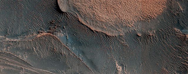
• We identify and characterize a deposit (upper and lower units) on the floor of Uzboi Vallis near the confluence of Nirgal Vallis

• Upper unit formed by late alluvial deposition from Nirgal, possibly sustained by groundwater discharge from the adjacent regional aquifer

• The origin of the lower unit is poorly constrained but may include Luki crater ejecta as well as fluvial and (or) mass wasting sources

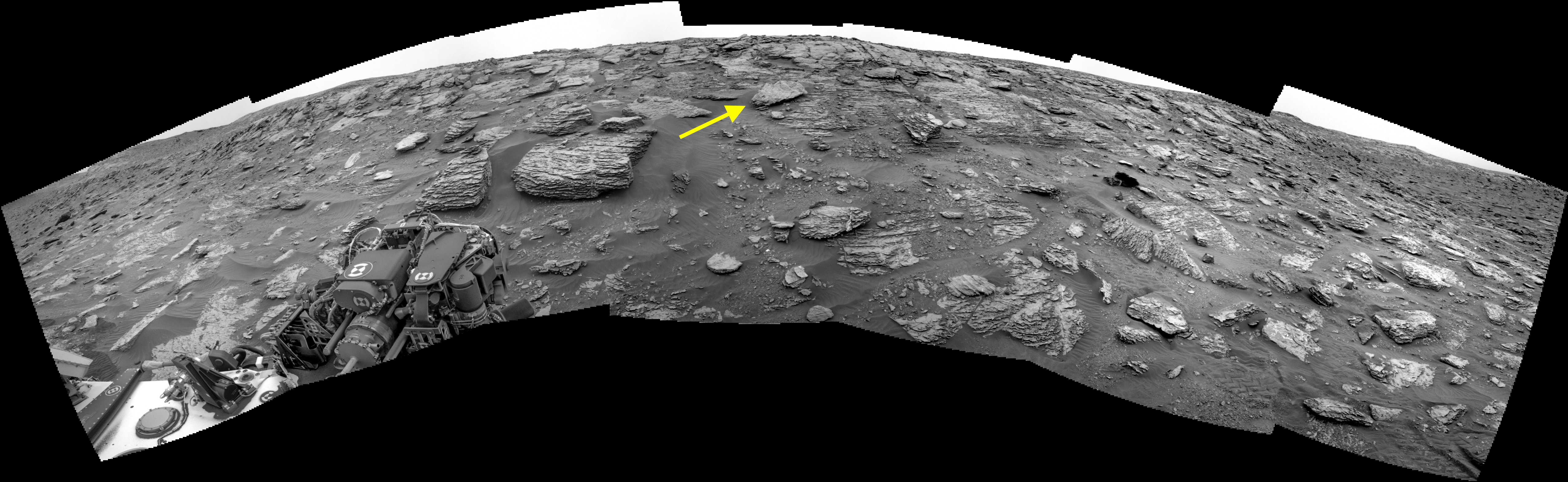
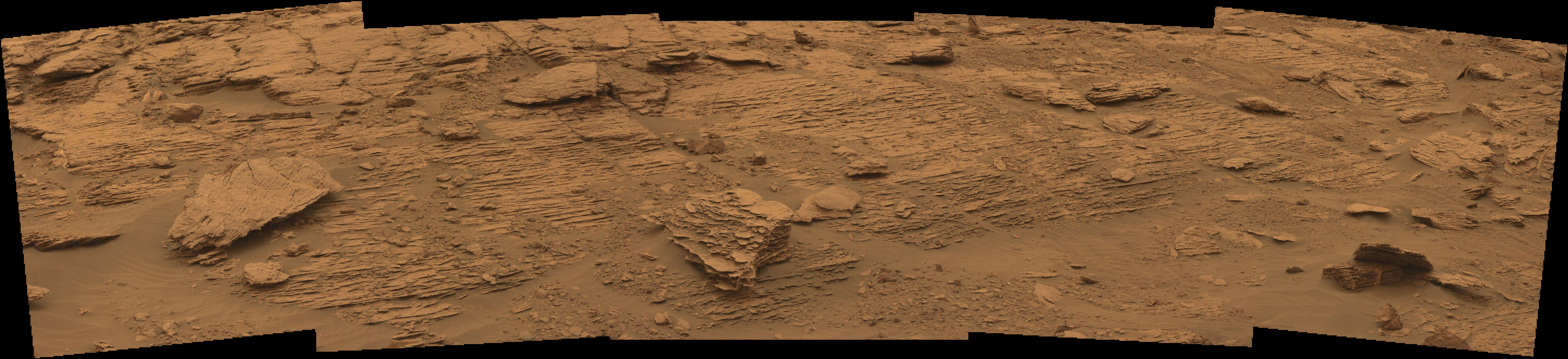
One of the most impressive landscapes carved by liquid water on Mars occurs in northwestern Noachis Terra and southern Margaritifer Terra. Uzboi Vallis, Ladon Valles, and Morava Valles are a sequence of valleys that formed as water flowed into and out of depressions in the landscape, stretching from the southern highlands to the northern plains.

Understanding the role of water in this region of Mars — in particular the period in which it occurred, and the length of time it persisted on the surface — provides important information about past climate conditions. Recently acquired high‐resolution images and topography were used to describe the nature and origin of a previously unrecognized mound of material on the floor of Uzboi Vallis.

The mound of material in Uzboi is adjacent to the mouth of Nirgal Vallis, Uzboi’s largest tributary. The lower part of the mound may have formed by a combination of material related to impact cratering, water‐driven movement of sediment, or landslides. The upper part of the mound, however, is a fan‐shaped deposit that formed as water flowed out of Nirgal and deposited sediment into Uzboi. Thus, the surface conditions in this region of Mars may have been hospitable for life relatively late in Martian history. [More at link]
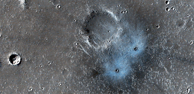
Posted in Reports | Tagged , , , , | Comments Off

THEMIS: Aram Chaos’ crumbling mesas

Broken mesas in Aram Chaos (THEMIS_IOTD_20180627)THEMIS Image of the Day, June 27, 2018. In this VIS image of part of Aram Chaos, the surface region is being dissected by linear valleys. As the dissection continues individual mesas will develop, creating the terrain termed chaotic. The linear nature of the valleys is most likely due to tectonic fractures.

Aram is a large and ancient impact crater which has been filled to the brim with later sediments. These became saturated with water, either when they were deposited or at some later time. Then in one of the martian climate’s grand changes, the water froze into ground ice.

Later still, after tectonic faulting, the ground ice melted and escaped along the fractures. This created the mesas by enlarging the fractures and eroding the sediment’s edges.

In this region of Aram Chaos the mesas are still large, with time the mesa edges will continue to erode and the mesas will become smaller and further from each other.

More THEMIS Images of the Day by geological topic.

Posted in Reports | Tagged , , , , , , , , , , | Comments Off

Curiosity: Which way up?

2092-navcam-annoSol 2092, June 25, 2018. Following a 24-meter (78 foot) drive, Curiosity is nearing a steeper part of the Vera Rubin Ridge. As the rover’s drive plan takes it back up the face of the ridge, the question arises of which way to go.

Above is the Navcam view, while below is the Mastcam’s zoom-in on an upper part of the ridge, showing its finely layered structure. The yellow arrow in the Navcam view above points to the large rock at left in the Mastcam scene below. Both images enlarge when clicked.

Sol 2092 raw images (from all cameras), and Curiosity’s latest location.

2092-mastcam34

Posted in Reports | Tagged , , , , , , , , | Comments Off

HiRISE: New crater blues

tumblr_paqoa5eopF1rlz4gso1_1280New crater blues. This new impact was found by the Context Camera team who asked HiRISE to take a high-resolution image. They estimated the impact happened between January 2012 and September 2016, because they have a picture from the  THEMIS instrument without it before that time frame. These craters may be somewhere between two and four (Earth) years old, which is exceedingly young in geologic terms. Most of the craters we see on Mars (like others in this picture) are millions of years old….

Beautiful Mars series. [More at links]

Posted in Reports | Tagged , , , , , , , , | Comments Off

Curiosity update: Watch the skies

NRB_582939234EDR_F0710228NCAM00276M_-br2Sols 2090-92, June 26, 2018, update by MSL scientist Ryan Anderson: Despite the global dust storm (more correctly known as a “planet encircling dust event”) darkening the skies, our nuclear-powered rover continues to do good science. The sol 2090 plan begins with the first of several Navcam observations of the dusty atmosphere over the weekend, followed by ChemCam observations of the targets “Caribou Lake,” “Simar,”and “Arlberg”. ChemCam also will image the target “Young Lake” again. Mastcam will take individual pictures of the ChemCam targets on Arlberg and Caribou Lake, plus small stereo mosaics of Simar and “Hawk Ridge” to help measure the orientation of the veins and layers seen there. Mastcam will then make some observations of the sun and the distant crater rim to measure the dust in… [More at link]

Posted in Reports | Tagged , , , , , , , , , , , , , , , , | Comments Off

HiRISE: Majestic slopes of Hebes Chasma

tumblr_paqk0ij7Ib1rlz4gso1_1280Majestic slopes of Hebes Chasma. Beautiful Mars series. [More at links]

Posted in Reports | Tagged , , , , , , , , | Comments Off

THEMIS: Collapsing ground in Margaritifer Chaos

Collapsing ground in Margaritifer Chaos (THEMIS_IOTD_20180626)THEMIS Image of the Day, June 26, 2018. Today’s VIS image shows a small section on Margaritifer Chaos. The term chaos is applied to regions where the surface is being eroded to form mesas. As the surface processes continue individual mesas become more isolated and take on the appearance of regions of hills.

At the top of the image is Margaritifer Terra, which is being dissected into large mesas. Towards the bottom of the image the mesas have been eroded into smaller hills.

More THEMIS Images of the Day by geological topic.

Posted in Reports | Tagged , , , , , , , , , , , , | Comments Off

HiRISE: Hills in Ganges Chasma

tumblr_paqntxazdH1rlz4gso1_1280The hills in Ganges Chasma. Ganges Chasma is in the northeast portion of Valles Marineris, and opens into outflow channels that flowed to the north. Scattered hills on the canyon floor may be remnants of chaos terrain that formed from collapse of the canyon. Some of the bedrock has diverse colors as we see in the enhanced-color cutout.

Beautiful Mars series. [More at links]

Posted in Reports | Tagged , , , , , , , , , | Comments Off

Weather update from Gale Crater

Posted in Reports | Tagged , , , , , , , , | Comments Off