


 All that the lava leaves behind. There are streamlined and eroded forms in this lava channel, a region with very little HiRISE coverage.
Beautiful Mars series. [More at links]
All that the lava leaves behind. There are streamlined and eroded forms in this lava channel, a region with very little HiRISE coverage.
Beautiful Mars series. [More at links]
 THEMIS Image of the Day, May 18, 2018. n planetary nomenclature, the descriptor term chaos means “distinctive area of broken terrain”. The general morphology of chaos is steep-sided mesas in close proximity.
This VIS image shows a region of Chryse Chaos where the isolated mesas are beginning to be formed. The interconnected channel forms erode, and mesas are created by erosion of the bounding channels. The bottom of the image shows some of the resultant mesas.
More THEMIS Images of the Day by geological topic.
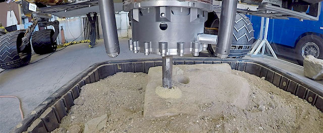 NASA’s Curiosity rover could soon be drilling rocks on Mars again.
Engineers have been working for the past year to restore the rover’s full drilling capabilities, which were hampered in 2016 due to a mechanical problem. Later this weekend, they’ll be adding percussion to a new technique already in use on Mars.
This new technique is called Feed Extended Drilling, or FED. It lets Curiosity drill more like the way a person would at home, using the force of its robotic arm to push its drill bit forward as it spins. The new version of FED adds a hammering force to the drill bit.
The drill was tested with the FED technique without percussion at the end of February. It didn’t successfully produce a rock sample, but did provide valuable results for engineers at NASA’s Jet Propulsion Laboratory in Pasadena, California. Data from the percussive tests, currently planned for Saturday night, will help them continue to refine the drill technique over the coming months.
“This is our next big test to restore drilling closer to the way it worked before,” said Steven Lee, Curiosity deputy project manager at JPL. “Based on how it performs, we can fine-tune the process, trying things like increasing the amount of force we apply while drilling.” [More at link]
 Sand dunes in Valles Marineris can be impressive in size, with steep slopes that seem to climb and descend. An enhanced-color cutout shows some of these on the slopes of Nectaris Montes within Coprates Chasma.
The brighter bedforms are inactive while the bigger dunes move over the landscape, burying and exhuming the surface. [More at link]
 Sol 2054, May 16, 2018, update by MSL scientist Abigail Fraeman: Our sol 2054 plan was limited by a small morning downlink. Occasionally, the flight paths of the Mars orbiters over Gale Crater don’t have favorable geometries for relays with Curiosity, and this means our data downlink passes are smaller than average. Today we received only 1.6 MB (Megabytes) of data at the start of our planning day. This was just enough to tell us the drive executed successfully and the rover was healthy, but not enough to include any new images from our current spot. We did get another (also small) downlink several hours into planning, which gave us the first view of our drill target smack in the middle of our workspace – a rock we are calling “Duluth.” [More at link]
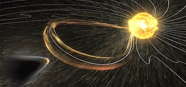 Newly published MAVEN results indicate that atmospheric escape of hydrogen during a strong solar storm that impacted Mars in September 2017 was comparable to the seasonal escape of hydrogen over a full Martian year… [More at link]
This movie, based on images taken by ESA’s Mars Express, showcases the 102 km wide Neukum Crater in the southern hemisphere of Mars.
The crater is named for the German physicist and planetary scientist, Gerhard Neukum, one of the founders of ESA’s Mars Express mission who inspired and led the development of the high-resolution stereo camera on Mars Express.
This complex impact crater has a diverse geologic history, as indicated by various features on the crater rim and floor. Particularly striking are the dark dune fields, likely made up of volcanic material blown in and shaped by strong winds… [More at link]
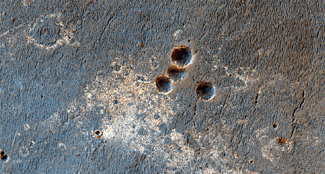 Following Opportunity. This image adds more coverage the general area that the rover Opportunity passed through (not the entire image). The image would also be useful for secondary crater studies and monitoring the disappearance of Opportunity’s tracks over time.
Beautiful Mars series. [More at links]
 THEMIS Image of the Day, May 17, 2018. This VIS image shows an unnamed crater located in Utopia Planitia. This relatively young crater has a steep inner rim, with floor deposits that originate from the crater rim itself.
As craters age, the floor starts to fill with wind blown materials. Regional lava flows can also enter and fill the crater, raising and smoothing the floor. The lack of such modifications indicates the relatively youthful nature of this crater.
More THEMIS Images of the Day by geological topic.
 Dust-lifting activity continued at mid-to-high latitudes for both hemispheres this past week. Looking to the northern lowlands, a mixture of dust storms and water-ice clouds propagated eastward, signaling further development of the north polar hood. Large local-scale dust storms occurred along much of the seasonal south polar ice cap edge. Dust storms over Noachis, Sirenum, and Cimmeria pushed moderately equatorward… [More at link, including video]