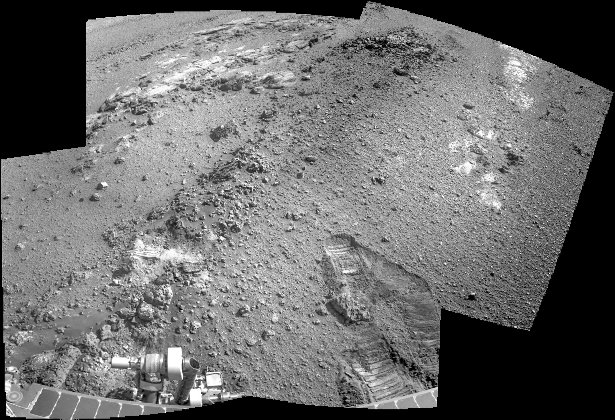
Sol 5060, April 19, 2018. The rover has backed off slightly from the outcrop and mission scientists are planning Opportunity’s next moves. The above shows the Navcam view of the outcrop with the flat tabular rocks at upper left. These show a smooth surface texture markedly different from the vesicular rocks in the foreground. Click the image to enlarge it.
Southwest Research Institute scientists posit a violent birth of the tiny Martian moons Phobos and Deimos, but on a much smaller scale than the giant impact thought to have resulted in the Earth-Moon system. Their work shows that an impact between proto-Mars and a dwarf-planet-sized object likely produced the two moons, as detailed in a paper published [April 18, 2018] in Science Advances.
The origin of the Red Planet’s small moons has been debated for decades. The question is whether the bodies were asteroids captured intact by Mars gravity or whether the tiny satellites formed from an equatorial disk of debris, as is most consistent with their nearly circular and co-planar orbits. The production of a disk by an impact with Mars seemed promising, but prior models of this process were limited by low numerical resolution and overly simplified modeling techniques.
“Ours is the first self-consistent model to identify the type of impact needed to lead to the formation of Mars’ two small moons,” said lead author Dr. Robin Canup, an associate vice president in the SwRI Space Science and Engineering Division. Canup is one of the leading scientists using large-scale hydrodynamical simulations to model planet-scale collisions, including the prevailing Earth-Moon formation model.
“A key result of the new work is the size of the impactor; we find that a large impactor — similar in size to the largest asteroids Vesta and Ceres — is needed, rather than a giant impactor,” Canup said. “The model also predicts that the two moons are derived primarily from material originating in Mars, so their bulk compositions should be similar to that of Mars for most elements. However, heating of the ejecta and the low escape velocity from Mars suggests that water vapor would have been lost, implying that the moons will be dry if they formed by impact.” [More at links]
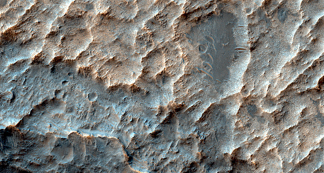
Curved ridge and layered materials. Is the curved ridge a remnant of inverted stream channel sediment, crater ejecta, or something else (e.g., tectonic)? Are the layered materials sedimentary rock?
THEMIS Image of the Day, April 19, 2018. Located on the western margin of Lunae Planum, Sacra Fossae is a group of linear depressions. The right angle turns and uniform width seen in this VIS image indicate that these channels were formed by faulting rather than liquid flow. Two bounding faults with a down-dropped interior are called graben.
Streamlined features and fractures in Hebrus Valles. The rationale for this observation is to assess outflow channel discharges as well as getting a better look at the actual topography.
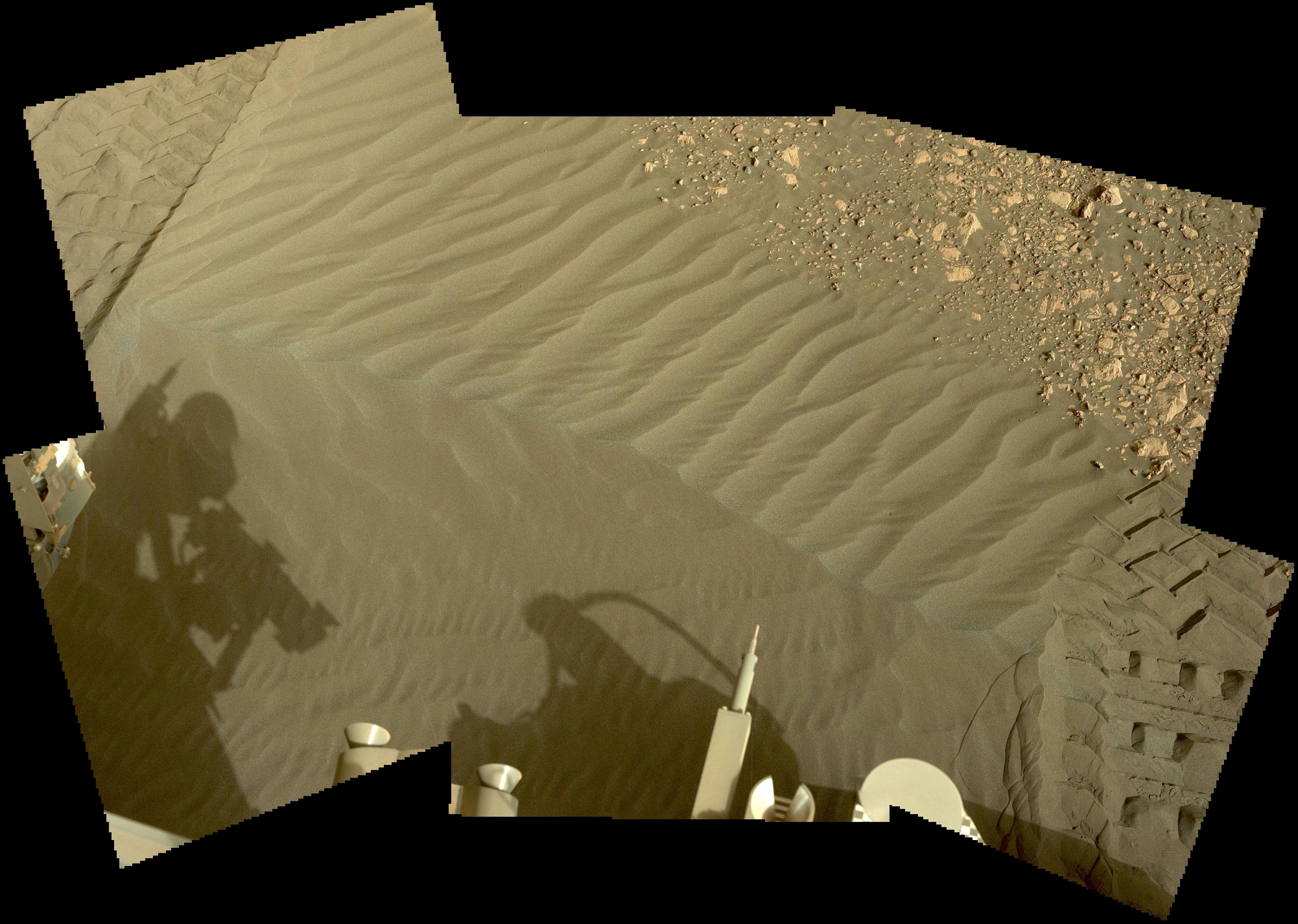
Sol 2023, April 15, 2018. Curiosity is examining the Suilven sand ripple using the Mastcam 34mm lens to shoot a composite of the dune structure. Below, the Navcam’s view of what lies to the south, with the ripple at bottom center. Click either image to enlarge it.
Sol 2023 raw images (from all cameras), and Curiosity’s latest location.
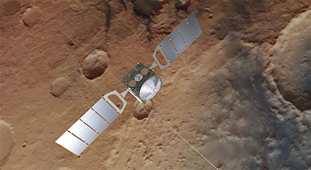
A tired but very happy Mars Express flight control team pulled shift through the night between 16 and 17 April, overseeing the successful reboot and recovery of ESA’s nearly 15-year-old Red Planet explorer following the installation of significant updates to the spacecraft’s operating system.
One online media channel, following the event via Twitter, reported: “The team behind the European Space Agency’s Mars Express were cock-a-hoop with delight last night after hitting the big red button to restart and install updates on the veteran orbiter.” [More at link]
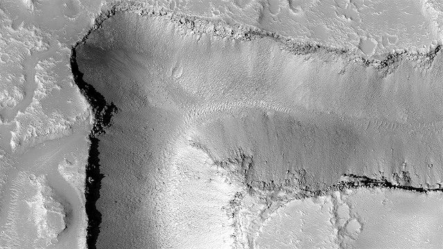
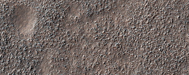
THEMIS Image of the Day, April 18, 2018. Osuga Valles is a complex set of channels located near Eos Chasma. The channels were likely cut by multiple episodes of flowing water.
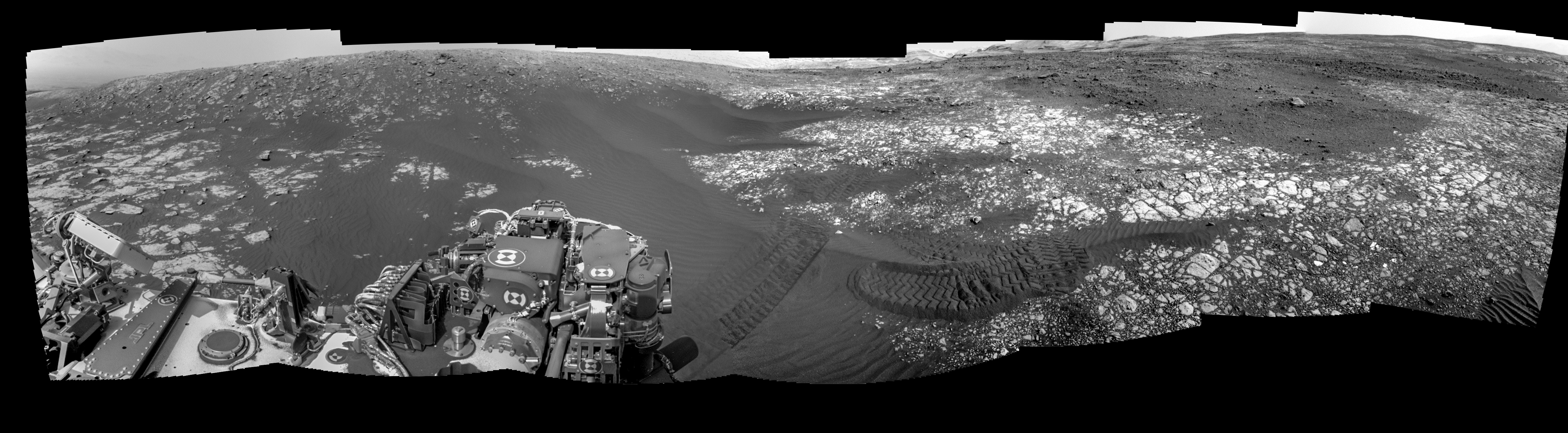
Sol 5058, April 17, 2018. Two Navcam frames show Opportunity facing the area named La Salinera, with many vesicular rocks running in a small ridge uphill in the center of the composite image. On the left edge of the image, some flat, tabular rocks are visible whose relation to the vesicular rocks is unknown.
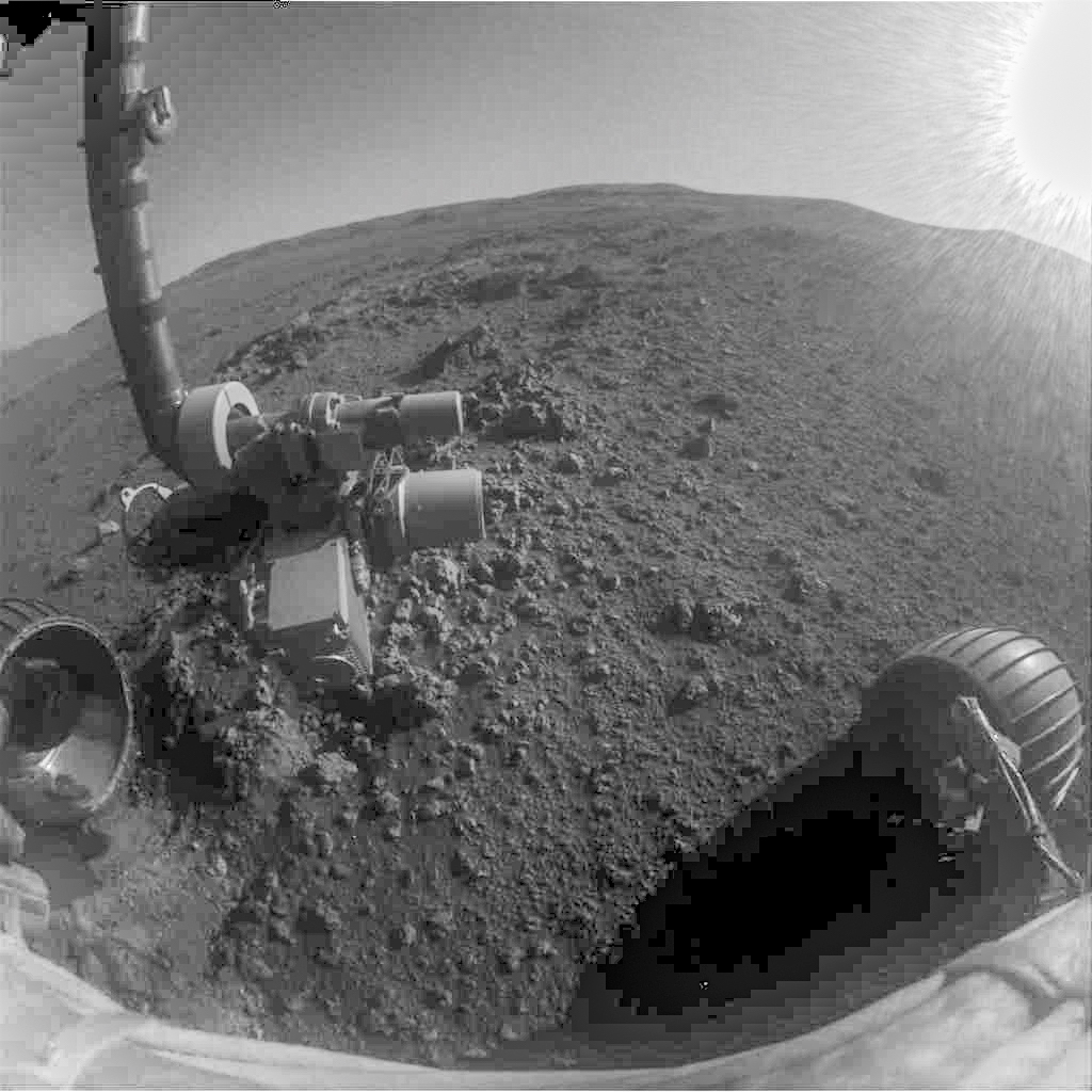
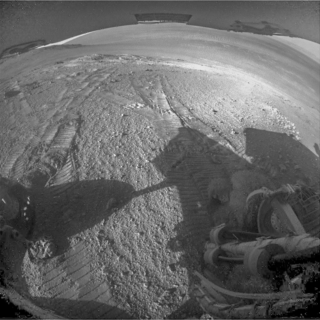
At right are the views from the ground-level Hazcams, to the front and rear. (The front image has severe flare from the Sun being in the field of view.) Click any image to enlarge it.


 Sol 5060, April 19, 2018. The rover has backed off slightly from the outcrop and mission scientists are planning Opportunity’s next moves. The above shows the Navcam view of the outcrop with the flat tabular rocks at upper left. These show a smooth surface texture markedly different from the vesicular rocks in the foreground. Click the image to enlarge it.