Impact-heated rock led to relatively recent water-carved valleys on Mars

lyot-craterNew research shows that water from melted snow and ice likely carved valley networks around Lyot crater on Mars.

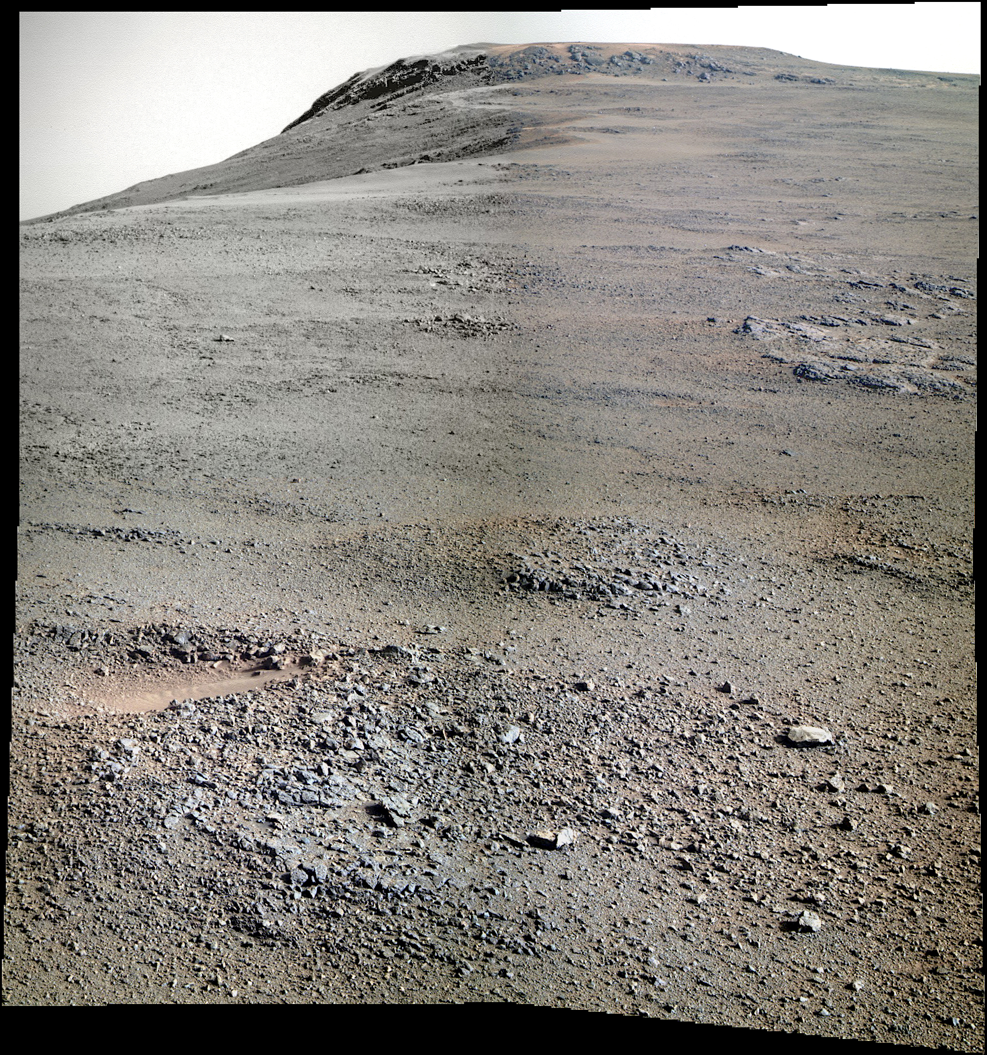
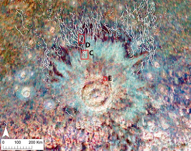
Present-day Mars is a frozen desert, colder and more arid than Antarctica, and scientists are fairly sure it’s been that way for at least the last 3 billion years. That makes a vast network of water-carved valleys on the flanks of an impact crater called Lyot — which formed somewhere between 1.5 billion and 3 billion years ago — something of a Martian mystery. It’s not clear where the water came from.

Now, a team of researchers from Brown University has offered what they see as the most plausible explanation for how the Lyot valley networks formed. They conclude that at the time of the Lyot impact, the region was likely covered by a thick layer of ice. The giant impact that formed the 225-kilometer crater blasted tons of blazing hot rock onto that ice layer, melting enough of it to carve the shallow valleys.

“Based on the likely location of ice deposits during this period of Mars’ history, and the amount of meltwater that could have been produced by Lyot ejecta landing on an ice sheet, we think this is the most plausible scenario for the formation of these valleys” said David Weiss, a recent Ph.D. graduate from Brown and the study’s lead author.

Weiss co-authored the study, which is published in Geophysical Research Letters, with advisor and Brown planetary science professor Jim Head, along with fellow graduate students Ashley Palumbo and James Cassanelli. [More at links]

Posted in Reports | Tagged , , , | Comments Off

Curiosity update: Curiosity’s four-day weekend

NLB_550542439EDR_F0633326NCAM00353M_-br2Sol 1725, June 12, 2017, update by MSL scientist Michelle Minitti: On most weekends, Curiosity dedicates part of her efforts to do contact science – deployment of APXS, MAHLI, and sometimes the DRT – because multi-sol weekend plans have more time and power to fit in these more complex activities. Last weekend, however, time and power were dedicated to a more rare, and more complex, activity – analysis of a previously-drilled rock sample by SAM. To keep up our regular cadence of contact science, the team effectively extended the weekend by a day, planning contact science in this Monday plan. The workspace in front of the rover did not disappoint, with no shortage of options on a nice slab of Murray formation bedrock to reach out and touch! [More at link]

Posted in Reports | Tagged , , , , , , , , , , , | Comments Off

THEMIS: Noachis Terra in daytime infrared

THEMIS Art #124 Noachis Terra (THEMIS_IOTD_20170613)THEMIS Image of the Day, June 13, 2017. Do you see what I see? Is that a little beetle at the top of the image? (THEMIS Art #124)

More THEMIS Images of the Day by geological topic.

Posted in Reports | Tagged , , , , , , , , , | Comments Off

Opportunity: Pancam composite on Winnemucca

4757-pancamFCSol 4757, June 12, 2017. Sitting below Winnemucca mesa, Opportunity is continuing to profile its surroundings with the Pancam. This four-shot false-color view (missing some of the filtered frames for the top left quadrant) looks up toward the mesa (Holger Isenberg false-color reconstructions). Click image to enlarge it.

Opportunity raw images, its latest mission status, location map, and atmospheric opacity, known as tau.

Posted in Reports | Tagged , , , , , , , | Comments Off

HiRISE: Monitoring sand sheets and dunes

ESP_050182_1165This crater features sand dunes and sand sheets on its floor. What are sand sheets? Snow fall on Earth is a good example of sand sheets: when it snows, the ground gets blanketed with up to a few meters of snow. The snow mantles the ground and “mimics” the underlying topography. Sand sheets likewise mantle the ground as a relatively thin deposit.

This kind of environment has been monitored by HiRISE since 2007 to look for movement in the ripples covering the dunes and sheets. This is how scientists who study wind-blown sand can track the amount of sand moving through the area and possibly where the sand came from. Using the present environment is crucial to understanding the past: sand dunes, sheets, and ripples sometimes become preserved as sandstone and contain clues as to how they were deposited. [More at link]

Posted in Reports | Tagged , , , , , , , , | Comments Off

THEMIS: Late summer scarps and textures

Late summer polar cap features (THEMIS_IOTD_20170612)THEMIS Image of the Day, June 12, 2017. This VIS image shows more of the variety of textures on the south polar cap, as southern summer winds to its close.

More THEMIS Images of the Day by geological topic.

Posted in Reports | Tagged , , , , , , , , | Comments Off

Curiosity update: Leftovers for dinner

1464MH0003970010503887C00_DXXX-br2Sol 1722-24, June 9, 2017, update by MSL scientist Scott Guzewich: Today, as I served as the Science Operations Working Group Chair, we prepared a 3-sol duration plan to keep Curiosity busy over the weekend.  Almost the entirety of the first two sols (1722 and 1723) are dedicated to a SAM analysis of a “doggy bagged” sample from the Quela drill hole collected back in September 2016 (Sol 1464).  Several times in the mission we’ve saved samples from our drill locations to analyze later.  This SAM analysis will help us determine the precise chemical composition of the martian bedrock and therefore improve our understanding of ancient… [More at link]

Posted in Reports | Tagged , , , , , , , , , , | Comments Off

Diverse environments seen in Curiosity samples

PrintNASA scientists have found a wide diversity of minerals in the initial samples of rocks collected by the Curiosity rover in the lowermost layers of Mount Sharp on Mars, suggesting that conditions changed in the water environments on the planet over time.

Curiosity landed near Mount Sharp in Gale Crater in August 2012. It reached the base of the mountain in 2014. Layers of rocks at the base of Mount Sharp accumulated as sediment within ancient lakes around 3.5 billion years ago. Orbital infrared spectroscopy had shown that the mountain’s lowermost layers have variations in minerals that suggest changes in the area have occurred.

In a paper published recently in Earth and Planetary Science Letters, scientists in the Astromaterials Research and Exploration Science (ARES) Division at NASA’s Johnson Space Center in Houston report on the first four samples collected from the lower layers of Mount Sharp.

“We went to Gale Crater to investigate these lower layers of Mount Sharp that have these minerals that precipitated from water and suggest different environments,” said Elizabeth Rampe, the first author of the study and a NASA exploration mission scientist at Johnson. “These layers were deposited about 3.5 billion years ago, coinciding with a time on Earth when life was beginning to take hold. We think early Mars may have been similar to early Earth, and so these environments might have been habitable.” [More at links]

Posted in Reports | Tagged , , , , , , , , , | Comments Off

HiRISE: Sandlot

tumblr_oq5p8zrEPV1rlz4gso1_1280Sandlot. Beautiful Mars series.

Posted in Reports | Tagged , , , , , , , , , , | Comments Off

Curiosity: More rocks, less sand

1721-navcamSol 1721, June 9, 2017. As Curiosity approaches Vera Rubin Ridge, the ground is slowly changing. Rocks are becoming widespread and they mostly lie flat. The gaps between the rocks now show lines of smaller rocks, pebbles, and gravel where they were previously filled with almost entirely with sand. Below, the rover’s location. Click either image to enlarge it.

Sol 1721 raw images (from all cameras), and Curiosity’s latest location.

Sol_1721_loc_1200x900m-full

Posted in Reports | Tagged , , , , , , , , | Comments Off