Opportunity: Walkabout Pancam imaging

4754-pancamFC1P550227051ESFCZK6P2594L5M1_L4L5L5L5L6
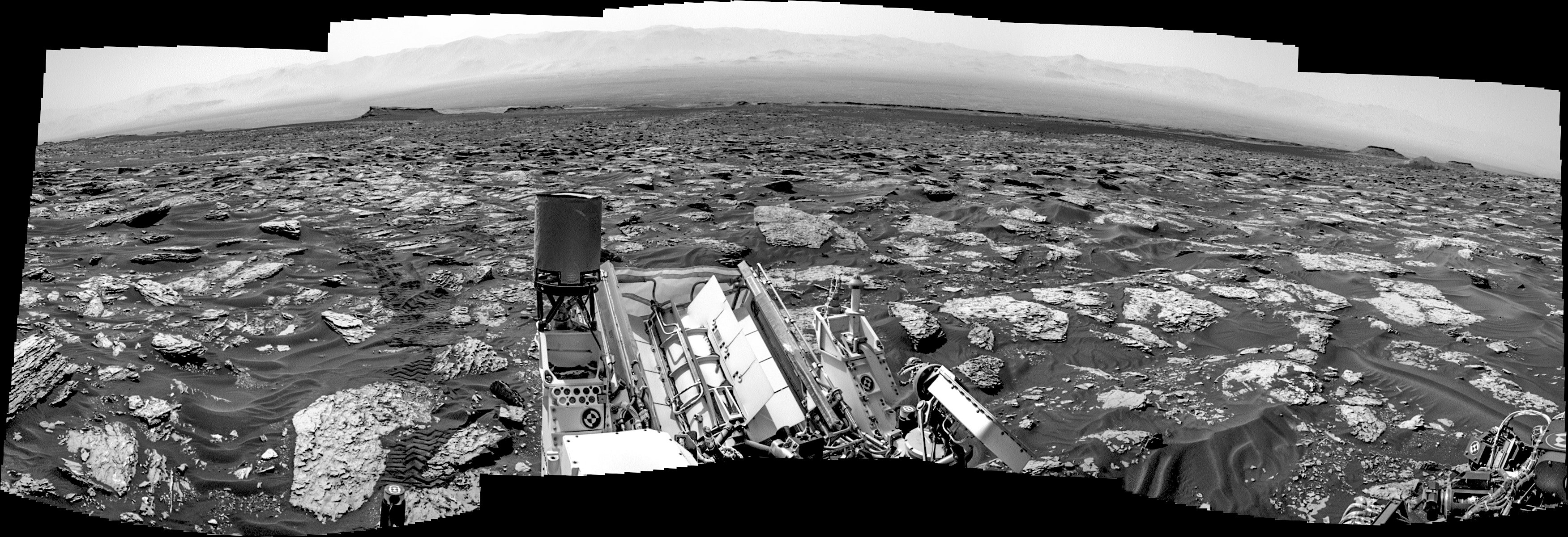
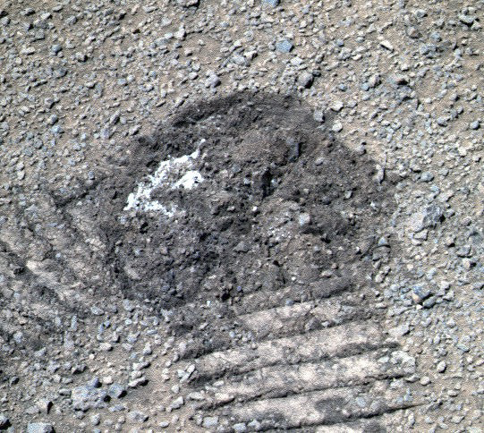
Sol 4754, June 8, 2017. As Opportunity continues its “walkabout” survey at the head of Perseverance Valley, the rover used the Pancam to image the soil dug up by a wheel turn (right) at a target site dubbed Laramie.

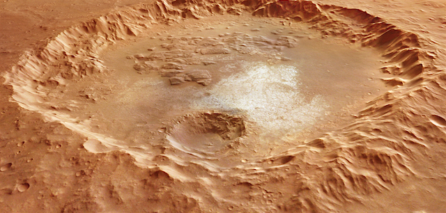
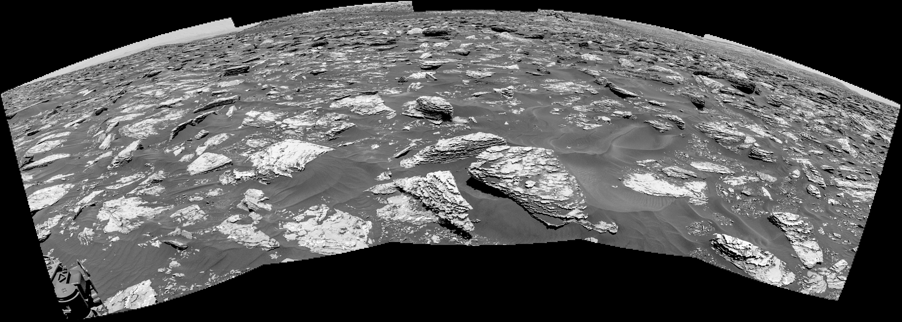
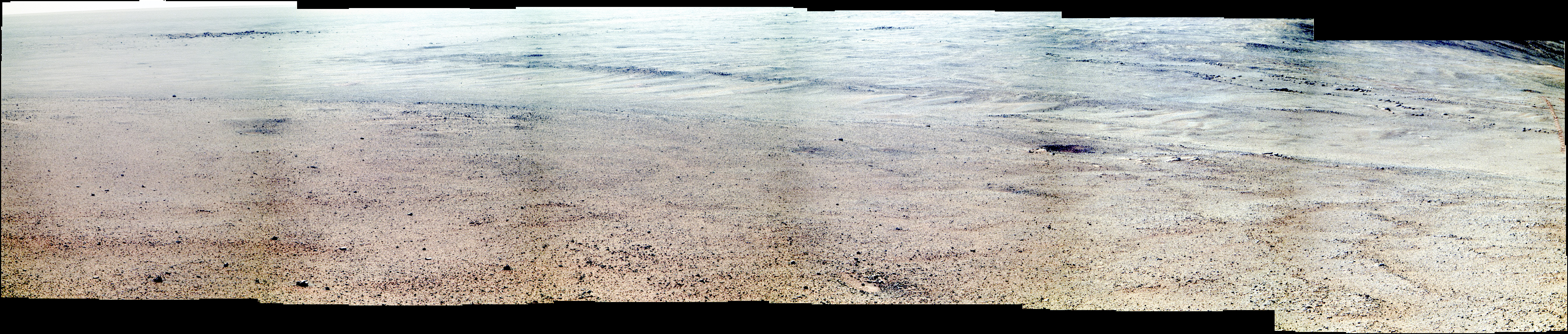
Above is a false-color Pancam composite aiming toward the northwest to show the grooves which may help scientists determine how the valley was eroded. (For more on this question, see here.)  In the distance at left is a relatively recent impact crater on the Meridiani plains, surrounded by ejected blocks of rock. False-color images by Holger Isenberg; both images enlarge when clicked.

Opportunity raw images, its latest mission status, location map, and atmospheric opacity, known as tau.

Posted in Reports | Tagged , , , , , , , | Comments Off

Curiosity update: An easier planning day

NRB_550192340EDR_F0632978NCAM00375M_-br2Sol 1721, June 8, 2017, update by MSL scientist Ken Herkenhoff: MSL drove 26 meters on Sol 1720, as planned, to a location with blocks of bedrock in the arm workspace. Because the rover climbed another 3 meters in elevation, contact science has top priority for today’s plan, with driving next in priority. One of our strategic goals is to measure the chemistry of Murray formation rocks using APXS at elevation intervals of no more than 5 meters. So the GEO science theme group (STG) selected a smooth, typical Murray bedrock target named “Fawn Pond” as the top priority for contact science (APXS and MAHLI observations), and planned ChemCam and Right Mastcam observations of nearby target “Kief Pond.” The GEO plan also includes a 6×2 Right Mastcam mosaic to investigate sedimentary structures at “Arey Cove” and… [More at link]

Posted in Reports | Tagged , , , , , , , , , , , | Comments Off

THEMIS: South polar ice features

South polar ice cap THEMIS_IOTD_20170609)THEMIS Image of the Day, June 9, 2017. Today’s VIS image shows more of the south polar cap at the end of southern summer.

More THEMIS Images of the Day by geological topic.

Posted in Reports | Tagged , , , , , , , , , | Comments Off

HRSC: Window to a watery past

Perspective_view_across_a_crater_in_Erythraeum_ChaosThis 70 km-wide crater and its surrounds offer a window into the watery past of the Red Planet. The scene, captured by ESA’s Mars Express, is a composite of two images taken in March 2007 and February 2017.

It focuses on a large crater in the Margaritifer Terra region in the southern hemisphere of Mars, and includes a portion of Erythraeum Chaos to the north (right in the main colour image below).

The region is located at the northern edge of Noachis Terra, which at 3.7–4 billion years old, represents some of the oldest and most heavily cratered terrain on Mars… [More at link]

Posted in Reports | Tagged , , , , , , , , , , , , , | Comments Off

Curiosity update: Rough road ahead

FRB_550099570EDR_F0632672FHAZ00304M_-br2Sol 1720, June 8, 2017, update by MSL scientist Christopher Edwards: I was the Surface Properties Scientist, or SPS on staff today. The SPS has an interesting job, in that the SPS helps Rover Planners (called RPs) assess the terrain around the rover with safety in mind, first and foremost.

There are two main jobs of an SPS. The first is to assess how likely the rover is to slip in its current position, called the Slip Risk Assessment Process (SRAP). Is it on a stable footing, like thin sand cover over smooth rocks, or is a wheel perched on a ledge? The reason this is important is because as MSL’s arm is articulated to conduct contact science, a perched rover wheel might slip and cause damage to the arm by contact between the turret and the ground. That would be bad! Today we were on a solid surface and passed SRAP without any concerns. [More at link]

Posted in Reports | Tagged , , , , , , , , | Comments Off

HiRISE: Small, fresh, and martian

tumblr_oq5oflNteF1rlz4gso1_1280Small, fresh, and martian – By “fresh,” (and sometimes “recent”), we are talking in geological terms only. Beautiful Mars series.

Posted in Reports | Tagged , , , , , , , , , | Comments Off

THEMIS: South polar textures as local summer ends

Polar textures before winter (THEMIS_IOTD_20170607)THEMIS Image of the Day, June 8, 2017. This VIS image of the south pole was taken at the end of summer. Frost will soon start to form as the season transitions into fall. Fall in the southern hemisphere means spring in the northern, so the north polar cap is just starting to thaw.

More THEMIS Images of the Day by geological topic.

Posted in Reports | Tagged , , , , , , , , , , , | Comments Off

Curiosity: Looking back, looking ahead

1718-navcan-northSol 1718, June 6, 2017. The drive to Vera Rubin Ridge continues across the bumpy, rounded rocks. Above, the view to the rear showing the gradual slope the rover has driven up, with the floor and north rim of Gale Crater in the distance. Below, the terrain ahead, with portions of the ridge barely in view at the top of the image. Both views enlarge when clicked.

Sol 1718 raw images (from all cameras), and Curiosity’s latest location.

1718-navcam-south

Posted in Reports | Tagged , , , , , , , , | Comments Off

HiRISE: Dark sediments in the Medusae Fossae Formation

tumblr_oq5o1uZz4r1rlz4gso1_1280Dark sediments in the Medusae Fossae Formation. Beautiful Mars series.

Posted in Reports | Tagged , , , , , , , , , , | Comments Off

MARCI weather report, May 29-June 4, 2017

June-1-2017Numerous local-scale dust storms danced across the southern mid-to-high latitudes of Mars this past week. During that time, dust storms that developed along the receding north polar ice cap were spotted over the plains of Acidalia, Arcadia, and Utopia. The diffuse water-ice clouds of the low latitudes continued to slowly become more widespread as the aphelion cloud-belt signaled the beginning of its lengthy emergence. Due to a… [More at link, including video]

Posted in Reports | Tagged , , , , , , , , , , , , , | Comments Off