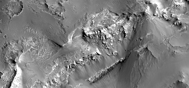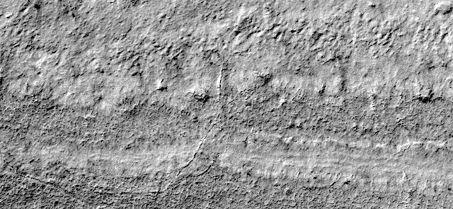
HiRISE: Silence of the south polar layered deposits

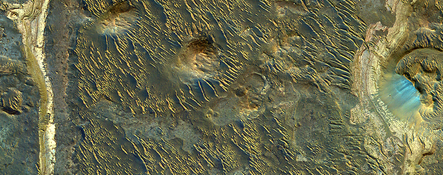
tumblr_onfpe4UTvE1rlz4gso1_1280Silence of the south polar layered deposits. Beautiful Mars series.

Posted in Reports | Tagged , , , , , , , | Comments Off

Curiosity: Bumpy path ahead

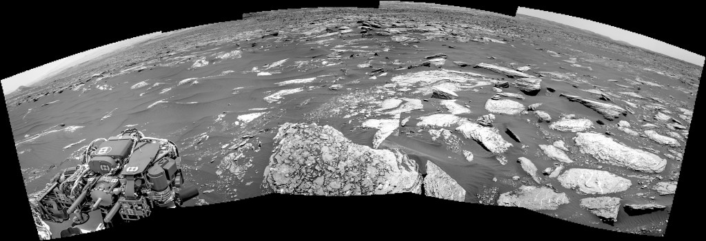
1666-navcam1666-rmiSol 1666, April 13, 2017. Following a 9-meter (30-foot) drive, Curiosity reached a point where five Navcam frames show a rock-strewn path ahead, as it threads its way south between sand patches.

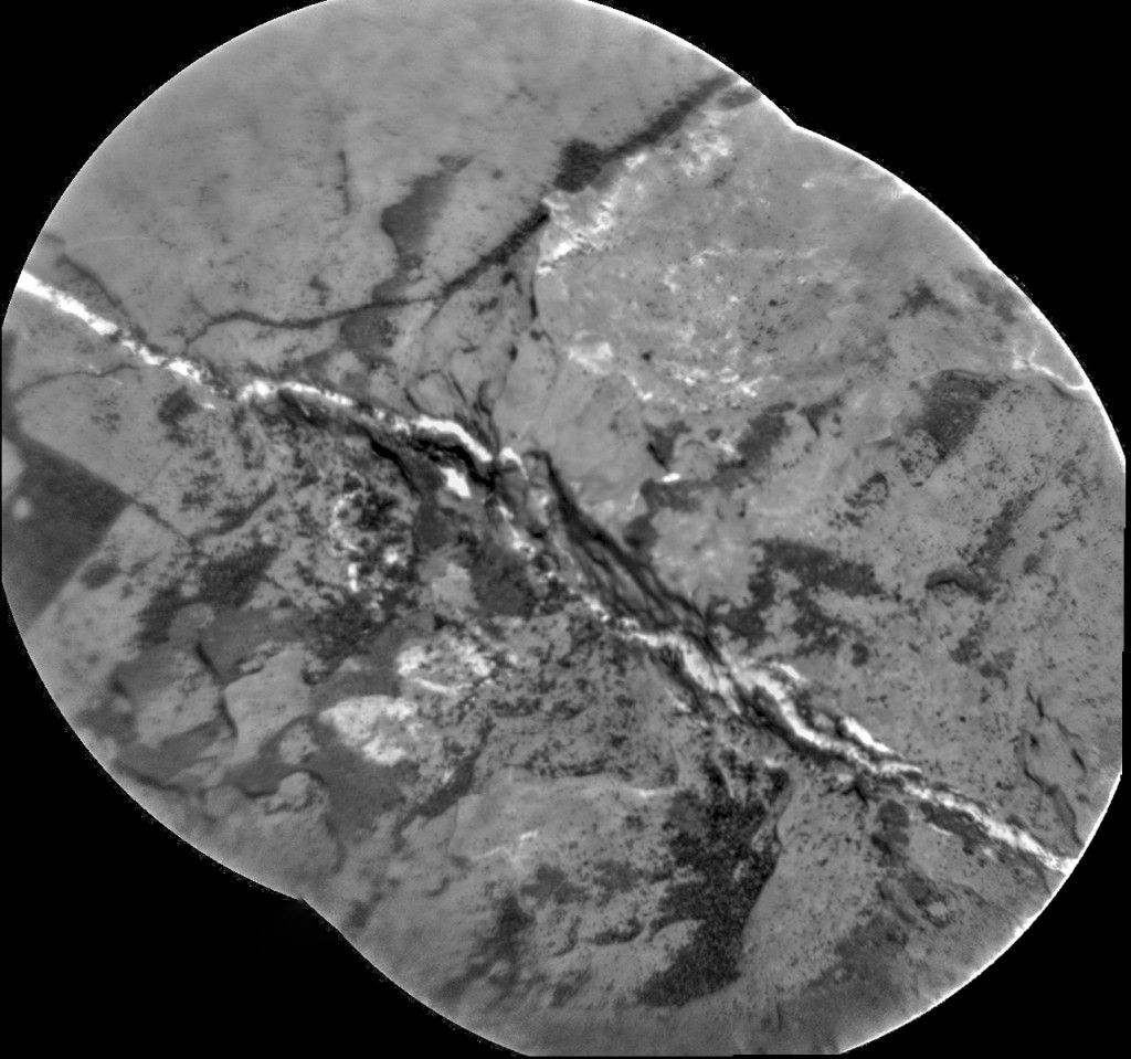
At right, an RMI composite on a rock with a bright mineral vein, taken before the drive. Click either image to enlarge it.

Sol 1666 raw images (from all cameras), and Curiosity’s latest location.

Posted in Reports | Tagged , , , , , , , , | Comments Off

Opportunity: Looking around, looking down

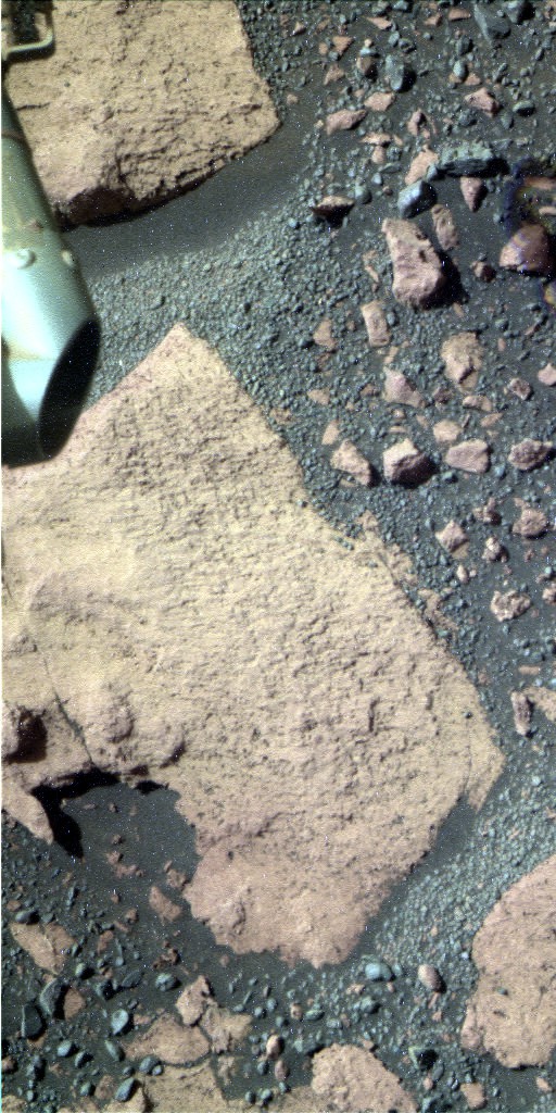
1P545349441ESFCXT6P2574L5M1_L2L5L5L7L71P545348683ESFCXT6P2509L5M1_L2L5L5L7L7Sol 4699, April 13, 2017. At the foot of Cape Tribulation, there’s an exposure of flat-lying rock that scientists are examining. At right is a false-color image showing Opportunity’s “work plane” (where the instrument can reach).

Above is another false color image showing a geologically recent impact crater, which lies a short distance away from the rover’s path. This may be the best view scientists get of it, as a closer visit isn’t in the plans. (Both images are reconstructions by Holger Isenberg and both enlarge when clicked.)

Opportunity raw images, its latest mission status, a location map, and atmospheric opacity, known as tau.

Posted in Reports | Tagged , , , , , | Comments Off

THEMIS: Tempe Fossae graben in false color

Tempe Fossae in false color (THEMIS_IOTD_20170414)THEMIS Image of the Day, April 14, 2017. Today’s false color image shows a section of Tempe Fossae located in Tempe Terra. This is a graben that formed when subsurface forces pulled the ground apart, and a portion of the surface between geological faults collapsed.

The THEMIS VIS camera contains 5 filters. The data from different filters can be combined in multiple ways to create a false color image. These false color images may reveal subtle variations of the surface not easily identified in a single band image.

More THEMIS Images of the Day by geological topic.

Posted in Reports | Tagged , , , , , , , , , , | Comments Off

HiRISE: Lakebeds in Holden Crater

ESP_011542_1530Holden Crater was once filled by at least two different lakes. The sediments deposited in those lakes are relatively light-toned where exposed, as we see in this observation.

Each layer represents a different point in time and perhaps a changing environment for Martian life, if it existed. The elongated ridges with sharp crests are sand dunes. [More at link]

Posted in Reports | Tagged , , , , , , , , | Comments Off

Curiosity update: Moosehead Lake

NLB_545223247EDR_F0620690NCAM00297M_Sol 1666-67, April 12, 2017, update by USGS scientist Ken Herkenhoff: The Sol 1664 drive was halted after the rover had driven less than 2 meters because the angle of the left bogie slightly exceeded the suspension limit. Such limits are routinely set based on the results of detailed modeling of the vehicle’s response to the terrain, so that unexpected conditions will automatically cause the rover to stop and wait for further instructions. Analysis of the vehicle’s orientation this morning showed nothing that concerned the mobility team, so a drive is planned for Sol 1666. Before the drive, ChemCam and Right Mastcam will observe a vein target named “Ingalls Island,” a nearby outcrop target dubbed “Yellow Island,” and color boundary targets called “Bunker Cove” and “Cromwell Cove.” Mastcam will then acquire a multispectral observation of Moosehead Lake, the drive goal. After the drive and usual post-drive imaging, the arm will be unstowed for more drill diagnostic tests and moved… [More at link]

Posted in Reports | Tagged , , , , , , , , , , , , , | Comments Off

HiRISE: Recent crater & bedrock in Meridiani Planum

tumblr_oo68306pVF1rlz4gso1_1280Recent crater and bedrock in Meridiani Planum. Beautiful Mars series.

Posted in Reports | Tagged , , , , , , , , | Comments Off

Curiosity: Hazcam views, fore and aft

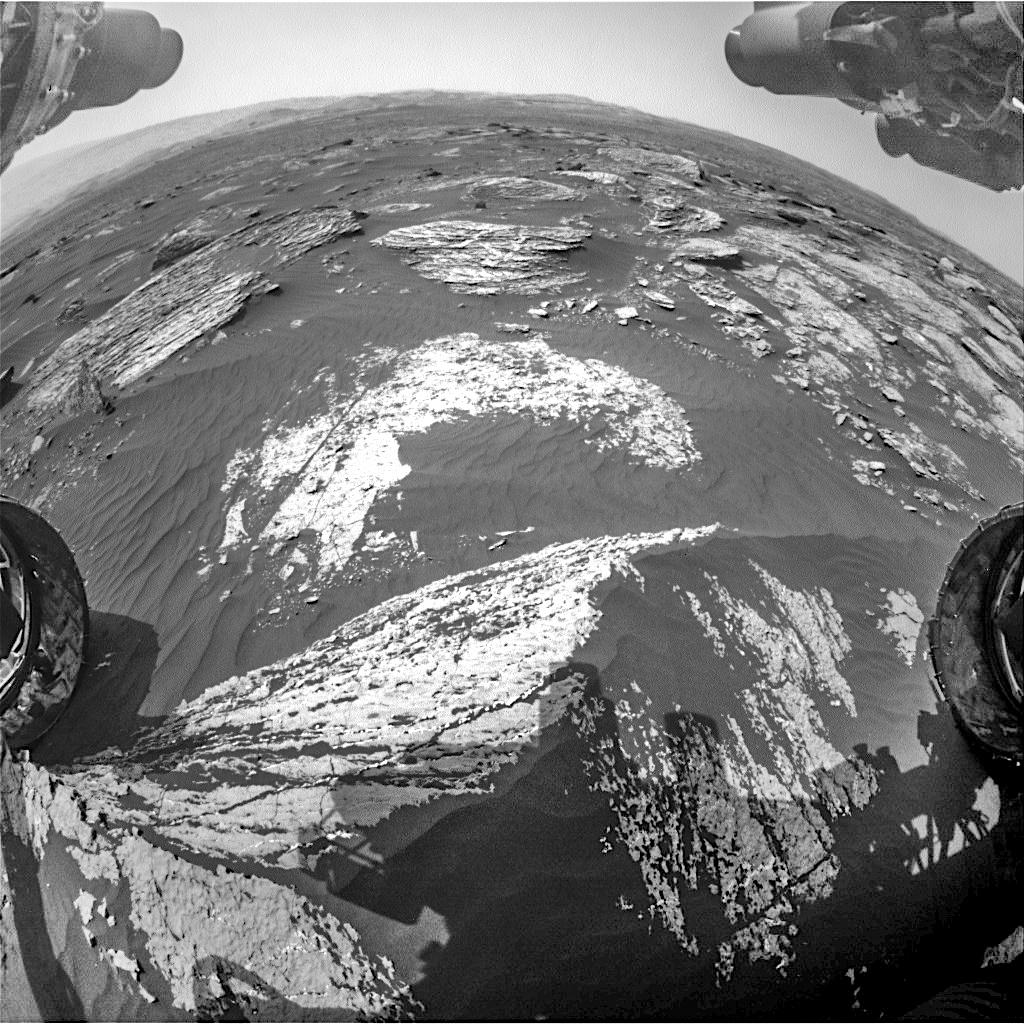
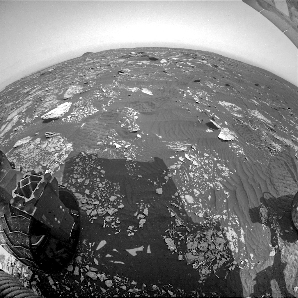
FRB_545295898EDR_F0620690FHAZ00341M_Sol 1665, April 12, 2017. A bright day in Gale Crater on Mars, and Curiosity stands partway across its rock-and-sand path toward Vera Rubin Ridge and eventually Mt. Sharp.

At top right is the view from the front Hazcam, while at lower right is the view behind. In the rear view, the rounded bump in the far distance on the left is Ireson Hill. The rover drove away from it almost two months ago. (Images enlarge when clicked.)

RRB_545295925EDR_F0620690RHAZ00341M_Sol 1665 raw images (from all cameras), and Curiosity’s latest location.

Posted in Reports | Tagged , , , , , , , , , , , | Comments Off

HiRISE: Complex terrain on floor of Hellas Planitia

tumblr_oo67uonj8Q1rlz4gso1_1280Complex terrain on the floor of Hellas Planitia. Beautiful Mars series.

Posted in Reports | Tagged , , , , , , , , , | Comments Off

THEMIS: Flows upon flows in Daedalia Planum

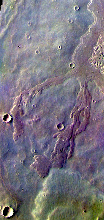
Flows on flows in Daedalia Planum (THEMIS_IOTD_20170413)THEMIS Image of the Day, April 13, 2017. Today’s false color image shows a small portion of Daedalia Planum. This part of Mars is built up from countless interwoven lava flows that have spilled from the giant volcanos of Tharsis lying just to the north.

The THEMIS VIS camera contains 5 filters. The data from different filters can be combined in multiple ways to create a false color image. These false color images may reveal subtle variations of the surface not easily identified in a single band image.

More THEMIS Images of the Day by geological topic.

Posted in Reports | Tagged , , , , , , , , , , | Comments Off