HiRISE: Sources of gullies in Hale Crater

PSP_005688_1450
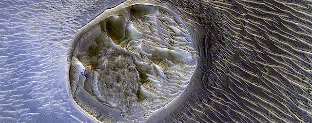
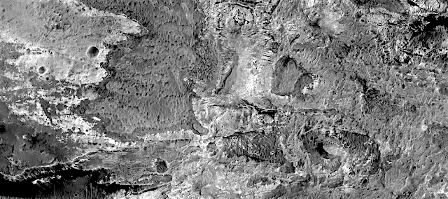
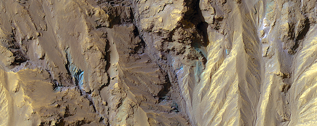
HiRISE color can show mineralogical differences due to the near-infrared filter. The sources of channels on the north rim of Hale Crater show fresh blue, green, purple and light toned exposures under the the overlying reddish dust.

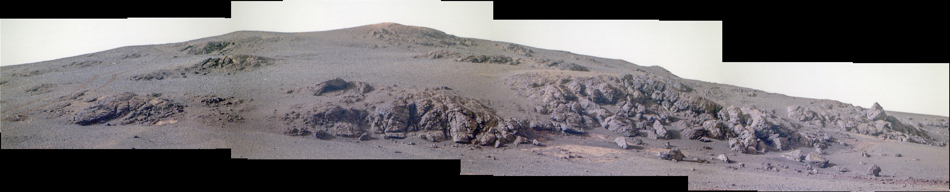
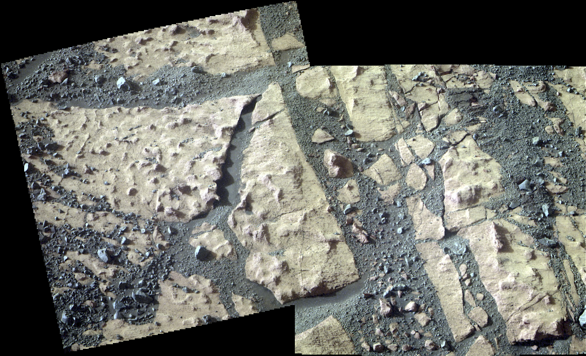
The causes and timing of activity in channels and gullies on Mars remains an active area of research. Geologists infer the timing of different events based on what are called “superposition relationships” between different landforms. Areas like this are a puzzle!

Posted in Reports | Tagged , , , , , , , , | Comments Off

MARCI weather report, April 3-9, 2017

april-5-2017Dust-lifting activity increased over the southern high-latitudes of Mars this past week. Southern Sirenum and Aonia encountered repeated local-scale dust storms. Focusing on the northern hemisphere, long arcuate-shaped dust storms advanced over Deuteronilus and Utopia, just south of the seasonal north polar ice cap edge. Condensate water-ice clouds were more prevalent among latitudes with active dust events. Diffuse… [More at link, including video]

Posted in Reports | Tagged , , , , , , , , , , , , , | Comments Off

Curiosity: Heading southward

1664-navcamSol 1664, April 11, 2017. Curiosity’s Navcam shows the ground ahead to the south: sand patches and lots of relatively flat and thinly layered rocks. The challenge for rover drivers is to ease Curiosity’s way forward to keep the wear on the wheels to a minimum. (Click image to enlarge it.)

Sol 1664 raw images (from all cameras), and Curiosity’s latest location.

Posted in Reports | Tagged , , , , , , , , | Comments Off

HiRISE: Branching valley in Syrtis Major region

tumblr_oo67j9iKhN1rlz4gso1_1280A branching valley in Syrtis Major region. Beautiful Mars series.

Posted in Reports | Tagged , , , , , , , , | Comments Off

THEMIS: Gale Crater, false color, part 2

Gale Crater in false color part 2 (THEMIS_IOTD_20170412)THEMIS Image of the Day, April 12, 2017. Today’s false color image shows part of Gale Crater. The Curiosity Rover is located in Gale Crater. The Curiosity Rover is located in Gale Crater, where it is traversing the Bagnold Dunes, shown in this image as the area with the darkest blue tint. (This image is centered just east of the preceding Gale Crater image and overlaps part of it.)

The THEMIS VIS camera contains 5 filters. The data from different filters can be combined in multiple ways to create a false color image. These false color images may reveal subtle variations of the surface not easily identified in a single band image.

More THEMIS Images of the Day by geological topic.

Posted in Reports | Tagged , , , , , , , , , , , , , | Comments Off

Opportunity: Pausing to check the surroundings

4697-miSol 4697, April 11, 2017. Having descended the the southern slope of the Cape Tribulation rim segment, mission controllers paused and shot some Pancam views of targets around the rover.

Above is the view looking back uphill to the north, showing the outcrop-studded southern face of Cape Tribulation. (The tracks the rover made as it descended are visible at far left.)

At right is the Microscopic Imager’s close-up view of a piece of a nearby outcrop. And below is a two-frame view of the flat outcrop. Click any image to enlarge it; color reconstructions by Holger Isenberg.

Opportunity raw images, its latest mission status, a location map, and atmospheric opacity, known as tau.

4697-pancam-outcrop

Posted in Reports | Tagged , , , , , | Comments Off

HiRISE: Mesa in Noctis Labyrinthus

ESP_012744_1725This small (0.4 kilometer) mesa is one of several surrounded by sand dunes in Noctis Labyrinthyus, an extensively fractured region on the western end of Valles Marineris.

Heavily eroded, with clusters of boulders and sand dunes on its surface, this layered mesa is probably comprised of sedimentary deposits that are being exhumed as it erodes. The layers themselves are visible as faint bands along the lower left edge of the mesa. [More at link]

Posted in Reports | Tagged , , , , , | Comments Off

Curiosity update: Keep on driving

CR0_545049855PRC_F0620660CCAM15903L1Sol 1664-65, April 10, 2017, update by USGS scientist Ken Herkenhoff: MSL drove about 24 meters on Sol 1662, and another drive is planned for Sol 1664.  Before the drive, lots of targeted remote sensing is planned:  ChemCam and Right Mastcam will observe a bright rock named “Peaks Island,” an exposure of bedding dubbed “Great Wass Island,” a sand ripple called “Baldpate Mountain,” and an interesting rock that was selected by AEGIS after the Sol 1662 drive, now named “Chebeague Island.”  Mastcam will also acquire a stereo mosaic of outcrops toward the south, in the direction of the planned drive. [More at link]

Posted in Reports | Tagged , , , , , , , , , , | Comments Off

HiRISE: Light-toned terrain in Gorgonum Chaos

tumblr_olfxc67nze1rlz4gso1_1280Light-toned exposed terrain in Gorgonum Chaos basin. Beautiful Mars series.

Posted in Reports | Tagged , , , , , , , | Comments Off

THEMIS: Gale Crater in false color

Gale Crater false color (THEMIS_IOTD_20170411)THEMIS Image of the Day, April 11, 2017. Today’s false color image shows part of the floor of Gale Crater. The Curiosity Rover is located in Gale Crater, where it is traversing the Bagnold Dunes, shown in this image as the area with the darkest blue tint.

The THEMIS VIS camera contains 5 filters. The data from different filters can be combined in multiple ways to create a false color image. These false color images may reveal subtle variations of the surface not easily identified in a single band image.

More THEMIS Images of the Day by geological topic.

Posted in Reports | Tagged , , , , , , , , , , , , , | Comments Off