Curiosity update: A weekend full of remote sensing

NRB_541222493EDR_F0611140NCAM00274M_
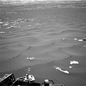
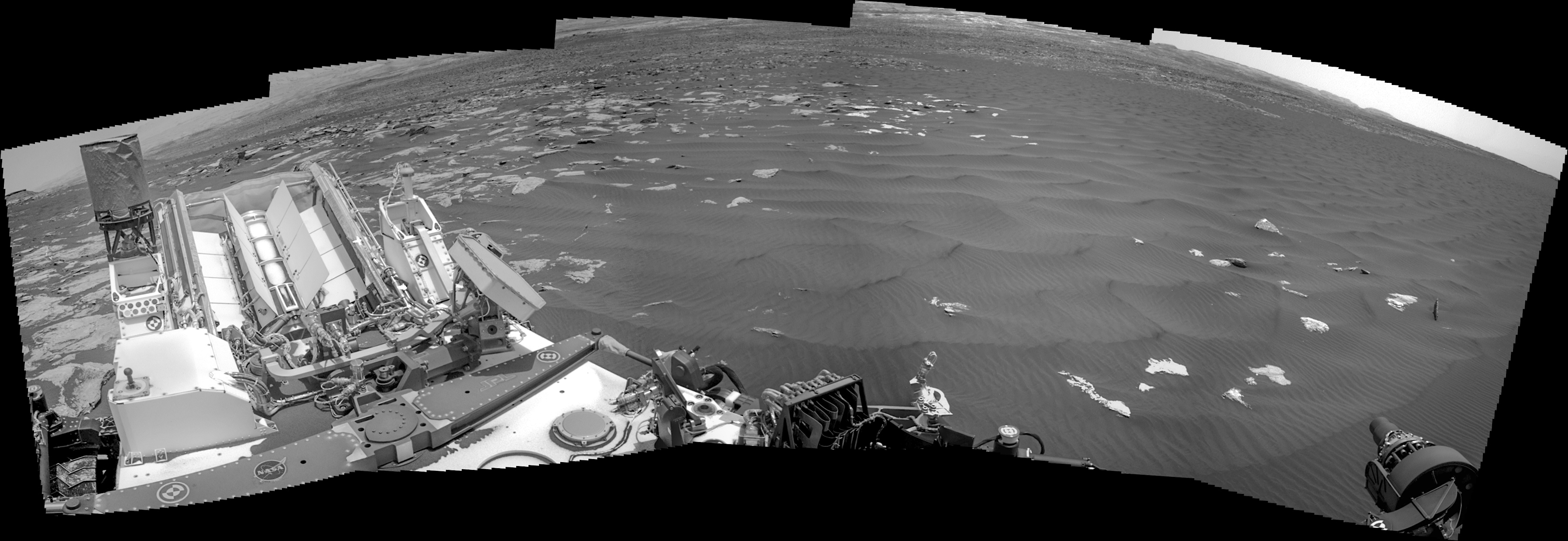
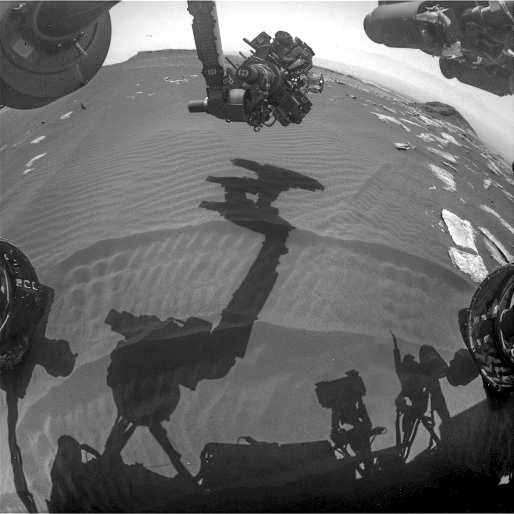
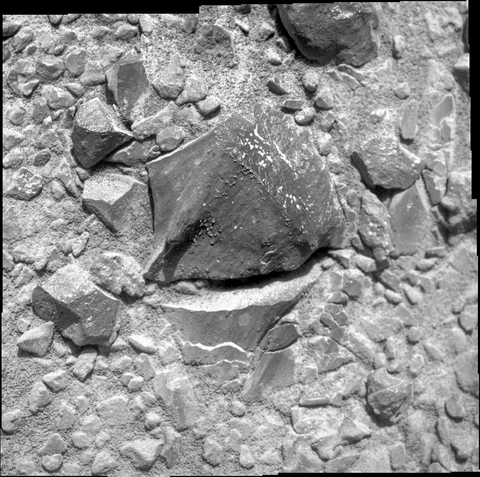
Sol 1620-22, February 24, 2017, update by USGS scientist Lauren Edgar: On Sol 1619, MAHLI experienced a fault and did not finish its planned imaging, so unfortunately the subsequent arm and mobility activities did not execute.  That means that the weekend plan is devoted to MAHLI recovery activities and a lot of remote sensing.  I was the GSTL today, and although it was a challenging start to the day, we were able to put together a very full plan.  The first sol starts by retracting the arm.  Then Curiosity will acquire several environmental monitoring observations to measure atmospheric opacity and characterize spectral properties.  ChemCam will then assess the composition of typical bedrock and veins, at targets “Chase Brook,” “Aziscohos,” and “Chandler Ridge.” [More at link]

Posted in Reports | Tagged , , , , , , , , , , , , | Comments Off

HiRISE: Group of thin layers

tumblr_ol9wo43jDQ1rlz4gso1_1280Group of thin layers. Beautiful Mars series.

Posted in Reports | Tagged , , , , , , , | Comments Off

Curiosity: Looking around from dune stop #2

1619-navcamFRB_541222213EDR_F0611140FHAZ00302M_Sol 1619, February 24, 2017. The Navcam looks southward toward Mt. Sharp across the Bagnold sands (above), while the right front Hazcam details the arm’s placement over the sand surface, with buttes in the background (right). Click either image to enlarge it.

Sol 1619 raw images (from all cameras), and Curiosity’s latest location.

Posted in Reports | Tagged , , , , , , , , , , | Comments Off

Opportunity: MI on Boonville at Rocheport

4652-miSol 4652, February 24, 2017. The Microscopic Imager closed in on Boonville, part of the surface at Rocheport, the exposed, wind-swept surface at the head of Willamette Valley. Click image (2 MB) to enlarge it.

Opportunity raw images, its latest mission status, a location map, and atmospheric opacity, known as tau.

Posted in Reports | Tagged , , , , , , , , | Comments Off

Curiosity update: Wrapping up dune stop #2

NRB_541146790EDR_F0611140NCAM00207M_-br2Sol 1619, February 24, 2017, update by USGS scientist Ryan Anderson: We are wrapping up our observations at stop #2 of the second Bagnold dunes campaign. In the Sol 1619 plan, we start off with Navcam and Mastcam atmospheric observations, followed by a ChemCam observation of the sandy target “Leighton”. Mastcam will then document Leighton and the autonomously identified ChemCam target from the post-drive… [More at link]

Posted in Reports | Tagged , , , , , , , , , | Comments Off

THEMIS: Ross Crater gullies

Ross Crater gullies (THEMIS_IOTD_20170224)THEMIS Image of the Day, February 24, 2017. This VIS image shows Ross Crater in Aonia Terra. The crater rim is dissected by gullies, however these gullies are much smaller than those in yesterday’s image.

More THEMIS Images of the Day by geological topic.

Posted in Reports | Tagged , , , , , , , , , | Comments Off

HiRISE: Colorful bedrock layers

ESP_049009_1520Much of Mars’ surface is covered by fine-grained materials that hide the bedrock, but elsewhere, such as in this scene, the bedrock is well exposed (except where covered by sand dunes).

Colors are enhanced in the cutout of a pit exposing reddish layers. This is part of a stereo pair, so check out the stereo anaglyph for a 3D view. [More at link]

Posted in Reports | Tagged , , , , , , , | Comments Off

Curiosity update: A second stop at the dunes

NRB_541042107EDR_F0611086NCAM00385M_Sol 1618, February 22, 2017, update by USGS scientist Lauren Edgar: The drive on Sol 1617 went well, and Curiosity drove 20 m to the south, which put us in a good position for another stop at the Bagnold Dunes.  This site was selected to enable comparison of the leading and trailing edges of the dunes.  Today’s plan includes ChemCam observations of disturbed and undisturbed soil, at targets named “Tomhegan” and “Macworth.”  We’ll also acquire a Mastcam multispectral observation on “Macworth,” along with systematic deck monitoring.  A number of environmental monitoring activities are planned in the first… [More at link]

Posted in Reports | Tagged , , , , , , , , , , , , , | Comments Off

HiRISE: A small valley within a larger valley

tumblr_ol9wgbBQxZ1rlz4gso1_1280A small valley within a larger valley in Terra Sirenum. Beautiful Mars series.

Posted in Reports | Tagged , , , , , , , | Comments Off

Curiosity: Leaving the buttes behind

1617-navcamSol 1617, February 22, 2017. A three-frame composite by Curiosity’s Navcam shows the buttes (Ireson Hill at right) receding as the rover drives onto the edge of the Bagnold sands. Note the imprints of its wheels at right as they roll over sand and rock alternately.

On the left, the sand shows a set of semi-parallel dune ridges extending away from the rover. These ridges, however, have small sand ripples superimposed on them which indicate a different direction for the wind. Click image (1.6 MB) to enlarge it.

Sol 1617 raw images (from all cameras), and Curiosity’s latest location.

Posted in Reports | Tagged , , , , , , , , , , | Comments Off