
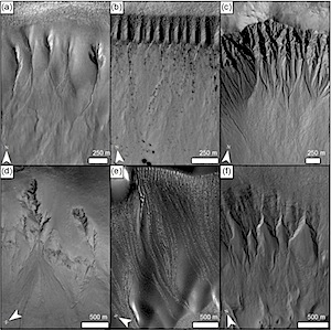
Gullies and ice on Mars

planetary_geomorphology_image_of_the_month_gulliesice2014_i1Planetary Geomorphology Image of the Month, November 2014: Susan Conway (Open University, UK).

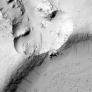
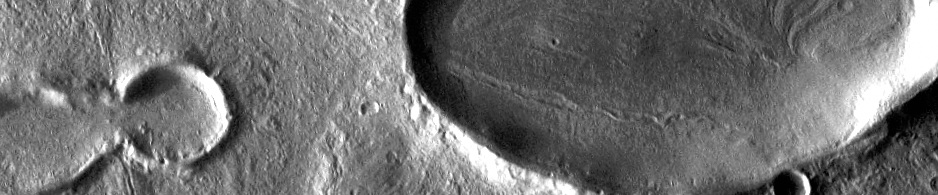
Gullies on Mars were first discovered in 2000 (Malin and Edgett, 2000) in images taken by the Mars Orbiter Camera on board NASA’s Mars Global Surveyor platform. They are kilometre-scale features and have a striking resemblance to water-carved gullies on Earth. Martian gullies have few superposed impact craters and are thought to have occurred in the last few millions of years (e.g., Johnsson et al., 2014), with some modifications of their morphology having occurred in the last few decades (e.g., Dundas et al., 2014). Gullies are concentrated at the mid-latitudes and are found most commonly on steep (>20°) pole-facing slopes, including crater walls… [More at link]
Posted in Reports | Tagged , , , | Comments Off

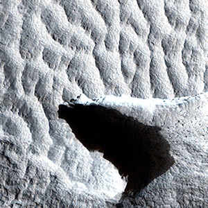
HiRISE: Hardened dunes in Arcadia Planitia

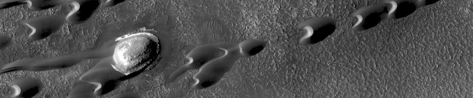
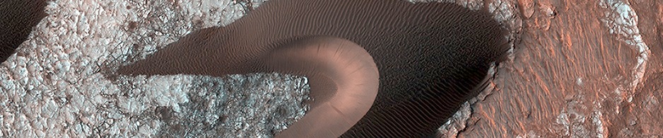
ESP_038143_2205HiRISE, with its high resolution and 8 years in orbit about Mars, has shown that many dunes and ripples on the planet are active. This demonstrates that in some areas sand is loose enough and winds strong enough, that significant change can occur. Nevertheless, other Martian dunes are clearly inactive… [More at link]

Posted in Reports | Tagged , , , , , , , , , | Comments Off

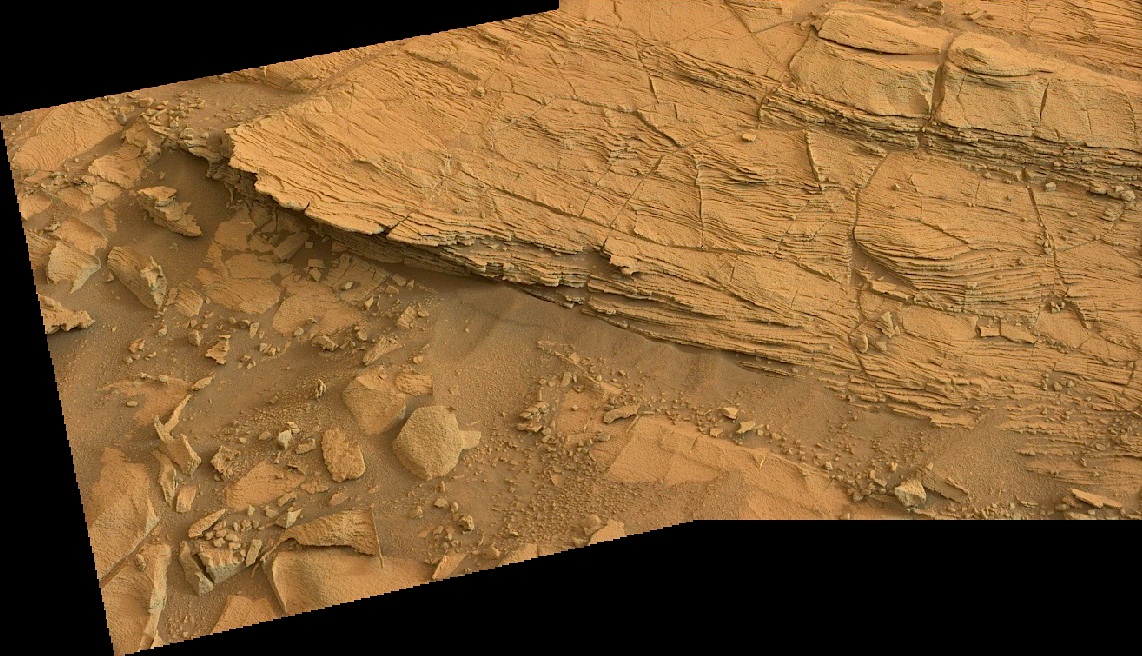
Curiosity: Chinle outcrop in color

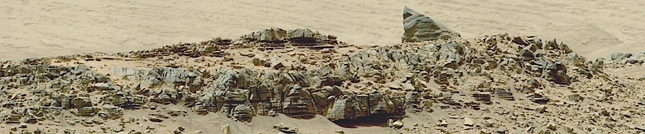
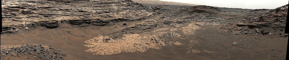
792-chinle-colorSol 792, October 28, 2014. This two-frame wide-angle Mastcam composite shows part of the Chinle outcrop and its small-scale layers.

NASA description (left image): This image was taken by Mastcam: Left (MAST_LEFT) onboard NASA’s Mars rover Curiosity on Sol 792 (2014-10-29 00:58:41 UTC).

Sol 792 raw images (from all cameras), and Curiosity’s latest location map.

Posted in Reports | Tagged , , , , , , , , | Comments Off

HiRISE: Which way is up?

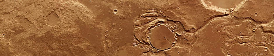
ESP_035969_1825This image shows an impact crater that was cut by lava in the Elysium Planitia region of Mars. The relatively flat, shallow floor, rough surface texture, and possible cooling cracks seem to indicate that the crater was partially filled with lava. The northern part of the image also shows a more extensive lava flow deposit that surrounds the impact ejecta of the largest impact crater in the image… [More at link]

Posted in Reports | Tagged , , , , , , , , | Comments Off

Curiosity update: ‘Beautiful layers’

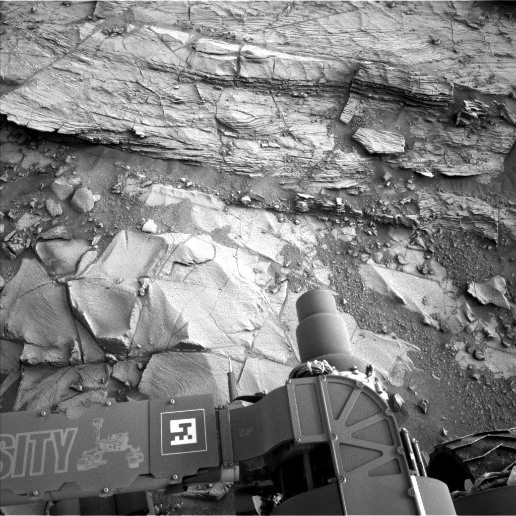
NLB_467815900EDR_F0440370NCAM00404M_Sol 794-795, October 29, 2014, update from USGS Scientist Ryan Anderson: “The 15.8 meter drive on Sol 792 was successful, bringing Curiosity right up to the Chinle outcrop, which has some beautiful layering. In the Sol 794 plan, we have ChemCam observations of four targets on the outcrop: “Cima,” “Sespe,” “Aguereberry Point,” and “Soledad Pass.” Mastcam…” [More at link]

Posted in Reports | Tagged , , , , , , , , | Comments Off

MARCI weather report, October 20-26, 2014

releaseimg_141020_141026This past week extensive dust-lifting in numerous areas of the planet contributed to expansive regional scale storms and dust mobilization. Early in the week several storms formed along the Acidalia storm-track, crossing the equator and moving into central Noachis… [More at link, including video]

Posted in Reports | Tagged , , , , , , , , , , | Comments Off

HiRISE: Search for the Mars 2 debris field

ESP_037371_1350Despite the recent successes of missions landing on Mars, like the Mars Science Laboratory (Curiosity) or the arrival of new satellites, such as India’s MOM orbiter, the Red Planet is also a graveyard of failed missions. The Soviet Mars 2 lander was the first man-made object to touch the surface of the Red Planet when it crashed landed on 27 November 1971. It is believed that the descent stage malfunctioned after the lander entered the atmosphere at too steep an angle. Attempts to contact the probe after the crash were unsuccessful… [More at link]

Posted in Reports | Tagged , , , , , , | Comments Off

Curiosity: Contact at Chinle

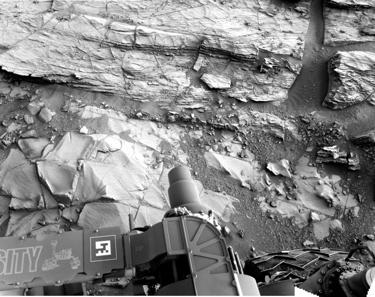
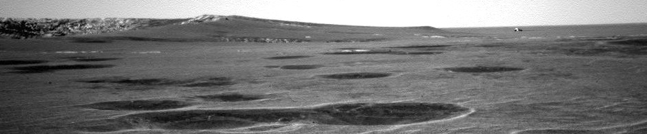
792-pan2Sol 792, October 28, 2014. Opportunity’s rover’s leftside Navcam captures a two-frame composite showing a stratigraphic change, which geologists call a “contact,” in the rock outcrop next to the rover. (Edit: the outcrop has been dubbed Chinle.)

Sol 792 raw images (from all cameras), and Curiosity’s latest location map.

Posted in Reports | Tagged , , , , , , , | Comments Off

THEMIS: Apollinaris Mons

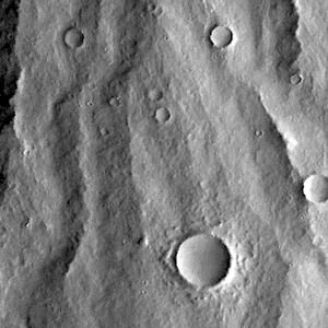
Lava-covered flanks of Apollinaris Mons (THEMIS_IOTD_20141029)THEMIS Image of the Day, October 29, 2014. Today’s VIS image shows the southern flank, where the volcanic material has been eroded into a ridge and channel surface.

More THEMIS Images of the Day by geological topic.

Posted in Reports | Tagged , , , , , , , | Comments Off

Curiosity: Fragile rocks dead ahead

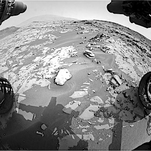
FRB_467715738EDR_F0440256FHAZ00323M_Sol 791, October 27, 2014. Just ahead of the rover’s right front wheel stand several fragile-looking rocks with curiously eroded structures.

NASA description: This image was taken by Front Hazcam: Right B (FHAZ_RIGHT_B) onboard NASA’s Mars rover Curiosity on Sol 791 (2014-10-27 21:15:28 UTC).

Sol 791 raw images (from all cameras), and Curiosity’s latest location map.


Posted in Reports | Tagged , , , , , , , | Comments Off