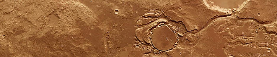
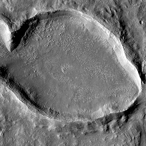
HiRISE: Lava flows in Syria Planum

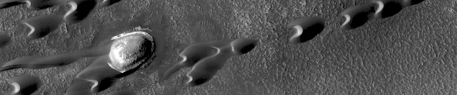
Lava flowstumblr_n7n3xdnOJP1rlz4gso1_1280 in Syria Planum. Beautiful Mars series.

Posted in Reports | Tagged , , , , , , , , , , | Comments Off

THEMIS: Dust devil tracks

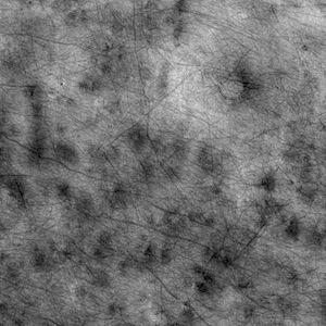
Northern dust devil tracks (THEMIS_IOTD_20140626)THEMIS Image of the Day, June 26, 2014. Today’s VIS image of the northern plains show hundreds of dust devil tracks.

More THEMIS Images of the Day by geological topic.

Posted in Reports | Tagged , , , , , , , , , | Comments Off

MARCI weather report: June 16-22, 2014

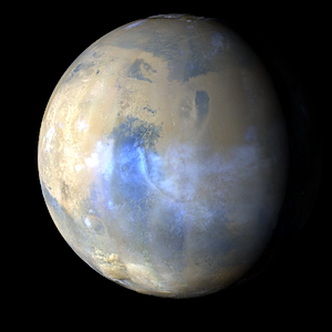
Dust-raising activityreleaseimg_140616_140622 was frequently observed this week in the mid-to-high latitudes of both hemispheres. In the north, storms occurred over and off of the residual north polar cap in Arcadia, Acidalia, and northern Utopia. In the south, local dust storms were observed in Sirenum, Aonia, Margaritifer, Noachis, Hellas, and Cimmeria…. [More at link, including video]

Posted in Reports | Tagged , , , , , , , , , , | Comments Off

Gale Crater’s icy hydrological cycle

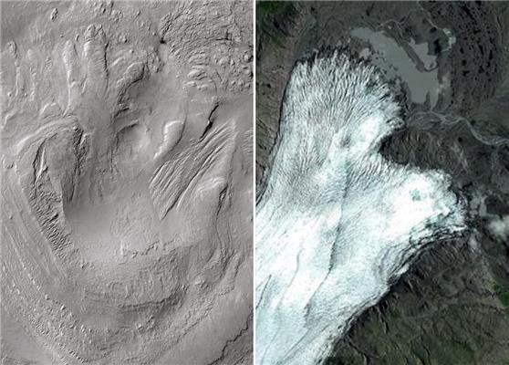
Left: Linear and lobate morphologies on the highest reaches of Aeolis Mons, shaped by glacial activity in the past. Right: Breiðamerkurjökull glacier, Iceland, a terrestrial analog of the glacial remains identified on Gale. Credit: CTX-MRO-NASA/Google maps

Left: Linear and lobate shapes on the highest reaches of Mount Sharp are interpreted as being shaped by glacial activity in the past. Right: Breiðamerkurjökull glacier, Iceland, a terrestrial analog of the glacial remains identified on Gale. ( CTX-MRO-NASA/Google maps)

Gale Crater was once home to glaciers and other features of an icy hydrological system, says a team of scientists led by Alberto Fairén (Centro de Astrobiología in Spain and Cornell University).

They base their work on images captured with the HiRISE and CTX cameras on NASA’s Mars Reconnaissance Orbiter, together with the HRSC instrument onboard the European Space Agency’s Mars Express orbiter. The team’s report was published in the journal Planetary and Space Science.

“Gale was covered by glaciers approximately 3.5 billion years ago,” says Fairén. “They were particularly extensive on its central mound.” The mound, officially named Aeolis Mons and informally dubbed Mount Sharp, rises 5 kilometers (3 miles) above the crater floor where the Curiosity rover is exploring.

Ancient Mars held large quantities of water, the team says. Very cold liquid water flowed through rivers and lakes on the lower-lying areas, forming landscapes similar to those which can be found in Iceland or Alaska today.

“For example, there is a glacier on Iceland — known as Breiðamerkurjökull — which shows evident resemblance to what we see in Gale Crater, and we suppose that is very similar to those which covered Gale’s central mound in the past,” says Fairén.

He emphasizes that the current study “provides strong local support for the global ‘cold and wet’ model of the ancient Martian environment. This, he says, “explains both the geological traces of the presence of liquid water in the past, which cover the entire planet, together with the climatic models which have demonstrated that Mars was never a warm planet.”
Posted in Reports | Tagged , , , , , , , , , , , , , , | Comments Off

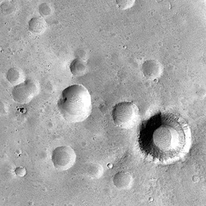
HiRISE: Where the dunes meet the land

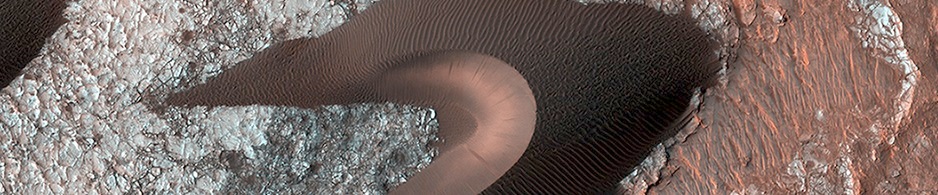
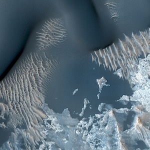
Where the dunes meet the landtumblr_n7mwdag6ms1rlz4gso1_1280. Beautiful Mars series.

Posted in Reports | Tagged , , , , , , , , , | Comments Off

THEMIS: Crater fill

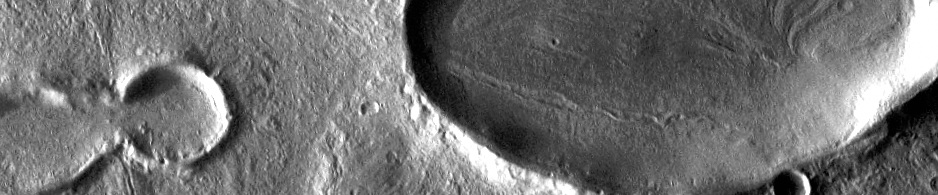
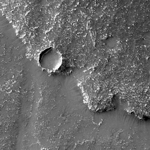
Squiggly concentric crater fill (THEMIS_IOTD_20140625)THEMIS Image of the Day, June 25, 2014. This unnamed crater in this VIS image is located on the margin between Terra Sabaea and Utopia Planitia and is filled with material with a grooved surface. The grooves parallel the crater rim and may indicate that the material is flowing away from the rim. The flow is probably supported by volatiles (like ice) within the fill material.

More THEMIS Images of the Day by geological topic.

Posted in Reports | Tagged , , , , , , , , , , | Comments Off

Curiosity update: ‘One Mars year!’

Sol 669, June 24, 2014, update on Curiosity from U.S. Geological Survey scientist Ryan Anderson: “Happy new year everyone! As of around 3pm (Mars time) on sol 669, Curiosity will have been exploring Mars for a full Martian year… [More at link]

Posted in Reports | Tagged , , , , , , | Comments Off

Curiosity: Sol 669, June 24, 2014

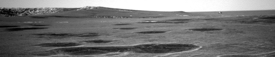
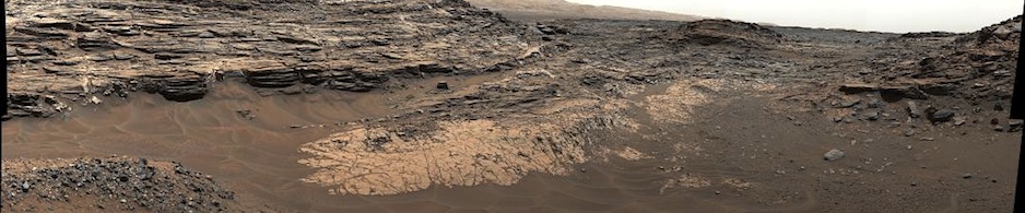
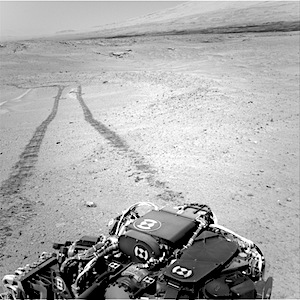
The road actually takenNRB_456887252EDR_F0370292NCAM00271M_ through Robert Frost Pass and Moosilauke Basin, as Curiosity’s second Mars year begins. (On Sol 668′s 107-meter drive, the odometer rolled past 8 kilometers (5 miles) since landing.)

NASA description: This image was taken by Navcam: Right B (NAV_RIGHT_B) onboard NASA’s Mars rover Curiosity on Sol 669 (2014-06-24 13:19:00 UTC).

Sol 669 raw images (from all cameras), and Curiosity’s latest location map.

Posted in Reports | Tagged , , , , , , , , , | Comments Off

HiRISE: Source channel near Ismenius Lacus

tumblr_n7muv74Mkj1rlz4gso1_1280Beautiful Mars series. Source channel near Ismenius Lacus. More Beautiful Mars images.

Posted in Reports | Tagged , , , , , , , , , | Comments Off

HiRISE: Multiple pows

tumblr_n7mtp20aK61rlz4gso1_1280Beautiful Mars series. Multiple pows. More Beautiful Mars images.

Posted in Reports | Tagged , , , , , , , , , | Comments Off