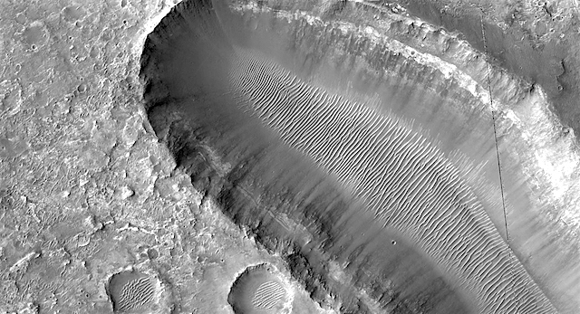
Curiosity update: Exploring the new terrain – one measurement at a time

NLA_602821881EDR_F0732958NCAM00320M_-br2Sols 2315-17, February 11, 2019, update by MSL scientist Suzanne Schwenzer: Curiosity is driving across the clay-bearing unit, which is still a very new terrain with many details yet to be understood. The region is covered in little pebbles – and has lots of small sand patches, too, both of which we continue to investigate. The Navigation camera image above shows the APXS being deployed on the sand patch Alba that was investigated on sol 2313. After that, the drive took us a little further north, to be exact, Curiosity drove 39 metres from the last location.

The parking location presented us with the same pebbly-strewn surface as before, with the occasional small sand feature. With this terrain being new, and some small-scale sedimentary features spotted by the eagle-eyed sedimentologists on the team, we decided to use ChemCam on three pebbly targets, “Dauntless,” “Otter,” and Thistle.” The team also found – for the first time in this new unit – a pebble large enough to get a full APXS raster on one continuous piece of rock. Yes, this is how small the pebbles are! We used the opportunity, named the target “Emerald,” and investigated it using a 3-spot APXS raster… [More at link]

Posted in Reports | Tagged , , , , , , , , , , , , , , , , , , | Comments Off

HiRISE: An elongated pit in Margaritifer Terra

ESP_054608_1770An elongated pit in Margaritifer Terra. There is nothing more interesting than a feature that resembles a giant amoeba. Margaritifer Terra is an ancient, heavily cratered region, centered just south of the Martian equator, and covers 2600 kilometers at its widest extent.

HiRISE Picture of the Day archive [More at links]

Posted in Reports | Tagged , , , , , , , , , , , | Comments Off

Opportunity: More than 835 recovery commands have been sent

NASA Mars Exploration Rover Status Report, February 7, 2019: Mars atmospheric opacity (tau) over the rover site is estimated to be somewhere in the range of 0.9 to 1.3.

No signal from Opportunity has been heard since Sol 5111 (June 10, 2018) during the historic global dust storm. Opportunity likely experienced a low-power fault, a mission clock fault and an up-loss timer fault. The team is continuing to listen for the rover over a broad range of times, frequencies and polarizations using the Deep Space Network (DSN) Radio Science Receiver.

The team has begun mission clock fault recovery commanding “in the blind,” in the hopes of catching the rover during an awake period, as their strategy of last resort. Since loss of signal, over 835 recovery commands have been radiated to the rover. [More at link]

Posted in Reports | Tagged , , , , , , | Comments Off

THEMIS: Floods of once-molten rock spread across Daedalia Planum

Floods of lava across Daedalia Planum (THEMIS_IOTD_20190211)THEMIS Image of the Day, February 11, 2019. Today’s VIS image shows part of the extensive volcanic flows that make up Daedalia Planum. The different layers and surface textures are due to flows at different times, or the affect of cooling as the flow narrows and extends far from the lava source.

Daedalia Planum volcanic flows originate at or near Arsia Mons.

See more THEMIS Images of the Day by geological subject.

Posted in Reports | Tagged , , , , , , , , , | Comments Off

HiRISE: Wind flow

ESP_057930_1720The atmospheric pressure on Earth at sea level is about 1 bar. On Mars, the pressure is 6 to 10 millibars, or 1/100th that of our planet. But even in this atmosphere, wind still flows around obstacles.

In this image the ripples in the sand tell us which way the wind was moving and how it was diverted around these rock formations. (Typically the wind direction is perpendicular to the crest of the dune or in this case, the ripples.) [More at link]

Posted in Reports | Tagged , , , , , , , , | Comments Off

Curiosity departs Vera Rubin Ridge

After exploring Mars’ Vera Rubin Ridge for more than a year, NASA’s Curiosity rover recently moved on. But a new 360-video lets the public visit Curiosity’s final drill site on the ridge, an area nicknamed “Rock Hall.” The video was created from a panorama taken by the rover on Dec. 19. It includes images of its next destination – an area the team has been calling the “clay-bearing unit” and recently named “Glen Torridon” – and the floor of Gale Crater, home to Mount Sharp, the geological feature the rover has been climbing since 2014.

Even though the rover has left the ridge, Curiosity’s team is still piecing together the story of its formation. While there have been a number of clues so far, none fully explains why the ridge has resisted erosion compared with the bedrock around it. But the rover’s investigation did find that the rocks of the ridge formed as sediment settled in an ancient lake, similar to rock layers below the ridge.

“We’ve had our fair share of surprises,” said Curiosity science team member Abigail Fraeman of NASA’s Jet Propulsion Laboratory in Pasadena, California. “We’re leaving with a different perspective of the ridge than what we had before.”

A NASA orbiter studying the ridge had previously identified a strong signal from hematite, an iron-rich mineral that often forms in water. Curiosity confirmed the presence of hematite, along with other signs of ancient water, like crystals. These signs appeared in patches… [More at link]

Posted in Reports | Tagged , , , , , , , , , , , , | Comments Off

Weather at Gale Crater

Posted in Reports | Tagged , , , , , , , | Comments Off

HiRISE: Layered history

ESP_057970_1645The geologic history of a planet is written in its layers. Erosion of the surface reveals several shades of light toned layers, likely sedimentary deposits.

The most recent geologic features are the narrow sand dunes snaking across the top of all the rock. [More at link]

Posted in Reports | Tagged , , , , , , , , | Comments Off

THEMIS: Noachis crater dunes

Noachis crater dunes (THEMIS_IOTD_20190208)THEMIS Image of the Day, February 8, 2019. Sand dunes cover part of the floor of this unnamed crater in Noachis Terra. Their dark tint suggests they are relatively free of light-toned dust, hence probably active under winds currently.

See more THEMIS Images of the Day by geological subject.

Posted in Reports | Tagged , , , , , , , , , , | Comments Off

Boulder trails suggest possible recent marsquakes

figure-3[Editor’s note: From a paper by Jason Brown and Gerald Roberts co-authors recently published in the Journal of Geophysical Research.]

Possible evidence for variation in magnitude for marsquakes from fallen boulder populations, Grjota Valles, Mars

Boulder trail populations were measured along faults on Grjota Valles, Mars to test the hypotheses that these faults are locations for possible marsquakes. If the boulder trail populations are due to single marsquakes, one theory is that the boulders were moved in the very recent past by large magnitude marsquakes.

The area we studied showed that there are coincident maxima in boulder trail density and boulder trail widths along the strike of the faults in Grjota Valles, Mars. We also saw that the boulder count values decrease away from the locations of most boulder trails.

Our results show us that geographically coincident maxima in boulder trail density per km and boulder trail widths along the fault exist. This suggests that a plausible mechanism to mobilize such populations of boulders is through seismic shaking associated with palaeomarsquakes. Our results point to this possibility because boulders mobilized by seismic shaking display a particular pattern: the number of boulder falls and boulder sizes decrease away from the epicenter.

Such research suggests that marsquakes not only occurred on Mars, but maybe occurred in the recent past, too. With the InSight mission now on Mars, its seismometer may well pick up seismic vibrations. [More at link]

Posted in Reports | Tagged , , , , , | Comments Off