
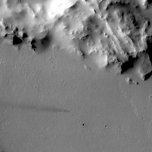
THEMIS image: Small and subtle

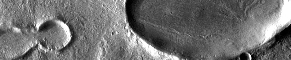
THEMIS Image of the Day, February 27, 2014. Windstreaks are a record of wind directions and are an important part of deciphering the history of the surface. This VIS image contains a very subtle windstreak in the bottom 1/3 of the image. Originating at a small crater, the windstreak records a wind that blew east to west. This VIS image is located southwest of Olympus Mons. More THEMIS Images of the Day by geological topic.

Posted in Reports | Tagged , , , , , , , , | Comments Off

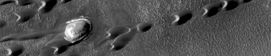
HiRISE image: Frost in dune shadows

This Southern autumn image captures a view of frosty dunes. The sunlight is shining on the dunes from the upper right. The low sun angle creates large shadows from these dunes, making for a dramatic picture. Frost is visible in the shadows of the dunes that appear as lighter or bluer swirls in each shadow. Along the illuminated section of the dunes, in the center-right of the image, five dark thin dust devil tracks are snaking their way along, parallel to the dune ridge. (North is to the left in this image, the image height covers 1.2 kilometers of the surface. )

Posted in Reports | Tagged , , , , , , , , , | Comments Off

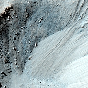
HiRISE image: Equatorial gullies

Gully-like landforms, or ravines, are most common in the middle latitudes of Mars, but also occur in polar and equatorial latitudes. We see here an impact crater about 900 meters wide, with distinct gullies on all inner slopes except in the northwest sector of the crater. The crater formed on the side of an ancient channel, so the northwestern section slumped into the channel, so the slopes are not as steep. This region of Mars is called Libya Montes, near the equator on the south edge of the Isidis impact basin. These are typical gullies… [More at link]

Posted in Reports | Tagged , , , , , , , , | Comments Off

MARCI weather report, February 17-23, 2014

Dust-raising activity and haze was observed in North Utopia, over Olympia, and in Acidalia. Several local dust storms were observed in Solis. Diffuse water ice clouds were present at tropical latitudes, and were particularly visible over Valles Marineris. Skies were relatively clear over the Opportunity rover site in Endeavor Crater and the Curiosity rover site at Gale Crater. [More, including video, at link]

Posted in Reports | Tagged , , , , , , , , , , , , , , , , | Comments Off

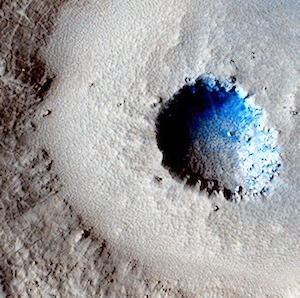
HiRISE image: Craters in an icy surface

Small impact craters usually have simple bowl shapes, but sometimes more complicated shapes can occur if the target is unusual. The crater in the center of this HiRISE image is unusual because there is a wide, flat bench, or terrace, between the outer rim and the inner section, making it appear somewhat like a bullseye. Crater shapes like this can occur if material underground changes from weak to strong. In these cases, the level of the terrace shows where this change occurs. In the area covered by this observation… [More at link]

Posted in Reports | Tagged , , , , , , , | Comments Off

HiRISE image: Dunes streaming through hills

This dramatic image shows dark rippled bodies of sand, sometimes in the form of dunes, streaming through Ganges Chasma. The floor of the canyon is covered by hills and mesas, perhaps remnants of chaotic terrain that formed from sudden collapse as water was withdrawn to form outflow channels. The sand moving through (generally from east to west, or upstream) interacts with the topography to make streamlined shapes. A closeup image in enhanced-color shows one hill with a dune piling up to the east.

Posted in Reports | Tagged , , , , , , , , | Comments Off

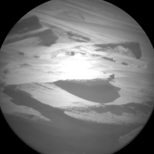
Curiosity raw image: Sol 554, February 25, 2014

ChemCam takes a shot at a layered target. This image was taken by ChemCam: Remote Micro-Imager (CHEMCAM_RMI) onboard NASA’s Mars rover Curiosity on Sol 554 (2014-02-26 06:38:17 UTC). More Sol 554 images (from all cameras), and the rover’s latest location map.

Posted in Reports | Tagged , , , , , , , | Comments Off

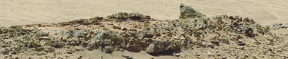
HiRISE image: Pits and hummocks

Beautiful Mars series: Pits and hummocks in the Ismeniae Fossae region. More Beautiful Mars images.

Posted in Reports | Tagged , , , , , , , , | Comments Off

THEMIS image: Which came first?

THEMIS Image of the Day, February 26, 2014. Towards the top of this VIS image is a T-shaped depression and two sections of narrow channel. Fluids (like water — or in this case most likely lava) flow downhill. If the depression formed first, the channels would have flowed towards the depression from both sides and then emptied into the depression, likely forming a delta deposit on both sides. If the channel formed first, it was a single channel and the fluid creating it stopped flowing before the depression was formed. Analysis of… [More at link]

Posted in Reports | Tagged , , , , , , , , | Comments Off

Curiosity raw image: Sol 553, February 25, 2014

Smooth driving ahead. This image was taken by Navcam: Right B (NAV_RIGHT_B) onboard NASA’s Mars rover Curiosity on Sol 553 (2014-02-25 09:20:50 UTC). More Sol 553 images (from all cameras), and the rover’s latest location map.

Posted in Reports | Tagged , , , , , , | Comments Off