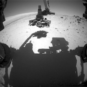
Curiosity: Sol 559, March 3, 2014

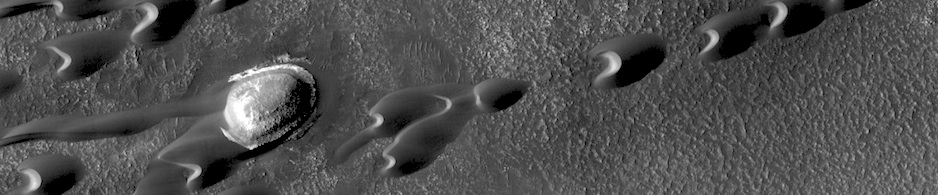
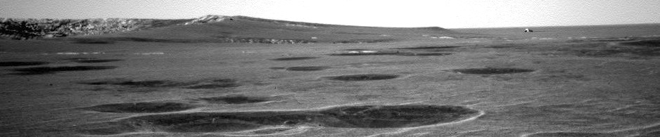
At soil target Johnny Cake. This image was taken by Front Hazcam: Left B (FHAZ_LEFT_B) onboard NASA’s Mars rover Curiosity on Sol 559 (2014-03-03 11:32:39 UTC). More Sol 559 images (from all cameras), and the rover’s latest location map.

Posted in Reports | Tagged , , , , , , , | Comments Off

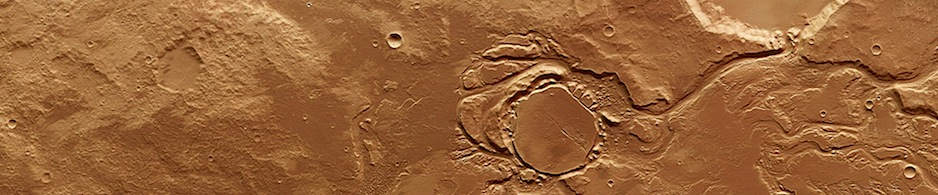
HiRISE: Terrain on Ophir Mensa

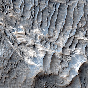
Beautiful Mars series: Terrain on Ophir Mensa. More Beautiful Mars images.

Posted in Reports | Tagged , , , , , , , , , , | Comments Off

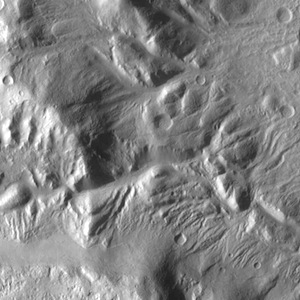
THEMIS: Crater rim channels

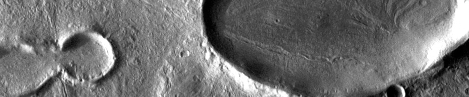
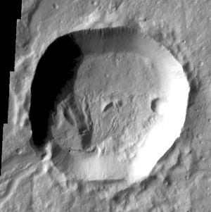
Numerous channels dissect the rim of this large crater located on Acheron Fossae.THEMIS Image of the Day, March 3, 2014. Numerous channels dissect the rim of this large crater located on Acheron Fossae. More THEMIS Images of the Day by geological topic.

Posted in Reports | Tagged , , , , , , , , | Comments Off

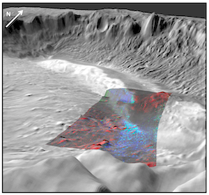
CRISM image: Mafic minerals in western Arabia Terra

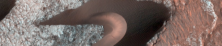
Mafic Minerals in Western Arabia TerraThe Arabia Terra region of Mars is an ancient, very heavily cratered region about 5,100 kilometers (3,170 miles) across, roughly the length of the United States! Arabia contains some of the oldest rocks on Mars. It is one of two very large regions – the other being the Tharsis volcanic plateau – that is almost completely covered in accumulations of windblown dust. However the wind and gravity-driven processes on slopes can also strip the dust away. This image shows an exposure of the underlying igneous rock forming Arabia, containing mafic (magnesium- and iron-rich) minerals that make up most of Mars’ crust. The blue coloring shows a mineral called pyroxene, the dominant silicate mineral in most Martian igneous rocks. More CRISM images.

Posted in Reports | Tagged , , , , , , , , | Comments Off

THEMIS image: Into the crater

Several channels are located on the flank of Hecates Tholus. In this VIS image one of those channels enters a crater, creating a deposit on the floor of the crater. Age relationships can be derived from this image. Hecates Tholus was formed first, then the crater was created, and finally flow of lava or water carved the channel that bisects the crater rim.THEMIS Image of the Day, February 28, 2014. Several channels are located on the flank of Hecates Tholus. In this VIS image one of those channels enters a crater, creating a deposit on the floor of the crater. Age relationships can be derived from this image. Hecates Tholus was formed first, then the crater was created, and finally flow of lava or water carved the channel that bisects the crater rim. More THEMIS Images of the Day by geological topic.

Posted in Reports | Tagged , , , , , , , , , , | Comments Off

Mars meteorite altered by water, has spherules enriched in carbon

A team of scientists at NASA’s Johnson Space Center in Houston and the Jet Propulsion Laboratory in Pasadena, Calif., has found evidence of past water movement throughout a Martian meteorite [Yamato 000593], reviving debate in the scientific community over life on Mars…. [snip]
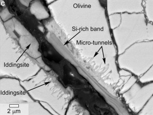
This scanning electron microscope image of a polished thin section of a meteorite from Mars shows tunnels and curved microtunnels. The clay mineral iddingsite is present in this meteorite, named Yamato 000593, which was found in Antarctica in 2000 and identified as originating from Mars. The scale bar at lower left is 2 microns. (NASA/JSC/JPL)

The team’s findings have been published in the February issue of the journal Astrobiology. The lead author, Lauren White, is based at the Jet Propulsion Laboratory. Co-authors are Gibson, Thomas-Keprta, Simon Clemett and McKay, all based at Johnson…. [snip]

Analyses found that the rock was formed about 1.3 billion years ago from a lava flow on Mars. Around 12 million years ago, an impact occurred on Mars which ejected the meteorite from the surface of Mars. The meteorite traveled through space until it fell in Antarctica about 50,000 years ago… [snip]

The team found two distinctive sets of features associated with Martian-derived clay. They found tunnel and micro-tunnel structures that thread their way throughout Yamato 000593. The observed micro-tunnels display curved, undulating shapes consistent with bio-alteration textures observed in terrestrial basaltic glasses, previously reported by researchers who study interactions of bacteria with basaltic materials on Earth.

The second set of features consists of nanometer- to-micrometer-sized spherules that are sandwiched between layers within the rock and are distinct from carbonate and the underlying silicate layer. Similar spherical features have been previously seen in the Martian meteorite Nakhla that fell in 1911 in Egypt. Composition measurements of the Y000593 spherules show that they are significantly enriched in carbon compared to the nearby surrounding iddingsite layers… [snip]

The authors note that they cannot exclude the possibility that the carbon-rich regions in both sets of features may be the product of abiotic mechanisms: however, textural and compositional similarities to features in terrestrial samples, which have been interpreted as biogenic, imply the intriguing possibility that the Martian features were formed by biotic activity… [More at link]
Posted in Reports | Tagged , , , | Comments Off

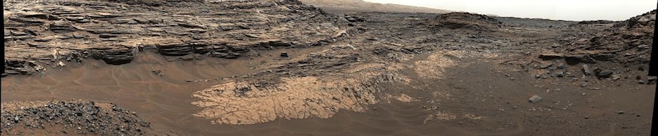
Curiosity panorama: Mt. Sharp from Junda outcrop

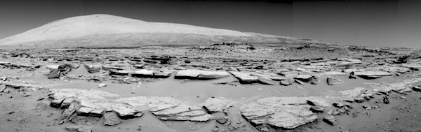
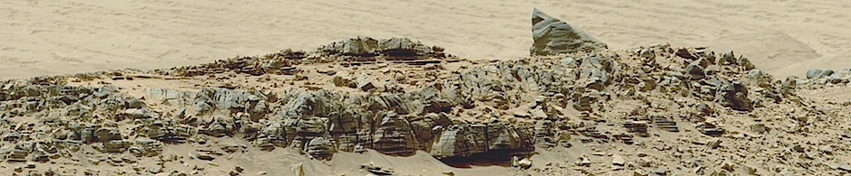
This landscape scene photographed by NASA’s Curiosity Mars rover shows rows of rocks in the foreground and Mount Sharp on the horizon. Curiosity’s Navigation Camera (Navcam) took the component images for this mosaic during a pause in driving on the 548th Martian day, or sol, of the rover’s work on Mars (Feb. 19, 2014). The Sol 548 drive… [More at link]

Posted in Reports | Tagged , , , , , , , , | Comments Off

Curiosity Hazcam image: Sol 555, February 27, 2014

Rolling toward Kimberley. This image was taken by Front Hazcam: Left B (FHAZ_LEFT_B) onboard NASA’s Mars rover Curiosity on Sol 555 (2014-02-27 11:31:02 UTC). More Sol 555 images (from all cameras), and the rover’s latest location map.
Posted in Reports | Tagged , , , , , , | Comments Off

Curiosity panorama: West of Dingo Gap

This scene looking back at where Curiosity crossed a dune at “Dingo Gap” combines several exposures taken by the Navigation Camera (Navcam) high on the rover’s mast. The panorama is centered toward the east and spans about 225 degrees, from north-northwest at the left to west-southwest at the right. For scale, the distance between Curiosity’s parallel wheel tracks is about… [More at link]

Posted in Reports | Tagged , , , , , , , , | Comments Off

HiRISE image: Differing mineralogies

Beautiful Mars series: Differing mineralogies in west Candor Chasma. More Beautiful Mars images.

Posted in Reports | Tagged , , , , , , , , , , | Comments Off