Curiosity update: Quite a diffracting weekend!

NLB_559954253EDR_F0660952NCAM00353M_-br2
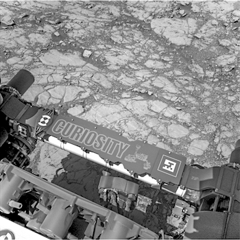
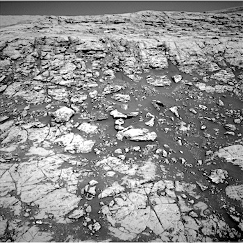
Sol 1831, September 30, 2017, update by MSL scientist Mark Salvatore: The science team has been waiting quite a long time for this moment. Back in late March, nearly 180 Mars-days ago and when Curiosity was investigating the last stretches of the Bagnold Dunes before continuing towards Vera Rubin Ridge, Curiosity’s scoop gathered a sample called “Ogunquit Beach.” In order to quantitatively determine the mineral assemblage present in this sample of a sand dune, Curiosity would have to deliver the sample to the CheMin X-ray diffractometer instrument. However, because of the ongoing troubles with the arm’s drill feed, Curiosity has been stuck with Ogunquit Beach in “storage” and unable to deliver the sample to CheMin – until this weekend! Tomorrow, at around 7:30am PDT, Curiosity will be given the “all clear” to deliver Ogunquit Beach to CheMin. Throughout the weekend, CheMin will analyze this sample, precisely measuring diffraction data for deriving its mineral assemblage, and will… [More at link]

Posted in Reports | Tagged , , , , , , , , , , , , , | Comments Off

Mars Express: Visual Monitoring Camera goes pro

36720523713_818ab4c948_oIn the past fortnight, the VMC camera on Mars Express has delivered some of the best images ever, showing the Martian surface in excellent detail, colour and contrast.

If you’re a VMCer (and, if you’re reading this, you are!) and you’ve been following the live (well, as live as possible) frequent updates in Twitter, you’ve been treated to some excellent images of the north polar ice cap, Valles Marineris, the Tharsis Montes region and some of the craters where rovers rove.

Many of the images in August and September so far were acquired from an altitude above the surface of just 3000-5000 km, giving even the puny VMC webcam a chance to use its simple optics to get a great ‘close-up’ view of what’s passing by below.

In fact, these are some of the closest-ever images that VMC has been able to grab, and were acquired approximately half-way between periares and apoares – the closest and furthest points to the surface in the highly elliptical MEX orbit.

And they contrast (nicely!) with the typical VMC images we’ve been used to seeing for the past near-decade, which were all taken at or very close to apoares at about 10 000km. [More at link]

Posted in Reports | Tagged , , , , , , | Comments Off

Curiosity update: We’ve got the power

NLB_559867237EDR_F0660856NCAM00267M_-br2Sol 1830, September 29, 2017, update by MSL scientist Michael Battalio: With apologies to Montgomery Scott, “we do not have the power…,” but we will, as today was about keeping our state of charge up in preparation for possible CheMin activities in a near-future plan. Fortunately, that absolutely did not preclude a lot of terrific science and a drive.

Today was a touch-and-go sol. Contact science was planned on a dark-toned target named “Collingham” in the hopes that the darker color indicated either a different chemistry or reduced surface dust. APXS, MAHLI, ChemCam, and Mastcam will all cooperate on observing this target. Mastcam will continue the Vera Rubin Ridge imaging campaign by capturing a 13×1 mosaic of a prominent outcrop, named “Tra Tra,” which is the large outcrop at the top left of the above Navcam image. (Mt. Sharp is to the right.) A stereo image will be taken to ascertain the geometry of the bedding. Curiosity then will drive about 11 meters towards the top of a nearby ridge. Post-drive Navcam imaging will be taken as well as an automated AEGIS imaging activity with ChemCam… [More at link]

Posted in Reports | Tagged , , , , , , , , , | Comments Off

HiRISE: Gullies in Icaria Planum crater

tumblr_owux2lvgTK1rlz4gso1_1280A certain starkness. Beautiful Mars series.

Posted in Reports | Tagged , , , , , , , , | Comments Off

MAVEN: Large solar storm sparks global aurora, doubles radiation levels at surface

PIA21855_MavenMarsAuroraBeforeDuringUTCAn unexpectedly strong blast from the Sun hit Mars this month, observed by NASA missions in orbit and on the surface.

“NASA’s distributed set of science missions is in the right place to detect activity on the Sun and examine the effects of such solar events at Mars as never possible before,” said MAVEN Program Scientist Elsayed Talaat, program scientist for MAVEN at NASA Headquarters in Washington, D.C.

The solar event on Sept. 11, 2017 sparked a global aurora at Mars more than 25 times brighter than any previously seen by the MAVEN orbiter, which has been studying the Martian atmosphere’s interaction with the solar wind since 2014.

It produced radiation levels on the surface more than double any previously measured by the Curiosity rover’s Radiation Assessment Detector, or RAD, since that mission’s landing in 2012. The high readings lasted more than two days.

Strangely, it occurred in conjunction with a spate of solar activity during what is usually a quiet period in the Sun’s 11-year sunspot and storm-activity cycle. This event was big enough to be detected at Earth too, even though Earth was on the opposite side of the Sun from Mars.

“The current solar cycle has been an odd one, with less activity than usual during the peak, and now we have this large event as we’re approaching solar minimum,” said Sonal Jain of the University of Colorado Boulder’s Laboratory for Atmospheric and Space Physics, who is a member of MAVEN’s Imaging Ultraviolet Spectrograph instrument team.

“This is exactly the type of event both missions were designed to study, and it’s the biggest we’ve seen on the surface so far,” said RAD Principal Investigator Don Hassler of the Southwest Research Institute’s Boulder, Colorado, office. “It will improve our understanding of how such solar events affect the Martian environment, from the top of the atmosphere all the way down to the surface.” (…)

“If you were outdoors on a Mars walk and learned that an event like this was imminent, you would definitely want to take shelter, just as you would if you were on a space walk outside the International Space Station,” Hassler said. “To protect our astronauts on Mars in the future, we need to continue to provide this type of space weather monitoring there.” [More at link]

Posted in Reports | Tagged , , , , , , , , , , , , , , | Comments Off

THEMIS: Garden of Rubble in Coprates Chasma

Garden of Rubble in Coprates Chasma (THEMIS_IOTD_20170929)THEMIS Image of the Day, September 29, 2017. This image is located in central Coprates Chasma. The floor of the chasma is covered by a complex deposit of material. This chaotic surface differs from most of the floor of the canyon and indicate a local process, perhaps a very large landslide or failure of the cliff face.

Coprates Chasma is one of the numerous canyons that make up Valles Marineris. The chasma stretches for 960 km (600 miles) from Melas Chasma to the west and Capri Chasma to the east. Landslide deposits, layered materials and sand dunes cover a large portion of the chasma floor.

NASA’s Mars Odyssey spacecraft has spent over 15 years in orbit around Mars, circling the planet more than 69,000 times. It holds the record for longest working spacecraft at Mars. THEMIS, the IR/VIS camera system, has collected data for the entire mission and provides images covering all seasons and lighting conditions.

Over the years many features of interest have received repeated imaging, building up a suite of images covering the entire feature. From the deepest chasma to the tallest volcano, individual dunes inside craters and dune fields that encircle the north pole, channels carved by water and lava, and a variety of other feature, THEMIS has imaged them all.

For the next several months the Image of the Day will focus on the Tharsis volcanoes, the various chasmata of Valles Marineris, and the major dunes fields. We hope you enjoy these images!

More THEMIS Images of the Day by geological topic.

Posted in Reports | Tagged , , , , , , , , , , , , | Comments Off

New look at old data points to subsuface equatorial ice

PIA21848_hiresScientists taking a new look at older data from NASA’s longest-operating Mars orbiter have discovered evidence of significant hydration near the Martian equator — a mysterious signature in a region of the Red Planet where planetary scientists figure ice shouldn’t exist.

Jack Wilson, a post-doctoral researcher at the Johns Hopkins University Applied Physics Laboratory in Laurel, Maryland, led a team that reprocessed data collected from 2002 to 2009 by the neutron spectrometer instrument on NASA’s Mars Odyssey spacecraft. In bringing the lower-resolution compositional data into sharper focus, the scientists spotted unexpectedly high amounts of hydrogen — which at high latitudes is a sign of buried water ice — around sections of the Martian equator.

[The paper is published in Icarus.]

An accessible supply of water ice near the equator would be of interest in planning astronaut exploration of Mars. The amount of delivered mass needed for human exploration could be greatly reduced by using Martian natural resources for a water supply and as raw material for producing hydrogen fuel.

By applying image-reconstruction techniques often used to reduce blurring and remove “noise” from medical or spacecraft imaging data, Wilson’s team improved the spatial resolution of the data from around 320 miles to 180 miles (520 kilometers to 290 kilometers). “It was as if we’d cut the spacecraft’s orbital altitude in half,” Wilson said, “and it gave us a much better view of what’s happening on the surface.” [More at links]

Posted in Reports | Tagged , , , | Comments Off

Curiosity: Going up….

1829-navcamSSol 1829, September 28, 2017. Leaving Bar Harbor quadrangle and entering Kuruman quad, Curiosity is driving steadily up the stepped layers on top of Vera Rubin Ridge. The Navcam composite above looks south toward Mt. Sharp and the path ahead, while the view below looks north over the route behind. Click either image to enlarge it.

Sol 1829 raw images (from all cameras), and Curiosity’s latest location.

1829-navcamN

Posted in Reports | Tagged , , , , , , , , , , | Comments Off

Vapor loss during accretion shapes planetary compositions

magnesium-planet-articleAnalysing a mixture of earth samples and meteorites, scientists from the University of Bristol have shed new light on the sequence of events that led to the creation of the planets Earth and Mars.

Planets grow by a process of accretion – a gradual accumulation of  additional material – in which they collisionally combine with their neighbours.

This is often a chaotic process and material gets lost as well as gained.

Massive planetary bodies impacting at several kilometres per second generate substantial heat which, in turn, produces magma oceans and temporary atmospheres of vaporised rock.

Before planets get to approximately the size of Mars, gravitational attraction is too weak to hold onto this inclement silicate atmosphere. Repeated loss of this vapour envelope during continued collisional growth causes the planet’s composition to change substantially.

Dr Remco Hin from the University of Bristol’s School of Earth Sciences, led the research which is published [September 28] in Nature.

He said: “We have provided evidence that such a sequence of events occurred in the formation of the Earth and Mars, using high precision measurements of their magnesium isotope compositions.

“Magnesium isotope ratios change as a result of silicate vapour loss, which preferentially contains the lighter isotopes. In this way, we estimated that more than 40 per cent of the Earth’s mass was lost during its construction.

“This cowboy building job, as one of my co-authors described it,  was also responsible for creating the Earth’s unique composition.” [More at links]

Posted in Reports | Tagged , , , | Comments Off

Curiosity updates: Hello Kuruman!

NLB_559777903EDR_F0660684NCAM00266M_-br2Sol 1829, September 27, 2017, update by MSL scientist Abigail Fraeman: As was predicted in yesterday’s blog, we have officially left the “Bar Harbor” quadrangle and are now into the “Kuruman” quadrangle. This quadrangle is named after a charming town situated on the edge of the Kalahari desert in South Africa. Notably, the town of Kuruman is the namesake for the Kuruman Iron Formation, an ~2.46 billion year sedimentary rock that is rich in hematite. Hematite is the same mineral we can see is distributed throughout the Vera Rubin Ridge from orbital data! The target names we will use while in this quadrangle are pulled from famous geological features from South Africa and nearby Botswana and Zimbabwe.

During our first full sol in the Kuruman quad, we will be doing a touch-and-go. We will investigate target “Enon” with APXS, MAHLI, ChemCam, and Mastcam. We are also currently sitting in front of an erosion-resistant outcrop, “Mt. Hamden,” which is providing us with a nice vertical exposure that we will image with Mastcam left and right eyes. Finally, we will take another Mastcam image of target “Noisy” before… [More at link]

Posted in Reports | Tagged , , , , , , , , , , , , , , | Comments Off