THEMIS: Matara Crater’s sand sheet

Matara Crater dune sheet (THEMIS_IOTD_20170425)THEMIS Image of the Day, April 25, 2017. Today’s false color image shows part of the floor of Matara Crater, including the sand sheet with surface dune forms. Matara Crater is located in Noachis Terra, the oldest part of the martian surface.

The THEMIS VIS camera contains 5 filters. The data from different filters can be combined in multiple ways to create a false color image. These false color images may reveal subtle variations of the surface not easily identified in a single band image.

More THEMIS Images of the Day by geological topic.

Posted in Reports | Tagged , , , , , , , , , , | Comments Off

Curiosity update: Some Murray in hand

FLB_546283099EDR_F0621530FHAZ00302M_-br2Sol 1677, April 24, 2017, update by MSL scientist Abigail Fraeman: This morning we woke up to fresh images from Curiosity that showed our surroundings after an ~17 m Sunday afternoon drive. I always really enjoy days like this because, even after 1,676 sols and just under 16.1 kilometers of driving, it still thrills me to look at images from unexplored areas of Mars. Immediately after inspecting the data, the science team jumped into planning by debating whether we wanted to spend the morning of Sol 1677 doing remote sensing, or if we wanted to spend the time doing contact science with the arm, all before an early afternoon drive continuing up Mt. Sharp.

A big part of the science team strategy for exploring the Murray formation, the group of rocks that are the lowest and oldest in Mt. Sharp, has been to systematically characterize their changing chemistry and mineralogy. Understanding how these properties vary with elevation gives us insight into changing conditions in the geologic processes that deposited… [More at link]

Posted in Reports | Tagged , , , , , , , , | Comments Off

HiRISE: How old are martian gullies?

PSP_002293_1450Gullies eroded into the steep inner slope of an impact crater at this location appear perfectly pristine. Although at first glance it may appear that there are craters superimposed on the gully fans, inspection of HiRISE stereo coverage shows that the craters lie only on the pre-gully terrain.

Distinctive colors in the gully channels and alcoves offer another indication of youth and recent activity. The pre-gully landscape is covered by secondary craters from nearby Gasa Crater, estimated to be about 1 million years old. Although some have suggested that the Martian gullies are also about a… [More at link]

Posted in Reports | Tagged , , , , , , , | Comments Off

Opportunity: Rolling toward Perseverance

4709-navcamSol 4709, April 23, 2017. Four Navcam frames show the vista ahead as Opprtunity rolls toward the head of Perseverance Valley (arrow). Thanks to a long drive on Sol 4705, the rover has caught up with mission planners’ timeline for getting to Perseverance. Whether Opportunity will drive straight to the valley head or investigate the surroundings a little before doing that is up to the science team. Click image to enlarge it.

Opportunity raw images, its latest mission status, a location map, and atmospheric opacity, known as tau.

Posted in Reports | Tagged , , , , , , | Comments Off

Curiosity update: Slipping into a new plan

NLB_546020756EDR_F0621386NCAM00353M_-br2Sol 1674, April 21, 2017, update by MSL scientists Michelle Minitti and Michael Battalio: In the Sol 1673 drive, the rover planners aimed us for a nice curb of Murray bedrock which we could investigate with targeted science (with Mastcam and ChemCam) and contact science (with APXS, MAHLI and the dust removal tool (DRT)) over the weekend. The rover has to be sitting stably on the terrain for us to conduct contact science, with none of the six wheels in danger of slipping off a rock as we deploy the arm and turret. The arm and turret together are over 2 m in length and 95 kg in mass, providing a lever arm significant enough to move even our 900 kg rover! When placing APXS in contact with a rock, or MAHLI 1 cm away from a rock, the last thing you want is for the rover to move. While the rock in our workspace was indeed enticing, the rover planners found that two of our wheels were partially perched on rock slabs like those in the workspace, precluding us from using APXS and getting MAHLI any closer than 10 cm to any target in the workspace. [More at link]

Posted in Reports | Tagged , , , , , , , , , , , | Comments Off

HiRISE: Layers in a mid-latitude depression

tumblr_ookfvmW6v91rlz4gso1_1280Layers in a depression on a crater floor in the northern mid-latitudes. Beautiful Mars series.

Posted in Reports | Tagged , , , , , , , , | Comments Off

THEMIS: Newton Crater’s crater

Newton Crater's crater (THEMIS_IOTD_20170424)THEMIS Image of the Day, April 24, 2017. Today’s false color image shows an unnamed crater located on the floor of Newton Crater in Terra Sirenum.

The THEMIS VIS camera contains 5 filters. The data from different filters can be combined in multiple ways to create a false color image. These false color images may reveal subtle variations of the surface not easily identified in a single band image.

More THEMIS Images of the Day by geological topic.

Posted in Reports | Tagged , , , , , , , , | Comments Off

Opportunity: Sights ahead

4706-pancam11P545969997EFFCX__P2576L5M1_L2L5L5L7L7Sol 4706, April 21, 2017. After a 19-meter (62-foot) drive, the rover’s Pancam surveyed the ground ahead. The left arrow points to the start of Perseverance Valley, the right arrow indicates a bright outcrop of rock to investigate, and the center arrow points to an old and subdued crater.

At right is a foot-wide impact crater from a meteorite that struck with just enough force to push away the top regolith (Holger Isenberg false color). Click either image to enlarge it.

Opportunity raw images, its latest mission status, a location map, and atmospheric opacity, known as tau.

Posted in Reports | Tagged , , , , , , , | Comments Off

Opportunity landing site in color

pia21494-16
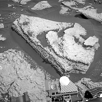
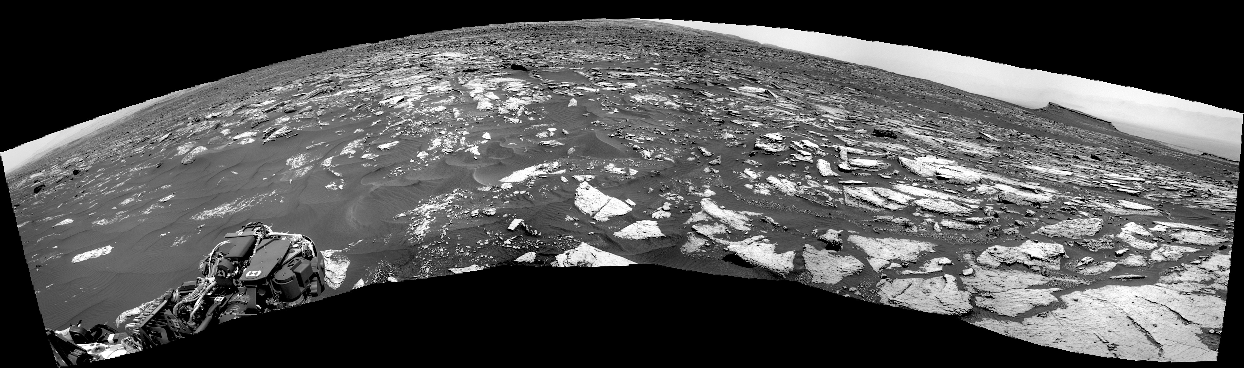
A new observation from NASA’s Mars Reconnaissance Orbiter (MRO) captures the landing platform that the rover Opportunity left behind in Eagle Crater more than 13 years and 27 miles (or 44 kilometers) ago.

A series of bounces and tumbles after initial touchdown plunked the airbag-cushioned lander into the crater, a mere 72 feet (22 meters) across, on Jan. 25, 2004, Universal Time (Jan. 24, PST).

The scene includes Eagle Crater and Opportunity’s nearby parachute and backshell, from the April 10, 2017, observation by MRO’s High Resolution Imaging Science Experiment (HiRISE) camera.

This is the first view from HiRISE of the Eagle Crater scene. Mars Reconnaissance Orbiter began orbiting Mars more than two years after Opportunity’s landing. One of the first images from HiRISE in 2006 showed Opportunity at the rim of a much larger crater, Victoria, nearly 4 miles (about 6 kilometers) south of the landing site.

Eagle Crater is at the upper right of the new image. The lander platform’s job was finished once the rover rolled off it. The parachute and backshell are at the lower left. [More at link]
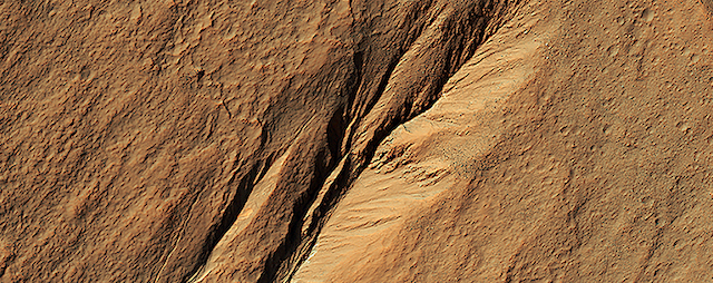
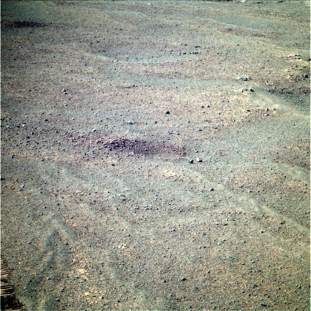
Posted in Reports | Tagged , , , , , , , , , , , | Comments Off

Curiosity: Working southward

1673-navcamSol 1673, April 21, 2017. As Curiosity continues driving southward (today: 19 meters, 62 feet), the path is gradually becoming more rocky and less sandy. Click image to enlarge it.

Sol 1673 raw images (from all cameras), and Curiosity’s latest location.

Posted in Reports | Tagged , , , , , , , , | Comments Off