Mars rings: Not now, but maybe someday

PIA17089-16As children, we learned about our solar system’s planets by certain characteristics — Jupiter is the largest, Saturn has rings, Mercury is closest to the sun. Mars is red, but it’s possible that one of our closest neighbors also had rings at one point and may have them again someday.

That’s the theory put forth by NASA-funded scientists at Purdue University, Lafayette, Indiana, whose findings were published in the journal Nature Geoscience. David Minton and Andrew Hesselbrock developed a model that suggests that debris that was pushed into space from an asteroid or other body slamming into Mars around 4.3 billion years ago alternates between becoming a planetary ring and clumping together to form a moon.

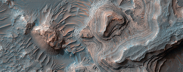
One theory suggests that Mars’ large North Polar Basin or Borealis Basin — which covers about 40 percent of the planet in its northern hemisphere — was created by that impact, sending debris into space.

“That large impact would have blasted enough material off the surface of Mars to form a ring,” Hesselbrock said.

Hesselbrock and Minton’s model suggests that as the ring formed, and the debris slowly moved away from the Red Planet and spread out, it began to clump and eventually formed a moon. Over time, Mars’ gravitational pull would have pulled that moon toward the planet until it reached the Roche limit, the distance within which a planet’s tidal forces will break apart a celestial body that is held together only by gravity.

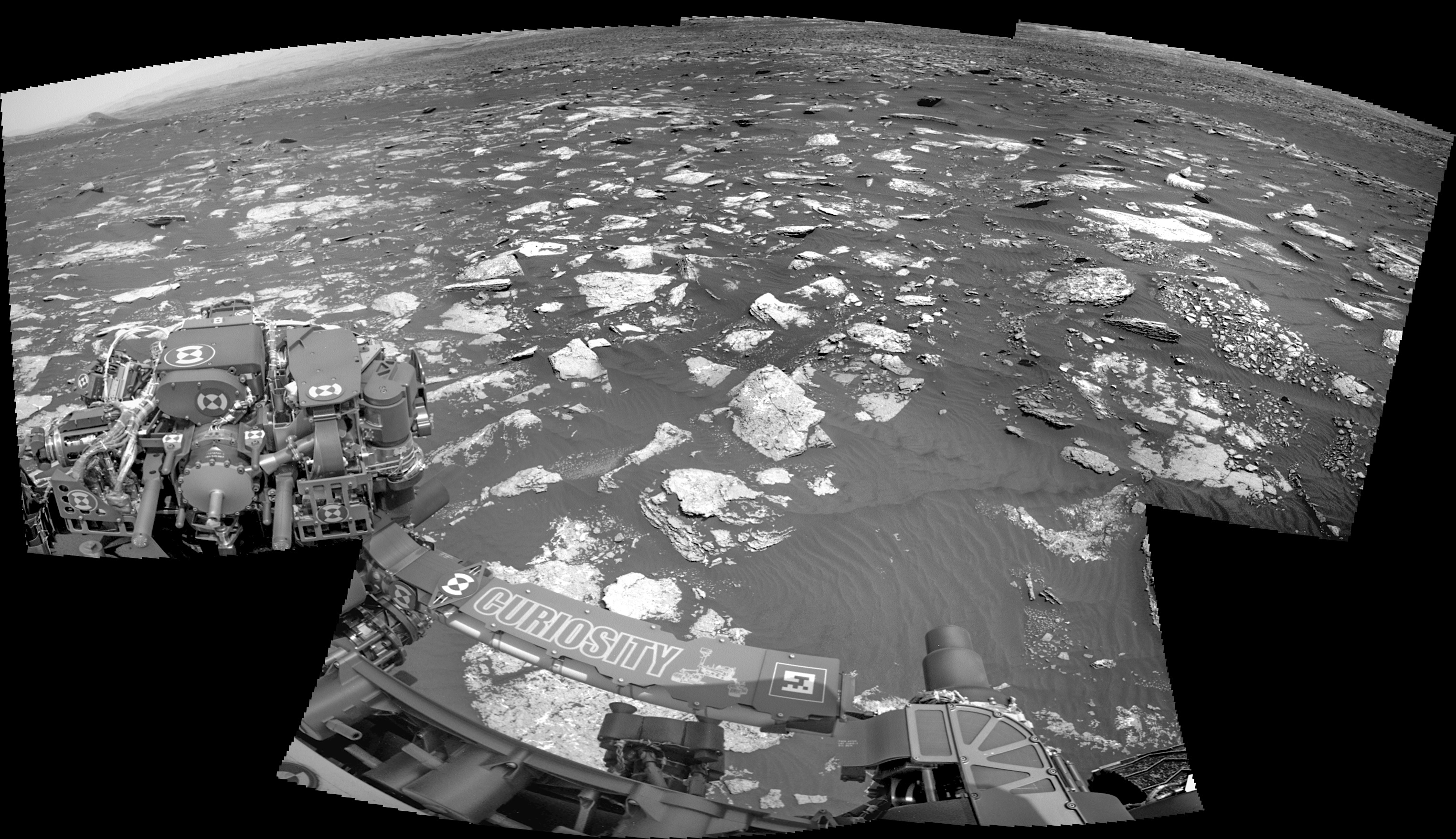
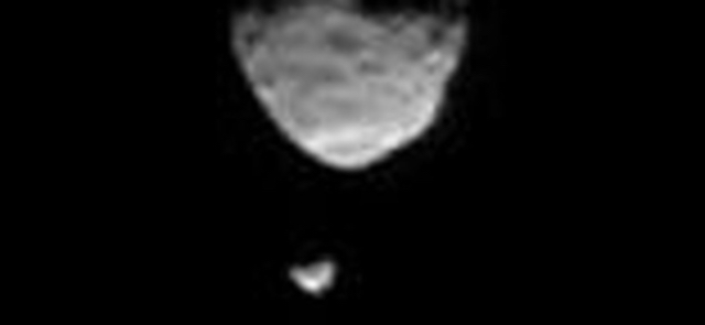
Phobos, one of Mars’ moons, is getting closer to the planet. According to the model, Phobos will break apart upon reaching the Roche limit, and become a set of rings in roughly 70 million years. Depending on where the Roche limit is, Minton and Hesselbrock believe this cycle may have repeated between three and seven times over billions of years. Each time a moon broke apart and reformed from the resulting ring, its successor moon would be five times smaller than the last, according to the model, and debris would have rained down on the planet, possibly explaining enigmatic sedimentary deposits found near Mars’ equator. [More at links]

Posted in Reports | Tagged , , , | Comments Off

THEMIS: Sand sea in Rabe Crater

Sea of dunes in Rabe Crater (THEMIS_IOTD_20170320)THEMIS Image of the Day, March 20, 2017. Today’s false color image shows part of the floor of Rabe Crater, which is covered mostly with a wind-shaped sea of sand.

The THEMIS VIS camera contains 5 filters. The data from different filters can be combined in multiple ways to create a false color image. These false color images may reveal subtle variations of the surface not easily identified in a single band image.

More THEMIS Images of the Day by geological topic.

Posted in Reports | Tagged , , , , , , , , , | Comments Off

Curiosity: Rocky path ahead

1639-navcamSol 1639, March 17, 2017. While Curiosity is studying rocks and sand immediately in front of it, rover drivers are planning a path southward toward Mt. Sharp. Sand lies everywhere, but so do rocks which will help prevent Curiosity from becoming bogged down in the Bagnold sands. Click the image (2.5 MB) to enlarge it.

Sol 1639 raw images (from all cameras), and Curiosity’s latest location.

Posted in Reports | Tagged , , , , , , , , | Comments Off

HiRISE: Layered deposits in Uzboi Vallis

PSP_010329_1525Layered deposits in Uzboi Vallis sometimes occur in alcoves along the valley and/or below where tributaries enter it. These deposits may record deposition into a large lake that once filled Uzboi Vallis when it was temporarily dammed at its northern end by the rim Holden Crater and before it was overtopped and breached allowing water to drain back out of the valley.

Layered deposits similar to those here may remain preserved where they were protected from erosion during drainage of the lake. Data from the CRISM instrument onboard MRO shows that clays are within these deposits that may differ from clays found elsewhere on the valley floor. Hence, the clays in these layers may have been washed into the lake from surrounding clay-bearing surfaces. [More at link]

Posted in Reports | Tagged , , , , , , , | Comments Off

THEMIS: Canyon’s edge in Ganges Chasma

Canyon's edge in Ganges Chasma (THEMIS_IOTD_20170317)THEMIS Image of the Day, March 17, 2017. Today’s false color image shows part of Ganges Chasma. Dunes are visible on the floor of the canyon (bottom right corner of the full image).

The THEMIS VIS camera contains 5 filters. The data from different filters can be combined in multiple ways to create a false color image. These false color images may reveal subtle variations of the surface not easily identified in a single band image.

More THEMIS Images of the Day by geological topic.

Posted in Reports | Tagged , , , , , , , , , , , | Comments Off

Curiosity update: Onward to Ogunquit Beach

1636MR0084510000801845E01_DXXX-br2Sol 1639, March 16, 2017, update by USGS scientist Ryan Anderson: Planning was challenging this morning because of some network issues at JPL, but the team figured out how to work around the problem and still managed to put together a good plan! We’ve been at Stop 3 of the dune campaign (now known as “Southern Cove”) for a couple of sols, so in today’s plan it’s time to move on.

On Sol 1639 the rover will begin by retracting the arm and doing some drill diagnostics before taking MAHLI images of the targets “Greenvale Cove” and “Holmes Hole”. After that, we have a remote sensing science block with a Navcam movie to watch for clouds above the crater rim, followed by a Mastcam change detection observation of “Holmes Hole”… [More at link]

Posted in Reports | Tagged , , , , , , , , , , , , | Comments Off

HiRISE: Surface textures in Sinus Meridiani

tumblr_omblou1vo61rlz4gso1_1280Surface textures in Sinus Meridiani. Beautiful Mars series.

Posted in Reports | Tagged , , , , , , , , | Comments Off

ExoMars: Aerobraking begins as TGO science checkout ends

Flying_over_Mellish_crater_node_full_image_2The ExoMars Trace Gas Orbiter has completed another set of important science calibration tests before a year of aerobraking gets underway.

The mission was launched a year ago this week, and has been orbiting the Red Planet since 19 October. During two dedicated orbits in late November, the science instruments made their first calibration measurements since arriving at Mars. The latest tests were carried out 5–7 March from a different orbit, and included checking procedures associated with taking images and collecting data on the planet’s atmosphere. (…)

“These dress rehearsals enable our science teams to fine-tune their data acquisition techniques including pointing commands, iron out any software bugs, and get used to working with the data, well in advance of the start of the main mission starting next year,” says Håkan Svedhem, ESA’s project scientist. “What we’re seeing so far is really promising for our science goals.” [More at link]

Posted in Reports | Tagged , , , , , , , , , | Comments Off

Curiosity update: Busy day for MAHLI

NLB_542832372EDR_F0612232NCAM00207M_-br2Sol 1638, March 15, 2017, update by USGS scientist Ryan Anderson: Today we are continuing our investigation of Stop #3 of the Bagnold Dune campaign. We start off with some MAHLI images of the APXS targets “Ripogenus” and “Spragueville” from yesterday. For these images, the MAHLI dust cover will stay closed. Then ChemCam will analyze the bedrock target “Holmes Hole” and the sand target “Spragueville”, with Mastcam support images. MAHLI will then come back to “Ripogenus” and “Spragueville” for some very close (2 cm and 1 cm, respectively) images, followed by some 25cm and 5cm… [More at link]

Posted in Reports | Tagged , , , , , , , , , , , | Comments Off

THEMIS: Rim gullies & dunes in Noachis crater

Gullies and dunes in Noachis Terra (THEMIS_IOTD_20170316)THEMIS Image of the Day, March 16, 2017. Today’s false color image shows part of the floor of an unnamed crater in Noachis Terra. A small field of dunes is visible in the bottom left corner of the full image, while gullies have deeply etched the rim.

The THEMIS VIS camera contains 5 filters. The data from different filters can be combined in multiple ways to create a false color image. These false color images may reveal subtle variations of the surface not easily identified in a single band image.

More THEMIS Images of the Day by geological topic.

Posted in Reports | Tagged , , , , , , , , , | Comments Off