


 THEMIS Image of the Day, September 3, 2015. This relatively young crater is located on the northern plains of Arcadia Planitia.
More THEMIS Images of the Day by geological topic.
THEMIS Image of the Day, September 3, 2015. This relatively young crater is located on the northern plains of Arcadia Planitia.
More THEMIS Images of the Day by geological topic.
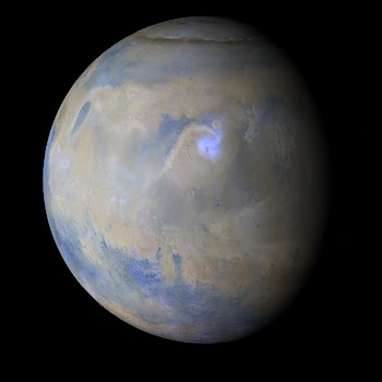 Sporadic storm activity continued in the southern mid-to-high latitudes of Mars last week. In the low latitudes, condensate water-ice clouds were prevalent over eastern Meridiani, Elysium, and the Tharsis bulge. To the north, fleeting dust storms and water-ice clouds continued to propagate eastward along the north polar seasonal ice cap edge. [More at link, including video]
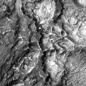
 Planetary Geomorphology Image of the Month, September 2, 2015: Wouter Marra (Universiteit Utrecht, Netherlands). There are many water-worn features on the planet Mars, which contribute to the reconstruction of former hydrological conditions. For example, dendritic valley networks show that there was precipitation in the Noachian, the oldest epoch on Mars more than 3.7 billion years ago (Craddock and Howard, 2002). In contrast, fluvial morphologies in younger terrains seem to originate from groundwater (e.g. Baker and Milton, 1974). These are valleys that appear suddenly in the landscape, for example the large outflow channels (e.g. Mangala Vallis and Kasei Vallis) and theatre-headed valleys (such as Nirgal Vallis). However, such systems and their implications are poorly understood. To better understand the formation of such landscapes, I performed several scale-experiments focused on the fundamental process and resulting morphology… [More at link]
 Polygonal fracturing on ejecta from a crater in the Arabia region.
Beautiful Mars series.
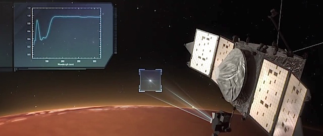 High above the thin Martian skies, NASA’s MAVEN spacecraft is carrying out a mission: determine how Mars lost its early atmosphere, and with it, its water.
While previous Mars orbiters have peered down at the planet’s surface, MAVEN is spending part of its time gazing at the stars, looking for subtle changes in their color as they dip through the limb of Mars and set below the horizon. Such stellar occultations reveal what Mars’ atmosphere is made of, and how its composition varies with altitude. [More at link, including video]
 THEMIS Image of the Day, September 2, 2015. The intersecting linear depressions in this VIS image are part of Hephaestus Fossae.
More THEMIS Images of the Day by geological topic.
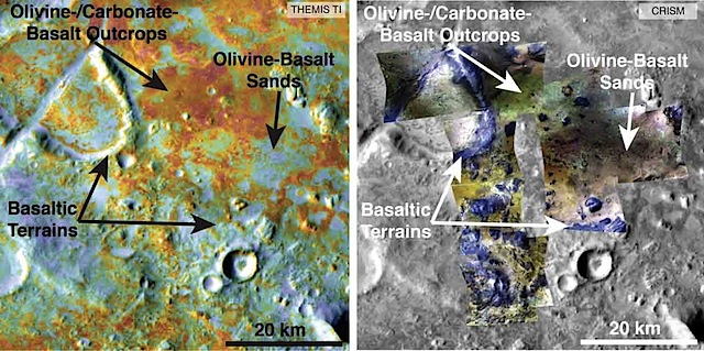 Scientists may be closer to solving the mystery of how Mars changed from a world with surface water billions of years ago to the arid Red Planet of today. A new analysis of the largest known deposit of carbonate minerals on Mars suggests that the original Martian atmosphere may have already lost most of its carbon dioxide by the era of valley network formation.
“The biggest carbonate deposit on Mars has, at most, twice as much carbon in it as the current Mars atmosphere,” said Bethany Ehlmann of the California Institute of Technology and NASA Jet Propulsion Laboratory, both in Pasadena. “Even if you combined all known carbon reservoirs together, it is still nowhere near enough to sequester the thick atmosphere that has been proposed for the time when there were rivers flowing on the Martian surface.”
[The work is reported in a paper published online in the journal Geology.]
Carbon dioxide makes up most of the Martian atmosphere. That gas can be pulled out of the air and sequestered or pulled into the ground by chemical reactions with rocks to form carbonate minerals. Years before the series of successful Mars missions, many scientists expected to find large Martian deposits of carbonates holding much of the carbon from the planet’s original atmosphere. Instead, these missions have found low concentrations of carbonate distributed widely, and only a few concentrated deposits. By far the largest known carbonate-rich deposit on Mars covers an area at least the size of Delaware, and maybe as large as Arizona, in a region called Nili Fossae. [More at links]
 Central uplift of a 46-kilometer crater near Ladon Valles basin.
Beautiful Mars series.
 Sol 1092, September 1, 2015, update from USGS scientist Lauren Edgar: Curiosity is currently investigating an outcrop of the Stimson unit. On Sol 1091, Curiosity acquired some low- resolution MAHLI images of the targets “Pentagon,” “Lebo,” “Ivanhoe,” and “Ledger” in order to plan more detailed imaging of those targets today.
The Sol 1092 plan includes targeted remote sensing followed by more contact science. In the midday science block, we’ll acquire ChemCam and Mastcam on the targets “Rabbit Hills” and “Horseshoe Hills” to investigate some of the alteration features seen here. We’ll also acquire some large Mastcam mosaics of the “Williams” area to investigate the… [More at link]
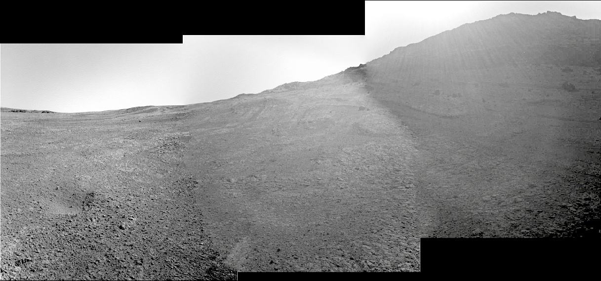 Sols 4123, 4125, August 30, September 1, 2015. Three composited Navcam frames show the rover’s uphill view in the afternoon. Lensflare from sunlight casts a haze over the middle and right frames. The rover’s location is near the Pvt. Robert Frazer outcrop.
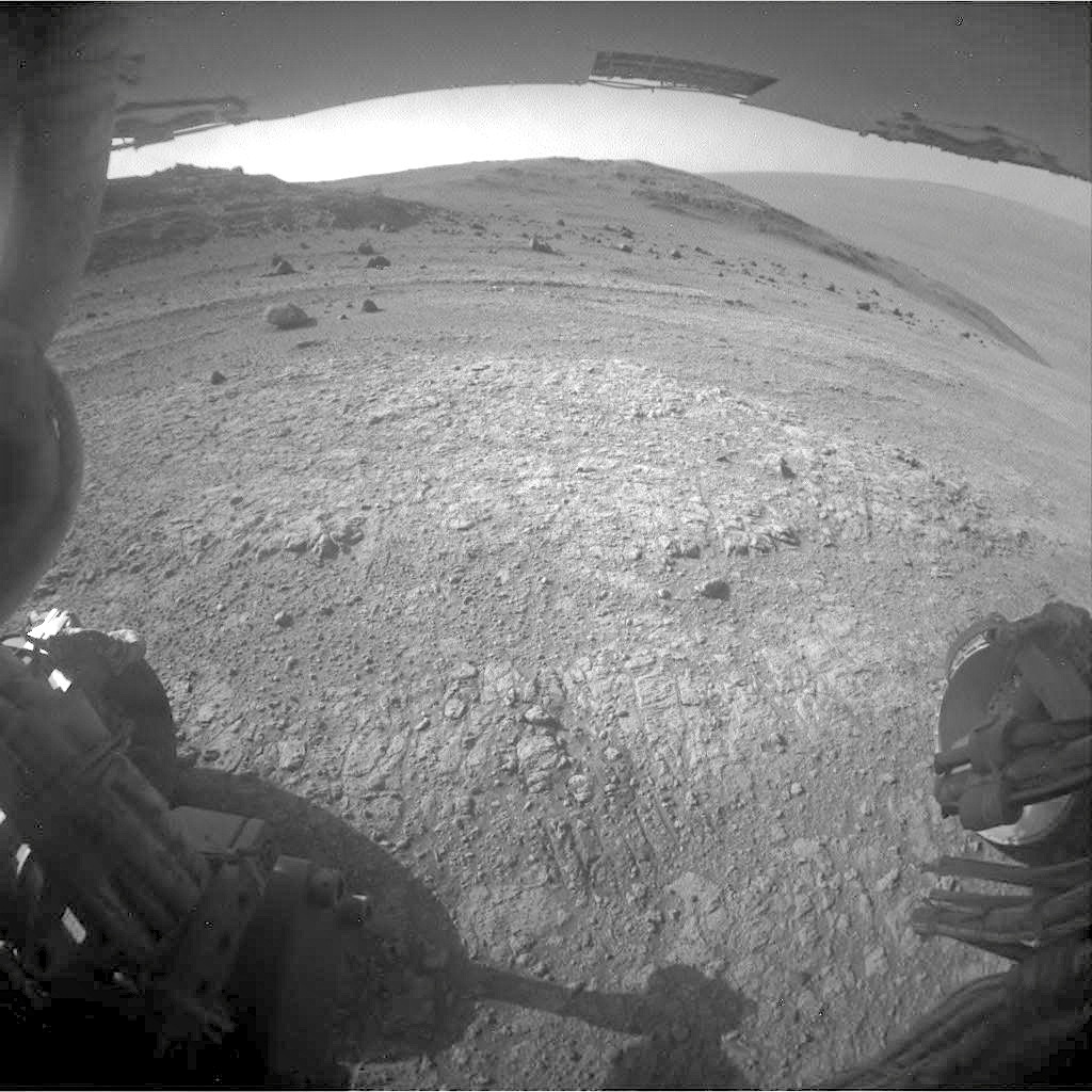
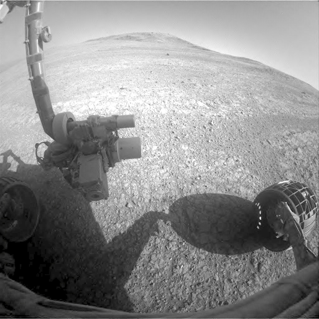 At right, front and rear Hazcams show the scene with the rover turned to face southerly. (Click any image to enlarge.)
 Opportunity raw images, its latest mission status, a location map. and atmospheric opacity, known as tau.