



Curiosity: Approaching Gilbert Peak

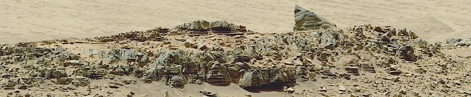
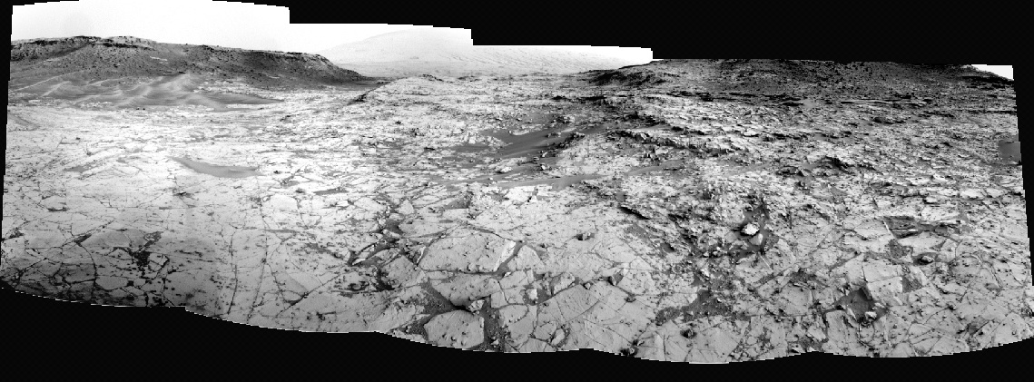
787-pan2Sol 787, October 23, 2014. With the rover on the exposed rocky pavement, scientists are planning their approach to the next targets at Gilbert Peak, at right in the panorama.

Sol 787 raw images (from all cameras), and Curiosity’s latest location map.
Posted in Reports | Tagged , , , , , , , , | Comments Off

CRISM: Comet nucleus in infrared

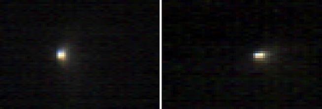
pia15291-16The Compact Imaging Spectrometer for Mars (CRISM) observed comet C/2013 A1 Siding Spring as the comet sped close to Mars on Oct. 19. CRISM recorded imaging data in 107 different wavelengths, showing the inner part of the cloud of dust, called the coma, surrounding the comet’s nucleus…. The appearance of color variations in the CRISM observations of the inner coma could be due to the properties of the comet’s dust, possibly dust grain size or composition. The full spectra will be analyzed to better understand the reason for the color variations… [More at link]

Posted in Reports | Tagged , , , , , , | Comments Off

Opportunity: Dusty days at Endeavour

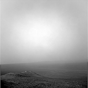
1N467319070EFFCH0UP1957R0M1Sol 3820, October 22, 2014. Dust in the air turns sunlight hazy over Endeavour Crater.  This afternoon view (3:30 p.m. local time) looks northeast, down Wdowiak Ridge. The crater’s far rim, 22 kilometers away, is difficult to distinguish from the crater floor and the sky.

Based on daily Sun images, the atmosphere’s tau, or opacity, has climbed steadily over the past several sols.

Opportunity raw images, its latest mission status, and a location map.

Posted in Reports | Tagged , , , , , , , , , , | Comments Off

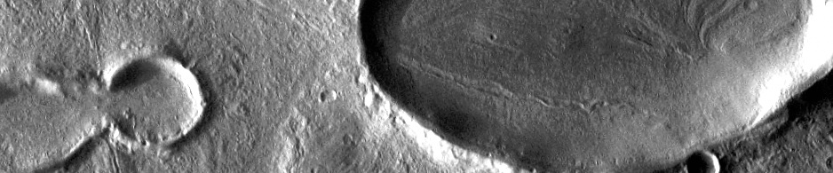
THEMIS: Mangala Fossa

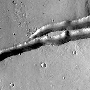
Mangala Fossa (THEMIS_IOTD_20141024)THEMIS Image of the Day, October 24, 2014. The depression in the center of this VIS image is a graben (fault bounded block of material). This graben is called Mangala Fossa.

More THEMIS Images of the Day by geological topic.

Posted in Reports | Tagged , , , , , , , , | Comments Off

HiRISE: Landforms in eastern Elysium Planitia

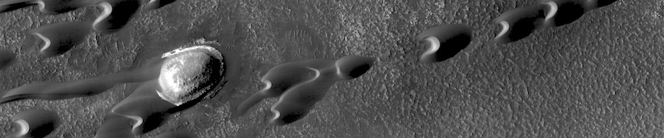
ESP_037300_1825This image shows a great deal of geologic diversity in a rather small area. In the northern section of the image, we see flat terrain that is probably an ancient lava field. This field runs up against a mesa, with slopes that show several dark streaks, possibly freshly disturbed material that is darker than the surrounding area and hasn’t had time to fade. These dust avalanches are common in dust-covered regions on Mars…. [More at link]

Posted in Reports | Tagged , , , , , , | Comments Off

MAVEN: Comet’s atomic hydrogen coma in UV

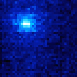
Siding-Spring-HLyA_redThe MAVEN spacecraft obtained an ultraviolet image of hydrogen surrounding comet Siding Spring on Friday, October 17th, two days before the comet’s closest approach to Mars. The Imaging Ultraviolet Spectrograph (IUVS) instrument imaged the comet at a distance of 5.3 million miles (8.5 million kilometers). The image shows sunlight that has been scattered by atomic hydrogen, and is shown as blue in this false-color representation. Comets are surrounded by a huge cloud of atomic hydrogen because water (H2O) vaporizes from the icy nucleus, and solar ultraviolet light breaks it apart into hydrogen and oxygen. Hydrogen atoms scatter solar ultraviolet light, and it was this light that was imaged by the IUVS. Two observations were combined to create this image, after removing the foreground signal that results from sunlight being scattered from hydrogen surrounding Mars… [More at link]

Posted in Reports | Tagged , , , , , , , | Comments Off

THEMIS: Candor Chasma

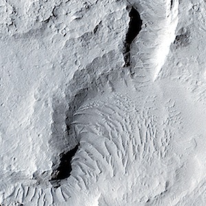
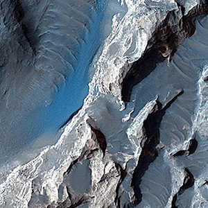
Dropping into Candor Chasma (THEMIS_IOTD_20141023)THEMIS Image of the Day, October 23, 2014. This VIS image shows eroded materials on the floor of Candor Chasma.

More THEMIS Images of the Day by geological topic.

Posted in Reports | Tagged , , , , , , , , | Comments Off

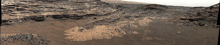
Curiosity update: ‘Drive to Gilbert Peak’

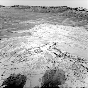
NRB_467190672EDR_F0440036NCAM00289M_Sol 787-788, October 22, 2014, update from USGS Scientist Lauren Edgar: “It was a busy day of rover operations here at the USGS…. Today we planned two sols and the goal was to characterize the Book Cliffs outcrop and drive toward the Gilbert Peak outcrop. This Navcam image [right] from Sol 785 shows our current location at Book Cliffs in the lower right part of the frame, and some beautiful ripples in the valley to the west…” [More at link]

Posted in Reports | Tagged , , , , , , , , , | Comments Off

HiRISE: Light-toned deposit in Arsinoes Chaos

ESP_037545_1730The objective of this observation is to examine a light-toned deposit in a region of what is called “chaotic terrain” at the base of the Valles Marineris canyon system. The deposit displays a rough surface, in contrast to the smoothness of the surrounding area. Some parts of the surface appear as if they were eroded by a fluid flowing north and south, or perhaps sculpted by the wind… [More at link]

Posted in Reports | Tagged , , , , , , , | Comments Off

MARCI weather report: October 13-19, 2014

releaseimg_141013_141019This week Mars experienced an uptick in regional storm activity, with widespread dust-lifting observed in both hemispheres. Storms travelled down the Acidalia storm-track throughout the week, passing through Chryse into eastern Valles Marineris, and contributing dust-haze past the equator into north-central Noachis… [More at link, including video]

Posted in Reports | Tagged , , , , , , , , , , | Comments Off