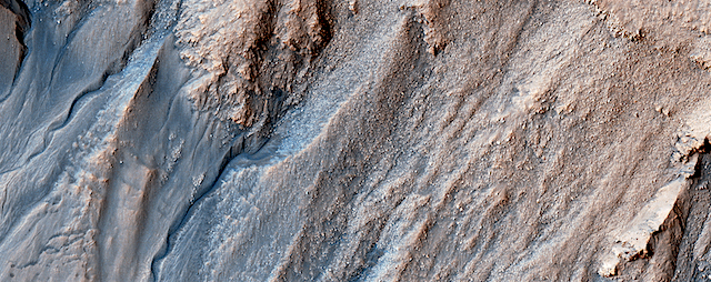
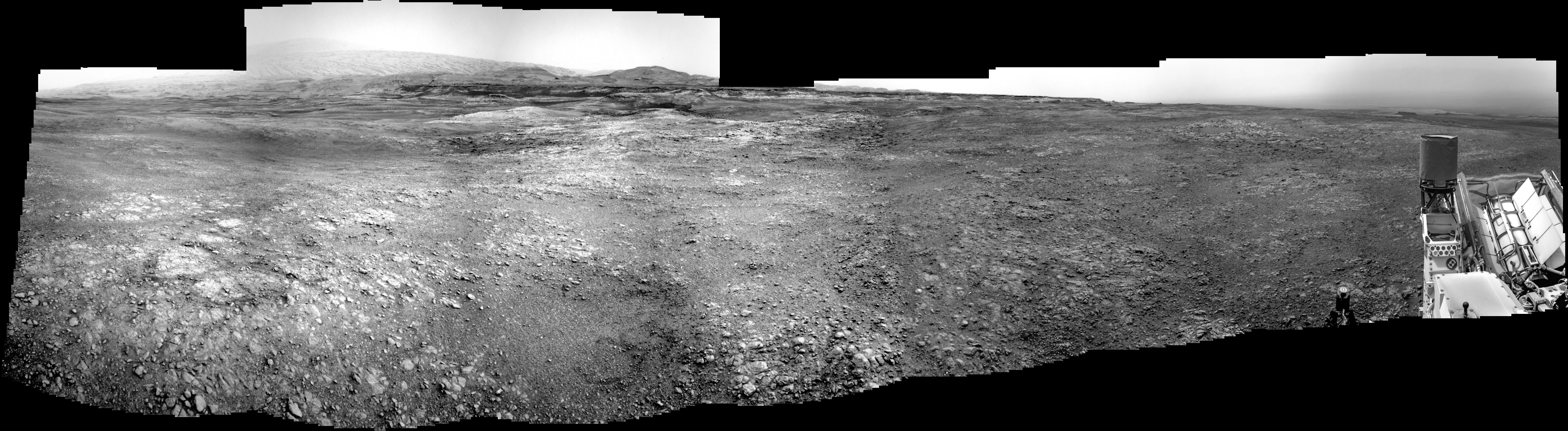
Curiosity update: Melrose Place

NLA_601512514EDR_F0731692NCAM00256M_-br2Sol 2299, January 23, 2019, update by MSL scientist Scott Guzewich: Curiosity is continuing the first phase of its journey to the “clay-bearing unit,” the low elevation portion in the middle distance of this Navcam image with a series of “touch-and-go” driving sols. During these sols, the rover does contact science with MAHLI and APXS in the morning, some additional remote sensing as time permits, and then drives away to a new location during the afternoon. We want to closely examine the bedrock as we drive to help understand how the Vera Rubin Ridge and the clay unit are related.

Today, “Melrose” was the target for contact science. Additional Mastcam and ChemCam observations were taken of other nearby geological targets. Curiosity is continuing to monitor a strong late-season dust… [More at link]

Posted in Reports | Tagged , , , , , , , , , , , | Comments Off

Opportunity: 15 years on Mars

PIA04413NASA’s Opportunity rover begins its 16th year on the surface of Mars today. The rover landed in a region of the Red Planet called Meridiani Planum on Jan. 24, 2004, sending its first signal back to Earth from the surface at 9:05 p.m. PST (Jan. 25, 2004, at 12:05 a.m. EST). The golf-cart-sized rover was designed to travel 1,100 yards (1,006 meters) and operate on the Red Planet for 90 Martian days (sols). It has traveled over 28 miles (45 kilometers) and logged its 5,000th Martian day (or sol) back in February of 2018.

“Fifteen years on the surface of Mars is testament not only to a magnificent machine of exploration but the dedicated and talented team behind it that has allowed us to expand our discovery space of the Red Planet,” said John Callas, project manager for Opportunity at NASA’s Jet Propulsion Laboratory in Pasadena, California. “However, this anniversary cannot help but be a little bittersweet as at present we don’t know the rover’s status. We are doing everything in our power to communicate with Opportunity, but as time goes on, the probability of a successful contact with the rover continues to diminish.” [More at link]

Posted in Reports | Tagged , , , , , , | Comments Off

HiRISE: A first look at dunes

ESP_057903_1390This image shows us a cross-section of a dune field. Dune shape depends on several factors, including the amount of sand present and the local wind directions. This dune field displays several distinct dune morphologies.

We see both individual barchan-like dunes and more complex dune shapes. The dunes are arranged in a linear fashion at the northern extent of the field, first in areas with lots of sand, and then with relatively sand-free patches in between dune crests. HiRISE has observed dune activity in other similar fields, but this is our first image over this group of dunes… [More at link]

Posted in Reports | Tagged , , , , , , , , , , | Comments Off

THEMIS: South polar ice cap in summer

Summer at the south pole (THEMIS_IOTD_20190124)THEMIS Image of the Day, January 24, 2019. This VIS image of the south polar cap was taken during the middle of southern hemisphere summer.

The surface is free of frost and the layering that makes up the cap is visible. The layers formed over thousands of years, with the seasonal influx of dust and ice.

See more THEMIS Images of the Day by geological subject.

Posted in Reports | Tagged , , , , , , , , | Comments Off

Geological evidence for a planet-wide groundwater system on Mars

figure-2[Editor’s note: From a paper by Francesco Salese and four co-authors recently published in the Journal of Geophysical Research.]

Geological evidence of planet-wide groundwater system on Mars

• Geological evidence supporting Martian planet-wide groundwater upwelling

• Water-saturated zone intercepted by basins reaching more than -4000m below the Mars 17 DATUM

• Putative relations between groundwater-saturated level (groundwater-fed lakes) and the proposed ocean shorelines around -4000m below the Mars DATUM

Most previous studies on Mars relevant groundwater have proposed models, but few have looked at the geological evidence of groundwater upwelling in deep closed basins in the northern hemisphere equatorial region.

Geological evidence of groundwater upwelling in these deep basins is a key point that will help to validate present‐day models and to better constraint them in the future. Observations in the northern hemisphere show evidence of a planet‐wide groundwater system on Mars.

The elevations of these water‐related morphologies in all studied basins lie within the same narrow range of depths below Mars datum and notably coincide with the elevation of some ocean shorelines proposed by previous authors. [More at link]

Posted in Reports | Tagged , , | Comments Off

Curiosity update: Commencement of the Clay- Bearing Unit campaign

NLA_601415261EDR_S0731482NCAM00255M_-br2Sol 2298, January 22, 2019, update by MSL scientist Roger Wiens: Curiosity has moved for the first time since December 13, 2018. More importantly, Curiosity is moving to a new geological unit that we have so far called the “Clay-Bearing Unit” (CBU). The MSL rover team, following previous rover teams, has organized itself into different campaigns to explore different geological units. Organizers are nominated to lead these campaigns, and their job is to help coordinate among the competing interests of the different instrument teams, helping to make synergistic, collaborative discoveries. The organizers of the CBU campaign have been patiently waiting for their turn to lead the campaign. After all, their first meeting was well over a year ago, on October 3, 2017.

Curiosity has not actually arrived yet. The rover team is searching for the geological contact between bedrock of Vera Rubin Ridge and that of the CBU. The precise boundary is not clear from orbit, and it could also be a relatively gradual change as seen from rover images. To have the best chance at observing the transition, Curiosity is doing relatively short drives, interspersed with frequent observations by both remote and contact instruments, as the terrain allows… [More at link]

Posted in Reports | Tagged , , , , , , , , , , , , , , , | Comments Off

HiRISE: Multi-elevation gullies

ESP_057450_1410Gullies probably formed along the bouldery layers in the upper slopes of this unnamed crater within the last few million years. Gullies eroded these crater slopes and transported sediment downslope forming debris aprons multiple times.

These older apron surfaces were cut by numerous fractures running perpendicular to the slope. Subsequent episodes of gully activity eroded through these fractures and deposited new aprons.

On the floor of the crater are ridges with bouldery layers. These ridges may mark the furthest extent of glaciers that predate much of the original gully activity. Bright flows continue to form in these gullies… [More at link]

Posted in Reports | Tagged , , , , , , , , | Comments Off

THEMIS: Ma’adim Vallis

Ma'adim Vallis (THEMIS_IOTD_20190123)THEMIS Image of the Day, January 23, 2019. This VIS image shows a small section of Ma’adim Vallis. Ma’adim Vallis is located in Terra Cimmeria and empties into Gusev Crater, the home of the MER Spirit rover.

See more THEMIS Images of the Day by geological subject.

Posted in Reports | Tagged , , , , , , , , , , , , , | Comments Off

Curiosity: New surroundings

2297-navcamSol 2297, January 22, 2019. A 36-meter (120-f00t) drive to the east placed Curiosity in new surroundings, although still atop Vera Rubin Ridge. The view above (click to enlarge it) sweeps from Mt. Sharp to the south around to the northwest.

Sol 2297 raw images (from all cameras).

Posted in Reports | Tagged , , , , , , , , | Comments Off

HiRISE: Impact near the south pole

ESP_057152_0985This image shows a new impact crater that formed between July and September 2018. It’s notable because it occurred in the seasonal southern ice cap, and has apparently punched through it, creating a two-toned blast pattern.

The impact hit on the ice layer, and the tones of the blast pattern tell us the sequence. When an impactor hits the ground, there is a tremendous amount of force like an explosion. The larger, lighter-colored blast pattern could be the result of scouring by winds from the impact shockwave. The darker-colored inner blast pattern is because the impactor penetrated the thin ice layer, excavated the dark sand underneath, and threw… [More at link]

Posted in Reports | Tagged , , , , , , , | Comments Off