HiRISE: A mass of viscous flow features

ESP_048913_1330Viscous, lobate flow features are commonly found at the bases of slopes in the mid-latitudes of Mars, and are often associated with gullies.

These features are bound by ridges that resemble terrestrial moraines, suggesting that these deposits are ice-rich, or may have been ice-rich in the past. The source of the ice is unclear, but there is some thought that it is deposited from the atmosphere during periods of high obliquity, also known as axial tilt. [More at link]

Posted in Reports | Tagged , , , , , , , , , | Comments Off

Curiosity: Skirting the sands

1628-navcam-south1628MH0006890020602661E01_DXXXSol 1628, March 6, 2017. The Navcam shows the way toward Mt. Sharp, but many sand patches line the path and Curiosity will need to drive carefully among them.

The ripples in the sand patch in the central part of the image show that winds at ground level swirl among the  rocks and make complicated patterns like waves around islands in the sea.

At right, contrasts in texture as the newly debugged MAHLI takes a look straight down onto wheel, rock, and sand. Click either image to enlarge it.

Sol 1628 raw images (from all cameras), and Curiosity’s latest location.

Posted in Reports | Tagged , , , , , , , , | Comments Off

THEMIS: Dust devil scrawls in Aonia Terra

Dust devil scrawls in Aonia (THEMIS_IOTD_20170306)THEMIS Image of the Day, March 6, 2017. This VIS image show dust devil tracks in Aonia Terra. As the dust devil moves along the surface it scours the dust and fine materials away, revealing the darker rocky surface below the dust.

More THEMIS Images of the Day by geological topic.

Posted in Reports | Tagged , , , , , , , , | Comments Off

HiRISE: Reull Vallis region terrain

tumblr_olnl4mkVIY1rlz4gso1_1280Reull Vallis region terrain. Beautiful Mars series.

Posted in Reports | Tagged , , , , , , , | Comments Off

Shock tests on synthetic Mars-meteorite mineral suggest a more water-rich history

Melas_Dorsa_impact_crater_perspective_view_article_mob
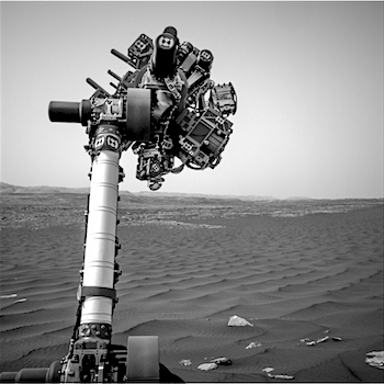
Mars may have been a wetter place than previously thought, according to research on simulated Martian meteorites conducted, in part, at the Department of Energy’s Lawrence Berkeley National Laboratory (Berkeley Lab).

In a study published [March 6, 2017] in the journal Nature Communications, researchers found evidence that a mineral found in Martian meteorites—which had been considered as proof of an ancient dry environment on Mars—may have originally been a hydrogen-containing mineral that could indicate a more water-rich history for the Red Planet.

Scientists at the University of Nevada, Las Vegas (UNLV), who led an international research team in the study, created a synthetic version of a hydrogen-containing mineral known as whitlockite.

After shock-compression experiments on whitlockite samples that simulated the conditions of ejecting meteorites from Mars, the researchers studied their microscopic makeup with X-ray experiments at Berkeley Lab’s Advanced Light Source (ALS) and at Argonne National Laboratory’s Advanced Photon Source (APS).

The X-ray experiments showed that whitlockite can become dehydrated from such shocks, forming merrillite, a mineral that is commonly found in Martian meteorites but does not occur naturally on Earth.

“This is important for deducing how much water could have been on Mars, and whether the water was from Mars itself rather than comets or meteorites,” said Martin Kunz, a staff scientist at Berkeley Lab’s ALS who participated in X-ray studies of the shocked whitlockite samples.

“If even a part of merrillite had been whitlockite before, it changes the water budget of Mars dramatically,” said Oliver Tschauner, a professor of research in the Department of Geoscience at UNLV who co-led the study with Christopher Adcock, an assistant research professor at UNLV.

And because whitlockite can be dissolved in water and contains phosphorous, an essential element for life on Earth—and merrillite appears to be common to many Martian meteorites—the study could also have implications for the possibility of life on Mars. [More at links]
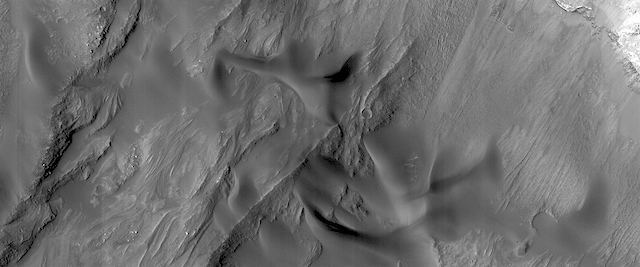
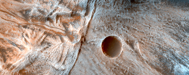
Posted in Reports | Tagged , , , | Comments Off

Curiosity update: Driving again

NRB_541744951EDR_F0611140NCAM00234M_Sol 1627-29, March 3, 2017, update by USGS scientist Lauren Edgar: Good news: the MAHLI cover was successfully opened and the instrument is marked healthy again. That means it’s time to close the cover, and if that’s successful, drive away toward the next stop in the Bagnold Dunes Campaign.  I was the GSTL again and it was a pretty straightforward planning day.  On the first sol, we’ll acquire ChemCam observations on “Swanback” and “Rangely” to assess the composition of a ripple crest and a bright patch of bedrock.  We’ll also use Mastcam to image the rover deck to monitor the movement of fines. In the afternoon, we’ll close the MAHLI cover and run a few more diagnostics.  The second sol starts with an early science block for environmental monitoring, including Navcam and Mastcam observations to look for clouds and monitor the amount of dust in the atmosphere.  Later in the day we’ll use Navcam to search… [More at link]

Posted in Reports | Tagged , , , , , , , , , , , | Comments Off

Opportunity report, Sol 4657, by A.J.S. Rayl, The Planetary Society

20170303_7Etchedview021217-SApano24c20170303_6Oppy_MEPAG_overviewMarch 3, 2017: Opportunity reaches top of Endeavour Rim, wraps Cape Tribulation: Driving the Mars Exploration Rovers (MER) mission further into its fourteenth year of surface operations, Opportunity continued hiking the slopes of Cape Tribulation in February and finally reached the crest of Endeavour Crater’s western rim. There, the robot field geologist looked around with her Panoramic Camera ‘eyes,’ took dozens of pictures of her view, and was about to hit the road – until the scientists saw something too intriguing to pass up in the images the rover was sending home.

“It’s kind of an important time for Opportunity,” said MER Deputy Principal Investigator Ray Arvidson, of Washington University St. Louis (WUSTL) during the final days of the month. “This is it for Cape Tribulation and so we stopped short of going over the crest to acquire a good, parting shot.”

But in the images the MER scientists saw an outcrop of finely striated bedrock that looks like it had been etched or carved by something. So they decided to have Opportunity also conduct one last scientific campaign before departing. “We were about to exit the ‘door,’ but suddenly we discovered this ‘door’ is pretty exciting,” said MER Project Manager John Callas, of the Jet Propulsion Laboratory (JPL), the birthplace of all NASA’s Mars rovers.

The outcrop is more of the same breccia bedrock that formed during the impact that created the 22-kilometer (about 13.7-mile) diameter Endeavour, which the team calls Shoemaker Formation. Opportunity has been roving on and around this breccia since pulling up to the crater’s western rim in August 2011. “But we realized it would be our last full science campaign in Cape Tribulation and of Shoemaker breccia, maybe forever,” said Arvidson. More than that, this sample of Shoemaker is so visually distinctive the scientists were compelled to command the rover to take a closer look.  [More at link]

Posted in Reports | Tagged , , , , , , | Comments Off

Curiosity: Distant layers, edge of a hill

1625-rmi-farSol 1625, March 2, 2017. The Remote Micro-Imager shot a 10-frame profile of distant layers and one edge of a butte. The direction lies southward from Curiosity’s current position at Bagnold Dunes stop #2. Click image (3 MB) to enlarge it.

Sol 1625 raw images (from all cameras), and Curiosity’s latest location.

Posted in Reports | Tagged , , , , , , , , | Comments Off

HiRISE: Monitoring dunes in Coprates Chasma

tumblr_olh90iWVPP1rlz4gso1_1280Monitoring dunes in Coprates Chasma.  – Always keep your eye on those dunes. They creep up on you. Slowly.

Beautiful Mars series.

Posted in Reports | Tagged , , | Comments Off

THEMIS: South polar cap layers

South polar cap layers (THEMIS_IOTD_20170303)THEMIS Image of the Day, March 3, 2017. This VIS image shows the layering of the South Polar cap of Mars. The image is located at the margin between the cap ice and the surrounding plains (bottom of image).

More THEMIS Images of the Day by geological topic.

Posted in Reports | Tagged , , , , , , , , , | Comments Off