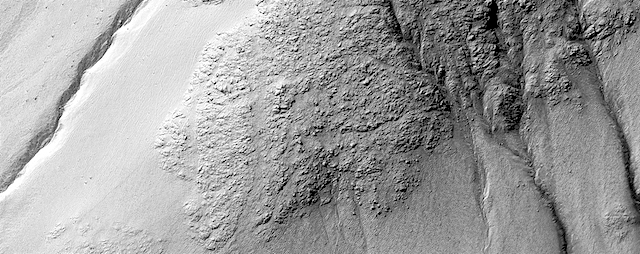
Curiosity update: And objects in the rear-view mirror may appear…interesting!

RLA_605050903EDR_F0740762RHAZ00311M_Sol 2340, March 6, 2019, update by MSL scientist Susanne Schwenzer: In the current plan, we start with a dust devil survey to look for them while they are still in season. This is followed by a ChemCam investigation “Schiehallion” and an RMI mosaic on “Motherwell.” Mastcam will finish off the investigation with multispectral images on the block in front of us, which contain the previous APXS targets “Fife” and “Arbuthnott.” So far, so routine, but then there was the look in the rear-view mirror!

Finishing up at the “Midland Valley” outcrop also included the inspection of a wide range of new images. In those images the team discovered a block that allows a unique 3D view of the rocks in the area. As the rover stands at this moment, the rock of interest is just behind it, with the line of sight and ChemCam line of laser shot blocked by the rover itself. The question was, whether to proceed as planned and drive… [More at link]

Posted in Reports | Tagged , , , , , , , , , , , , , , , , | Comments Off

MARCI weather report, Feb 25-March 3, 2019

MARCI-March-1-2019Last week on Mars, the southern highlands experienced an uptick in local-scale dust storm activity. Meanwhile, on the other side of the red planet, a mixture of dust storms and water ice clouds continued to propagate eastward along the seasonal north polar ice cap edge. During the middle of the week, a lone pulse of dust activity was spotted pushing south to Chryse Planitia. This dust event quickly subsided into a diffuse dust cloud. Scanning… [More at link, including video]

Posted in Reports | Tagged , , , , , , , , , , , , , , | Comments Off

Mapping potential sources of Mars water

fp_BIG IMAGE Fig1LPSC_fullres copyMissions carrying humans to Mars will require on-site resources, and a project led by Planetary Science Institute (PSI) scientists Nathaniel Putzig and Gareth Morgan is mapping the availability of potential shallow water-ice sources across the surface of the Red Planet.

Two teams led by Putzig and Morgan were contracted by NASA to pursue separate mapping efforts of subsurface ice deposits in Arcadia Planitia. After their mid-term reports showed significant synergy, the teams were combined in a joint project called “Subsurface Water Ice Mapping (SWIM) on Mars,” which extends the coverage of the mapping project from an experimental swath over Arcadia Planitia to all other low elevation regions across the Martian Northern Hemisphere.

“Water ice will be a critical resource for human explorers on Mars, not only for life support but also for generating fuel to power equipment on the ground and rockets for the return journey to Earth,” said Putzig, a Senior Scientist at PSI. “Maps that identify the nature and availability of potential water resources will help determine where humanity will establish its first outposts on Mars.” [More at links]

Posted in Reports | Tagged , , , , , , , , | Comments Off

HiRISE: Colorful impact ejecta in Ladon Valles

ESP_058565_1620This image covers the western portion of a well-preserved (recent) impact crater in Ladon Basin. Ladon is filled by diverse materials including chemically-altered sediments and unaltered lava, so the impact event ejected and deposited a wide range of elements.

This image is the first of a pair of images for stereo coverage, so check out the stereo anaglyph when completed.

Posted in Reports | Tagged , , , , , , , , | Comments Off

Sedimentary volcanism in southern Chryse Planitia: varieties of mud volcanos

figure_2

[Editor’s note: From a paper by Petr Broz and four co-authors recently published in the Journal of Geophysical Research.]

Subsurface Sediment Mobilization in the Southern Chryse Planitia on Mars

• Southern Chryse Planitia contains a large field of Amazonian‐aged extrusive landforms, which can be grouped into five classes

• They are exclusively located in the sedimentary plains between erosional remnants suggesting that they were formed by sedimentary volcanism

• The variability in shapes can be explained by properties of the mud and environment

Ever since the presence of methane in the Martian atmosphere was reported from ground‐based, orbital, and in situ observations, mud volcanism was hypothesized to be a possible release mechanism, and various mud volcano fields have been tentatively identified.

Although morphological similarities with Earth sedimentary volcanism have been proposed, it is difficult, however, to prove unambiguously the presence of mud volcanism in remote sensing data, and some of the reported mud volcanoes have alternatively been interpreted as igneous volcanoes. A definitive identification of sedimentary volcanoes on Mars is therefore still problematic.

A useful candidate area to test the hypothesis of sedimentary volcanism on Mars is a field of kilometer‐sized cone‐ and pie‐like landforms in the southern part of the large ancient Chryse impact basin, part of which was previously studied by Komatsu et al. In this study, we searched for those landforms inside Chryse Planitia and determined their full spatial extent.

We found that they can be divided into five morphologically different groups and that they occur exclusively on the level sedimentary plains. These findings enable us providing additional evidence to support the hypothesis of subsurface sediment mobilization as a possible mechanism for their formation. [More at link]
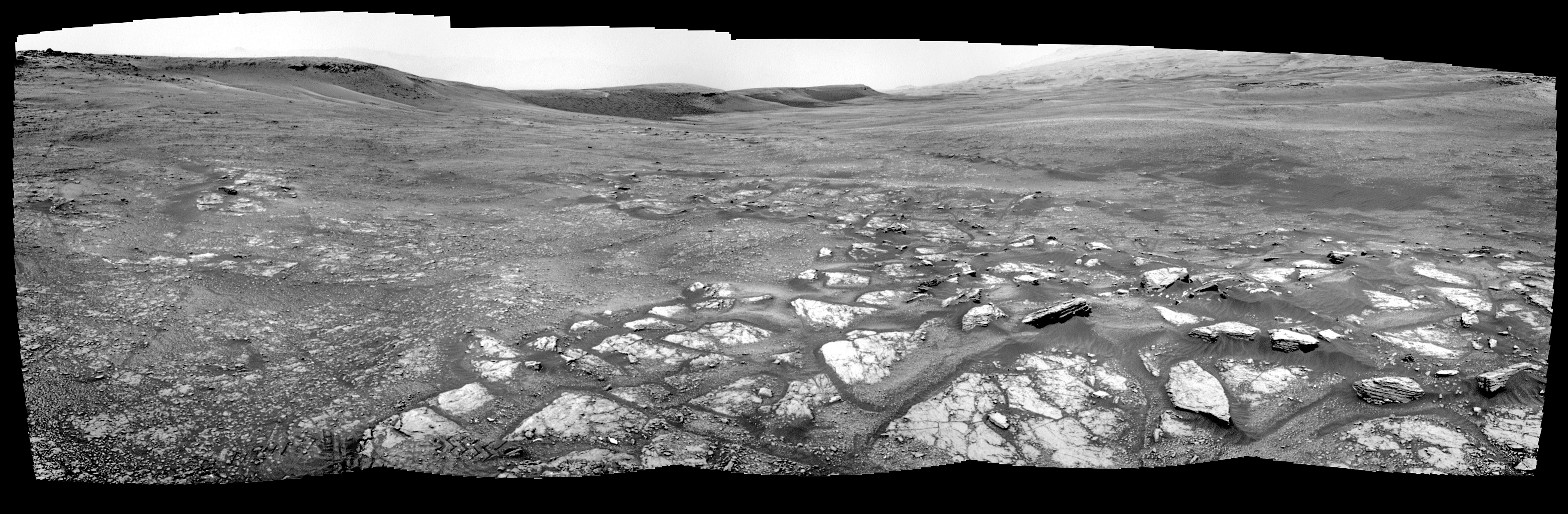
Posted in Reports | Tagged , , , , , | Comments Off

THEMIS: Crater dunes in Arabia Terra

Crater dunes (THEMIS_IOTD_20190306)THEMIS image of the Day, March 6, 2019. Today’s VIS image is located in Arabia Terra. The crater at the bottom of the image contains a large region of sand dunes. Dark blue in this band configuration indicates basaltic sand.

The THEMIS VIS camera contains 5 filters. The data from different filters can be combined in multiple ways to create a false color image. These false color images may reveal subtle variations of the surface not easily identified in a single band image.

Explore more THEMIS Images of the Day by geological subject.

Posted in Reports | Tagged , , , , , , , , , , , | Comments Off

HiRISE: Gullies in Galle

ESP_058196_1280This image was taken of the hills that resulted from uplifted rocks due to an impact that formed the 230-kilometer diameter Galle Crater.

These hills form a segment of a circle known as a “peak ring” and this particular formation makes Galle Crater look like a “smiley face” from orbit.

Small gullies, visible in the center of this image, have formed on the flanks of these hills and they have eroded back into the bedrock. The crater itself is probably billions of years old, yet these gullies are likely only hundreds of thousands of years old and may even be active today… [More at link]

Posted in Reports | Tagged , , , , , , , , | Comments Off

Curiosity: Going on —

2338-navcamSol 2338, March 5, 2019. Five Navcam frames composited show the way forward through the valley behind Vera Rubin Ridge, which forms the skyline on the left side of the image. (In addition, the top of Gale Crater’s rim is faintly visible behind the ridge.) Click the image to enlarge it.

Sol 2338 raw images (from all cameras).

Posted in Reports | Tagged , , , , , , , , , , , | Comments Off

InSight: Lander’s ‘mole’ pauses digging

PIA23046_hiresNASA’s Mars InSight lander has a probe designed to dig up to 16 feet (5 meters) below the surface and measure heat coming from inside the planet. After beginning to hammer itself into the soil on Thursday, Feb. 28, the 16-inch- long (40-centimeter-long) probe — part of an instrument called the Heat and Physical Properties Package, or HP3 — got about three-fourths of the way out of its housing structure before stopping. No significant progress was seen after a second bout of hammering on Saturday, March 2. Data suggests the probe, known as a “mole,” is at a 15-degree tilt.

Scientists suspect it hit a rock or some gravel. The team had hoped there would be relatively few rocks below ground, given how few appear on the surface beside the lander. Even so, the mole was designed to push small rocks aside or wend its way around them. The instrument, which was provided for InSight by the German Aerospace Center (DLR), did so repeatedly during testing before InSight launched.

“The team has decided to pause the hammering for now to allow the situation to be analyzed more closely and jointly come up with strategies for overcoming the obstacle,” HP3Principal Investigator Tilman Spohn of DLR wrote in a blog post. He added that the team wants to hold off from further hammering for about two weeks… [More at link]

PIA23045_hires

Posted in Reports | Tagged , , , , , , , , , | Comments Off

Latest weather at Gale Crater and Elysium Planitia

Daily Elysium charts and data (temperature, wind speed, atmospheric pressure) here.

Posted in Reports | Tagged , , , , , , , , , , , , , , | Comments Off